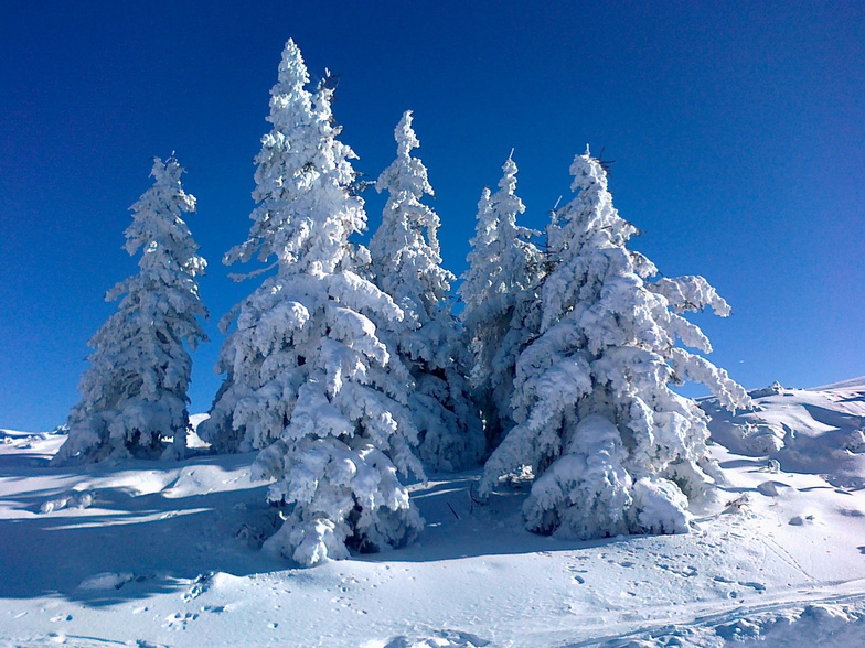


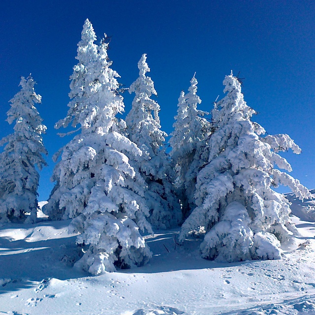
Portillo Storm Snowfall Total Passes 5m / 17 Feet
A snow storm that has now continued for nine days has taken Chilean ski resort Portillo to a snowfall total of 5.2 metres (17 feet) so far, with more snow forecast.

Next 3 days weather summary:Pioggia moderata (totale 19.0mm), più pesante Venerdì notte. Caldo (max 22°C Venerdì pomeriggio, min 12°C Venerdì notte). Vento sarà generalmente leggero. | Giorni 4-6 Flachau-Reitdorf sommario meteoPioggia abbondante (totale 33.0mm), più pesante durante Sabato pomeriggio. Caldo (max 21°C Lunedì pomeriggio, min 12°C Sabato pomeriggio). Vento sarà generalmente leggero. | ||||||||||||||||
Mer 29 | Giovedì 30 | Venerdì 31 | Sabato 1 | Domenica 2 | Lunedì 3 | ||||||||||||
PM | notte | AM | PM | notte | AM | PM | notte | AM | PM | notte | AM | PM | notte | AM | PM | notte | |
rischio temporale | rovesci pioggia | poche nuvole | poche nuvole | limpido | limpido | pioggia leggera | rovesci pioggia | poche nuvole | rischio temporale | rovesci pioggia | poche nuvole | poche nuvole | poche nuvole | nuvol- oso | nuvol- oso | rovesci pioggia | |
km/h | |||||||||||||||||
Mappa neve |  |  |  |  |  |  | |||||||||||
— | — | — | — | — | — | — | — | — | — | — | — | — | — | — | — | — | |
mm | 2 | 6 | — | — | — | — | 2 | 9 | — | 20 | 11 | — | — | — | — | — | 2 |
max °C | 19 | 16 | 19 | 21 | 20 | 21 | 22 | 14 | 18 | 17 | 14 | 17 | 20 | 18 | 19 | 21 | 16 |
min °C | 19 | 15 | 16 | 21 | 16 | 18 | 15 | 12 | 16 | 12 | 12 | 14 | 19 | 16 | 17 | 19 | 14 |
chill °C | 19 | 15 | 16 | 21 | 16 | 18 | 15 | 12 | 16 | 12 | 12 | 14 | 19 | 16 | 17 | 19 | 14 |
Umido. % | 56 | 65 | 46 | 38 | 56 | 39 | 72 | 76 | 56 | 93 | 64 | 53 | 51 | 63 | 46 | 51 | 60 |
Zero termico m | 4450 | 4350 | 4350 | 4600 | 4450 | 4650 | 4550 | 4500 | 4400 | 4100 | 4400 | 4350 | 4600 | 4650 | 4550 | 4650 | 4550 |
— | — | 5:41 | — | — | 5:41 | — | — | 5:43 | — | — | 5:45 | — | — | 5:46 | — | — | |
— | 8:44 | — | — | 8:43 | — | — | 8:42 | — | — | 8:39 | — | — | 8:38 | — | — | 8:37 | |
Diventa pro e intaglia:
Informazioni valanghe: European Avalanche Warning Services (EAWS)
Gli ultimi report della neve vicino a Flachau-Reitdorf:
| La profondità maggiore della neve é: | 0 cm |
|---|---|
| La profondità minore della neve é: | 0 cm |
| Fresh snowfall depth: | — |
| Quando ha nevicato l'ultima volta? | 10 Jun 2026 |
0.0 | Giorni neve fresca Neve fresca, prevalentemente soleggiato, vento debole. |
|---|---|
0.0 | Giorni neve fresca Fresh snow, limited sun, any wind. |
0.0 | Giorni Bluebird Neve media, prevalentemente soleggiato, vento debole. |
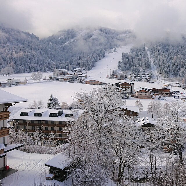
La tabella sopra da le previsioni meteo per Flachau-Reitdorf a specifiche altezze 1981 m. I nostri sofisticati modelli meteo ci consentono di fornire previsioni neve per la vetta, l'area intermedia e a valle delle stazioni sciistiche di Flachau-Reitdorf. Per accedere alle previsioni meteo ad altre altezze, per spostarti usa tab sopra la tabella. Per una visione meteo piu' ampia , controlla la mappa meteo di Austria.
Clicca qui per leggere ulteriori informazioni sullo zero termico e il nostro sistema di prevedere le temperature.
Complessivamente 4.5 Basato su 16 voti e 9 recensioni
Ok, hands up, we run an apartment business in Flachau but I can't believe the most recent review is Jan 12! Well, what's changed since then? Firstly, Flachau is fully linked to Wagrain/Alpendorf by the G-Link which means you have over 180km of piste without using bus links. The investment in lifts is second to none with most heated, fast and rarely are you waiting. There is a plan to further link to Kleinarl in the next year or two to further extend the skiing. Pistes are always well maintained with plenty of snow cannons if snow is bit thin. The Ski Amade lift pass covers over 860km of skiing. Like most of the Austrian resorts the on-piste restaurants and the apres is fantastic and around 15% cheaper than comparable French/Swiss resorts. The town is quite compact with loads of good eateries and shops if you're self-catering and at only 45 mins from Salzburg Airport, very short transfers. (note from the editor: advertising is not included in our resort review service . You may like to use the banner space and/or accommodation listing on the resort's pages. Contact [email protected])
The Red and White Ski Company da United Kingdom scrive:
Ok, hands up, we run an apartment business in Flachau but I can't believe the most recent review is Jan 12! Well, what's changed since then? Firstly, Flachau is fully linked to Wagrain/Alpendorf by the G-Link which means you have over 180km of piste without using bus links. The investment in lifts is second to none with most heated, fast and rarely are you waiting. There is a plan to further link to Kleinarl in the next year or two to further extend the skiing. Pistes are always well maintained with plenty of snow cannons if snow is bit thin. The Ski Amade lift pass covers over 860km of skiing.
Like most of the Austrian resorts the on-piste restaurants and the apres is fantastic and around 15% cheaper than comparable French/Swiss resorts. The town is quite compact with loads of good eateries and shops if you're self-catering and at only 45 mins from Salzburg Airport, very short transfers.
(note from the editor: advertising is not included in our resort review service . You may like to use the banner space and/or accommodation listing on the resort's pages. Contact [email protected])


 Nearest