Ultimi 6 giorniScorri a sinistra per gli ultimi 6 giorniOra
Next 3 days weather summary:
Pioggia abbondante (totale 27.0mm), più pesante durante Domenica pomeriggio. Temperature moderate (max 16°C Venerdì pomeriggio, min 7°C Domenica notte). Venti in aumento (venti deboli dalla O Sabato notte, forte vento da NW per Domenica notte).
Giorni 4-6 Stuhleck sommario meteo
Pioggia moderata (totale 11.0mm), più pesante Giovedì mattina. Temperature moderate (max 11°C Lunedì pomeriggio, min 6°C Martedì notte). Venti decrescenti (venti freschi da NNW Martedì notte, calma per Mercoledì pomeriggio).
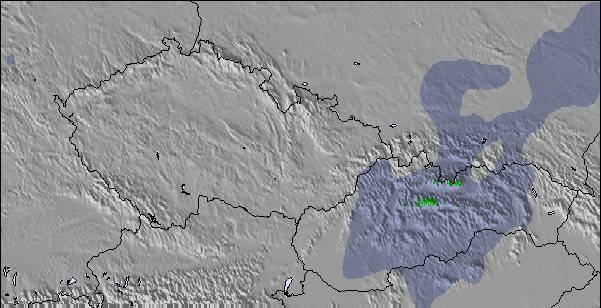
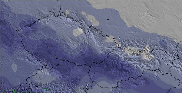
La tabella sopra da le previsioni meteo per Stuhleck a specifiche altezze 1774 m. I nostri sofisticati modelli meteo ci consentono di fornire previsioni neve per la vetta, l'area intermedia e a valle delle stazioni sciistiche di Stuhleck. Per accedere alle previsioni meteo ad altre altezze, per spostarti usa tab sopra la tabella. Per una visione meteo piu' ampia , controlla la mappa meteo di Austria.
Clicca qui per leggere ulteriori informazioni sullo zero termico e il nostro sistema di prevedere le temperature.
Recensioni dei visitatori di Stuhleck
Complessivamente 3.1 Basato su 19 voti e 3 recensioni
I will never go back here. Despite great trails on a great little mountain, albeit poorly groomed, the crowds, the lack of ski etiquette on the slopes, and the complete unfriendliness will guarantee no repeat visit. Crowds, on the weekend, were ridiculous and the pushiness in long lift lines had inexcusable human behavior that was beyond atrocious. Don't even think of renting ski gear, we were in line for one full hour. The rental staff were very professional though considering how slammed they were. The food was Austrian. What can I say, "I can't eat this", but I am in Austria and what can one expect besides pork?
Complessivamente: 3.1 Basato su 19 voti e 3 recensioni
Snowsure
2.8
Varietà di piste
2.9
Fuoripista
2.3
Paesaggio
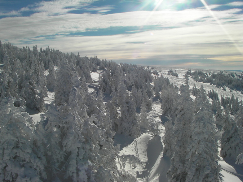
4.3
Apres-Ski
2.6
Bunny da Austria scrive:
I will never go back here. Despite great trails on a great little mountain, albeit poorly groomed, the crowds, the lack of ski etiquette on the slopes, and the complete unfriendliness will guarantee no repeat visit. Crowds, on the weekend, were ridiculous and the pushiness in long lift lines had inexcusable human behavior that was beyond atrocious. Don't even think of renting ski gear, we were in line for one full hour. The rental staff were very professional though considering how slammed they were. The food was Austrian. What can I say, "I can't eat this", but I am in Austria and what can one expect besides pork?
Gratis Snow-Forecast.com weather widget per il tho sito
Il Stuhleck widget meteo qui sotto è disponibile per essere incorporato su siti Web esterni a titolo gratuito. Esso fornisce un riepilogo giornaliero delle nostre Stuhleck previsioni meteo neve e dati meteo. Basta andare alla pagina di configurazione e seguire 3 semplici passi per prendere il codice html personalizzato ed incollarlo nel tuo sito. È possibile scegliere l'elevazione di previsione di neve (vetta, metà o piede della montagna) e l'unità metrica/imperiale per le previsioni meteo neve adeguata al proprio sito Web Clicca qui per ottenere il codice


 Nearest