

Portillo Re-Opens To Guests Arriving By Helicopter
Chile’s famous Portillo ski resort is reported to have re-opened to guests arriving by helicopter after being cut off by road for more than two weeks by over 6m/20 feet of snowfall.

Next 3 days weather summary:Pioggia abbondante (totale 32.0mm), più pesante durante Mercoledì notte. Caldo (max 26°C Lunedì pomeriggio, min 16°C Martedì notte). Vento sarà generalmente leggero. | Giorni 4-6 Seefeld-Reith/Gschwandtkopf sommario meteoPioggia abbondante (totale 36.0mm), più pesante durante Giovedì notte. Caldo (max 20°C Giovedì pomeriggio, min 13°C Giovedì notte). Vento sarà generalmente leggero. | ||||||||||||||||
Lun 3 | Martedì 4 | Mercoledì 5 | Giovedì 6 | Venerdì 7 | Sabato 8 | ||||||||||||
PM | notte | AM | PM | notte | AM | PM | notte | AM | PM | notte | AM | PM | notte | AM | PM | notte | |
rovesci pioggia | poche nuvole | limpido | rischio temporale | rovesci pioggia | rischio temporale | rischio temporale | rovesci pioggia | rischio temporale | rischio temporale | forte pioggia | pioggia leggera | rischio temporale | rovesci pioggia | poche nuvole | rischio temporale | rovesci pioggia | |
km/h | |||||||||||||||||
Mappa neve |  |  |  |  |  |  | |||||||||||
— | — | — | — | — | — | — | — | — | — | — | — | — | — | — | — | — | |
mm | 1 | — | — | 3 | 2 | 1 | 4 | 17 | 4 | 10 | 16 | 3 | 2 | 2 | — | 2 | 1 |
max °C | 26 | 22 | 25 | 26 | 20 | 22 | 24 | 21 | 20 | 20 | 16 | 15 | 18 | 16 | 18 | 19 | 17 |
min °C | 21 | 19 | 20 | 18 | 16 | 18 | 23 | 16 | 18 | 20 | 13 | 13 | 16 | 13 | 14 | 18 | 15 |
chill °C | 21 | 19 | 20 | 18 | 16 | 18 | 23 | 16 | 18 | 20 | 13 | 13 | 16 | 13 | 14 | 18 | 15 |
Umido. % | 58 | 55 | 38 | 75 | 69 | 58 | 59 | 87 | 66 | 68 | 98 | 88 | 84 | 89 | 67 | 72 | 81 |
Zero termico m | 4500 | 4500 | 4500 | 4550 | 4500 | 4400 | 4500 | 4350 | 4300 | 4350 | 3950 | 3900 | 3950 | 4050 | 3950 | 4100 | 4250 |
— | — | 5:56 | — | — | 5:56 | — | — | 5:58 | — | — | 6:00 | — | — | 6:01 | — | — | |
— | 8:45 | — | — | 8:45 | — | — | 8:44 | — | — | 8:42 | — | — | 8:40 | — | — | 8:38 | |
Diventa pro e intaglia:
Informazioni valanghe: European Avalanche Warning Services (EAWS)
Gli ultimi report della neve vicino a Seefeld-Reith/Gschwandtkopf:
| La profondità maggiore della neve é: | 0 cm |
|---|---|
| La profondità minore della neve é: | 0 cm |
| Fresh snowfall depth: | — |
| Quando ha nevicato l'ultima volta? | 16 May 2026 |
0.0 | Giorni neve fresca Neve fresca, prevalentemente soleggiato, vento debole. |
|---|---|
0.0 | Giorni neve fresca Fresh snow, limited sun, any wind. |
0.0 | Giorni Bluebird Neve media, prevalentemente soleggiato, vento debole. |
La tabella sopra da le previsioni meteo per Seefeld-Reith/Gschwandtkopf a specifiche altezze 1350 m. I nostri sofisticati modelli meteo ci consentono di fornire previsioni neve per la vetta, l'area intermedia e a valle delle stazioni sciistiche di Seefeld-Reith/Gschwandtkopf. Per accedere alle previsioni meteo ad altre altezze, per spostarti usa tab sopra la tabella. Per una visione meteo piu' ampia , controlla la mappa meteo di Austria.
Clicca qui per leggere ulteriori informazioni sullo zero termico e il nostro sistema di prevedere le temperature.
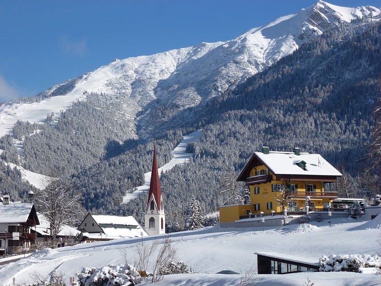
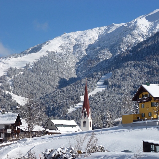
Il nome della localita' è scritto anche come Seefeld-Reith-Gschwandtkopf.
Complessivamente 3.9 Basato su 12 voti e 1 recensione
On the face of it Seefeld's second mountain has little to attract the diehard skier, but that would be to do the area a serious injustice! With a vertical of only 300m this puts the Geschwandtkopf on a par and scale with say Glenshee, but beyond that all the comparables end. Why? Because all the runs are north facing so are snow sure through the season, the pistes are all deserted, so very little if any ice and the mountain has two FIS rated race pistes which many national teams train and race on. Overall, the skiing is best suited to intermediates and beginners but advanced skiers will have a good day here too. Add to all of this the subline views of the Inn Valley and Seefeld plateau, the high quality and very reasonably priced Sportalm at the bottom, which is perfect for celebrity spotting (we saw Claudia Schiffer there one Sunday!) and the fact that Seefeld is one of the best all-round winter sports resort in the Alps and you have the perfect ingredients for a very enjoyable day or two as an alternative Seefeld's other ski area the Rosshutte. Recommended in small doses as part of a weeks stay in beautiful Seefeld.
Tirolerhund da United Kingdom scrive:
On the face of it Seefeld's second mountain has little to attract the diehard skier, but that would be to do the area a serious injustice!
With a vertical of only 300m this puts the Geschwandtkopf on a par and scale with say Glenshee, but beyond that all the comparables end. Why? Because all the runs are north facing so are snow sure through the season, the pistes are all deserted, so very little if any ice and the mountain has two FIS rated race pistes which many national teams train and race on.
Overall, the skiing is best suited to intermediates and beginners but advanced skiers will have a good day here too.
Add to all of this the subline views of the Inn Valley and Seefeld plateau, the high quality and very reasonably priced Sportalm at the bottom, which is perfect for celebrity spotting (we saw Claudia Schiffer there one Sunday!) and the fact that Seefeld is one of the best all-round winter sports resort in the Alps and you have the perfect ingredients for a very enjoyable day or two as an alternative Seefeld's other ski area the Rosshutte.
Recommended in small doses as part of a weeks stay in beautiful Seefeld.
Clicca qui per inviare la tua recensione di Seefeld-Reith/Gschwandtkopf


 Nearest