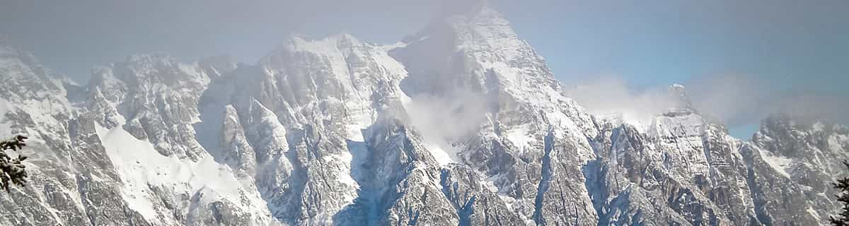


Portillo Storm Snowfall Total Passes 5m / 17 Feet
A snow storm that has now continued for nine days has taken Chilean ski resort Portillo to a snowfall total of 5.2 metres (17 feet) so far, with more snow forecast.

Next 4 days weather summary:Pioggia abbondante (totale 31.0mm), più pesante durante Venerdì notte. Caldo (max 29°C Venerdì pomeriggio, min 16°C Venerdì notte). Vento sarà generalmente leggero. | Giorni 5-7 Oberau sommario meteoPioggia abbondante (totale 21.0mm), più pesante durante Giovedì pomeriggio. Caldo (max 27°C Lunedì pomeriggio, min 16°C Martedì pomeriggio). Vento sarà generalmente leggero. | |||||||||||||||
Giovedì 30 | Venerdì 31 | Sabato 1 | Domenica 2 | Lunedì 3 | ||||||||||||
notte | AM | PM | notte | AM | PM | notte | AM | PM | notte | AM | PM | notte | AM | PM | notte | |
rovesci pioggia | limpido | limpido | limpido | poche nuvole | poche nuvole | rovesci pioggia | poche nuvole | rischio temporale | rovesci pioggia | limpido | poche nuvole | rovesci pioggia | poche nuvole | poche nuvole | rovesci pioggia | |
km/h | ||||||||||||||||
Mappa neve |  |  |  |  |  |  | ||||||||||
— | — | — | — | — | — | — | — | — | — | — | — | — | — | — | — | |
mm | 3 | — | — | — | — | — | 25 | — | 3 | 6 | — | — | 1 | — | — | 2 |
max °C | 24 | 24 | 28 | 25 | 26 | 29 | 25 | 22 | 24 | 20 | 22 | 26 | 24 | 25 | 27 | 24 |
min °C | 21 | 22 | 27 | 21 | 23 | 27 | 16 | 20 | 22 | 19 | 20 | 25 | 20 | 22 | 27 | 19 |
chill °C | 21 | 22 | 27 | 21 | 23 | 27 | 16 | 20 | 22 | 19 | 20 | 25 | 20 | 22 | 27 | 19 |
Umido. % | 54 | 39 | 25 | 46 | 36 | 35 | 71 | 55 | 62 | 68 | 49 | 40 | 56 | 41 | 37 | 51 |
Zero termico m | 4300 | 4300 | 4600 | 4500 | 4600 | 4700 | 4450 | 4400 | 4350 | 4350 | 4500 | 4550 | 4550 | 4500 | 4550 | 4500 |
— | 5:46 | — | — | 5:47 | — | — | 5:48 | — | — | 5:50 | — | — | 5:50 | — | — | |
— | — | — | 8:49 | — | — | 8:47 | — | — | 8:45 | — | — | 8:45 | — | — | 8:43 | |
Diventa pro e intaglia:
Informazioni valanghe: European Avalanche Warning Services (EAWS)
Gli ultimi report della neve vicino a Oberau:
| La profondità maggiore della neve é: | — |
|---|---|
| La profondità minore della neve é: | — |
| Fresh snowfall depth: | — |
| Quando ha nevicato l'ultima volta? | 16 May 2026 |
0.0 | Giorni neve fresca Neve fresca, prevalentemente soleggiato, vento debole. |
|---|---|
0.0 | Giorni neve fresca Fresh snow, limited sun, any wind. |
0.0 | Giorni Bluebird Neve media, prevalentemente soleggiato, vento debole. |
La tabella sopra da le previsioni meteo per Oberau a specifiche altezze 1200 m. I nostri sofisticati modelli meteo ci consentono di fornire previsioni neve per la vetta, l'area intermedia e a valle delle stazioni sciistiche di Oberau. Per accedere alle previsioni meteo ad altre altezze, per spostarti usa tab sopra la tabella. Per una visione meteo piu' ampia , controlla la mappa meteo di Austria.
Clicca qui per leggere ulteriori informazioni sullo zero termico e il nostro sistema di prevedere le temperature.
Just had 3rd visit to oberau.As always a great time.Very friendly and affordable resort.Ideal for learning to ski and for families.Everything is within walking distance with free skibus to auffach and neiderau.A must for first time skiers.
john chorley da United Kingdom scrive:
Just had 3rd visit to oberau.As always a great time.Very friendly and affordable resort.Ideal for learning to ski and for families.Everything is within walking distance with free skibus to auffach and neiderau.A must for first time skiers.


 Nearest