Ultimi 6 giorniScorri a sinistra per gli ultimi 6 giorniOra
Next 4 days weather summary:
Pioggia abbondante (totale 39.0mm), più pesante durante Giovedì notte. Caldo (max 23°C Giovedì notte, min 12°C Domenica pomeriggio). Vento sarà generalmente leggero.
Giorni 5-7 Oberau sommario meteo
Pioggia leggera (totale 8.0mm), per lo più che cade Martedì pomeriggio. Temperature moderate (max 19°C Lunedì pomeriggio, min 9°C Martedì notte). Vento sarà generalmente leggero.
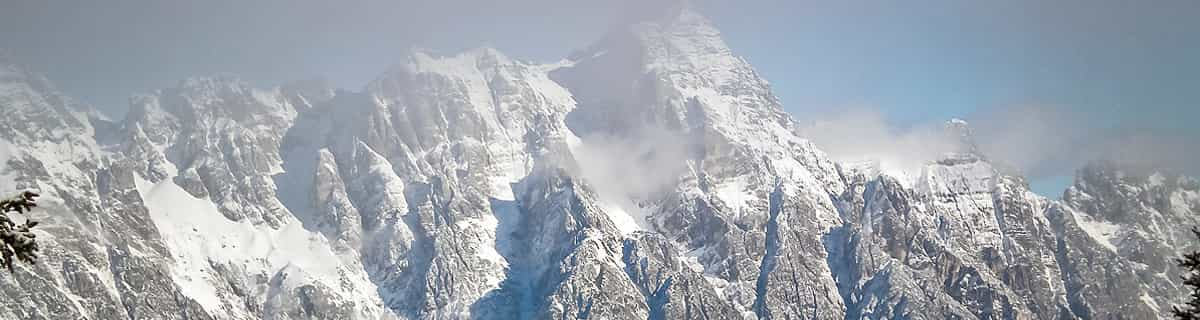
La tabella sopra da le previsioni meteo per Oberau a specifiche altezze 1068 m. I nostri sofisticati modelli meteo ci consentono di fornire previsioni neve per la vetta, l'area intermedia e a valle delle stazioni sciistiche di Oberau. Per accedere alle previsioni meteo ad altre altezze, per spostarti usa tab sopra la tabella. Per una visione meteo piu' ampia , controlla la mappa meteo di Austria.
Clicca qui per leggere ulteriori informazioni sullo zero termico e il nostro sistema di prevedere le temperature.
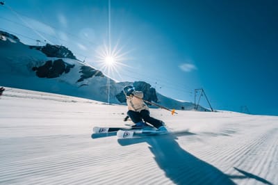
Oberau is a very tiny resort consisting of a couple of blues and a red/black run. However, it does sit in the middle of the Wildschonau region which gives access to Niederau and Auffach areas which are both much larger.
We stayed at the Schneerose which is ideally located for the black T-bar, the excellent ski school for beginners and the bus stop for the other resorts. The hotel was very comfortable and the resort is very beautiful. The veranda overlooked the black, so was an ideal place to wind down with a hot chocolate while the older kids put in a few more kilometres before tea.
We travelled with a school trip who had an excellent time in the ski school. The blue runs provided excellent pistes for beginners within Oberau, and the schools made a couple of trips to Niedearu when more challenging runs were required.
The more experienced of us were a little concerned about previous reports that there was not much to challenge us. On visiting Auffach (15 minutes by bus) we were met with a number of fabulous red runs with excellent snow conditions that were quite empty (even in half-term) with little or no queues. The day was completed by a 4km run down to the resort. The runs were well linked so we barely had to use our poles all day. To be honest, we skied the whole area in a day, but just wanted to come back for more.
Niederau (5 minutes by bus from Oberau) is the main resort in the valley and consisted of a number of nursery slopes at the bottom plus a number of reds and blacks coming down from the top. The blacks were long and steep in places, but the snow conditions were excellent so made them very enjoyable. The biggest gripe about Niederau is that the resort is so disjointed. The main gondola to the top has a red run straight down to the bottom, but the other reds/blacks can only be reached by a fair amount of poleing.
On the final day we finished off with tobogganing at Auffach, which was a hoot.
If you want a resort with Alpine charm and do not necessarily need 200km of Pistes, Oberau is a very good place to use as a base.
Gratis Snow-Forecast.com weather widget per il tho sito
Il Oberau widget meteo qui sotto è disponibile per essere incorporato su siti Web esterni a titolo gratuito. Esso fornisce un riepilogo giornaliero delle nostre Oberau previsioni meteo neve e dati meteo. Basta andare alla pagina di configurazione e seguire 3 semplici passi per prendere il codice html personalizzato ed incollarlo nel tuo sito. È possibile scegliere l'elevazione di previsione di neve (vetta, metà o piede della montagna) e l'unità metrica/imperiale per le previsioni meteo neve adeguata al proprio sito Web Clicca qui per ottenere il codice


 Nearest