

Portillo Re-Opens To Guests Arriving By Helicopter
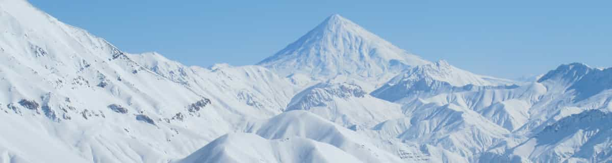
Chile’s famous Portillo ski resort is reported to have re-opened to guests arriving by helicopter after being cut off by road for more than two weeks by over 6m/20 feet of snowfall.

Next 3 days weather summary:Pioggia abbondante (totale 21.0mm), più pesante durante Mercoledì notte. Caldo (max 25°C Lunedì pomeriggio, min 15°C Mercoledì notte). Vento sarà generalmente leggero. | Giorni 4-6 Igls sommario meteoPioggia abbondante (totale 41.0mm), più pesante durante Giovedì notte. Caldo (max 22°C Giovedì pomeriggio, min 12°C Giovedì notte). Vento sarà generalmente leggero. | |||||||||||||||||
Lunedì 3 | Martedì 4 | Mercoledì 5 | Giovedì 6 | Venerdì 7 | Sabato 8 | |||||||||||||
AM | PM | notte | AM | PM | notte | AM | PM | notte | AM | PM | notte | AM | PM | notte | AM | PM | notte | |
limpido | poche nuvole | limpido | limpido | rovesci pioggia | rovesci pioggia | rischio temporale | rischio temporale | rovesci pioggia | rischio temporale | pioggia moderata | forte pioggia | pioggia leggera | rischio temporale | rovesci pioggia | limpido | rischio temporale | rovesci pioggia | |
km/h | ||||||||||||||||||
Mappa neve |  |  |  |  |  |  | ||||||||||||
— | — | — | — | — | — | — | — | — | — | — | — | — | — | — | — | — | — | |
mm | — | — | — | — | 2 | 3 | 1 | 4 | 11 | 3 | 6 | 19 | 3 | 3 | 3 | — | 2 | 2 |
max °C | 23 | 25 | 20 | 23 | 25 | 20 | 20 | 23 | 20 | 20 | 22 | 18 | 15 | 17 | 15 | 16 | 19 | 17 |
min °C | 18 | 22 | 18 | 19 | 18 | 16 | 16 | 22 | 15 | 16 | 20 | 12 | 12 | 16 | 12 | 13 | 18 | 14 |
chill °C | 18 | 22 | 18 | 19 | 18 | 16 | 16 | 22 | 15 | 16 | 20 | 12 | 12 | 16 | 12 | 13 | 18 | 14 |
Umido. % | 41 | 43 | 52 | 40 | 69 | 66 | 59 | 54 | 85 | 59 | 62 | 96 | 78 | 77 | 94 | 70 | 68 | 80 |
Zero termico m | 4500 | 4550 | 4500 | 4500 | 4550 | 4500 | 4400 | 4550 | 4400 | 4400 | 4450 | 3900 | 4000 | 4000 | 4000 | 4000 | 4100 | 4250 |
5:54 | — | — | 5:54 | — | — | 5:56 | — | — | 5:58 | — | — | 5:58 | — | — | 6:00 | — | — | |
— | — | 8:45 | — | — | 8:44 | — | — | 8:42 | — | — | 8:40 | — | — | 8:38 | — | — | 8:37 | |
Diventa pro e intaglia:
Informazioni valanghe: European Avalanche Warning Services (EAWS)
Gli ultimi report della neve vicino a Igls:
| La profondità maggiore della neve é: | — |
|---|---|
| La profondità minore della neve é: | — |
| Fresh snowfall depth: | — |
| Quando ha nevicato l'ultima volta? | 18 May 2026 |
0.0 | Giorni neve fresca Neve fresca, prevalentemente soleggiato, vento debole. |
|---|---|
0.0 | Giorni neve fresca Fresh snow, limited sun, any wind. |
0.0 | Giorni Bluebird Neve media, prevalentemente soleggiato, vento debole. |
La tabella sopra da le previsioni meteo per Igls a specifiche altezze 1558 m. I nostri sofisticati modelli meteo ci consentono di fornire previsioni neve per la vetta, l'area intermedia e a valle delle stazioni sciistiche di Igls. Per accedere alle previsioni meteo ad altre altezze, per spostarti usa tab sopra la tabella. Per una visione meteo piu' ampia , controlla la mappa meteo di Austria.
Clicca qui per leggere ulteriori informazioni sullo zero termico e il nostro sistema di prevedere le temperature.
Complessivamente 3.7 Basato su 2 voti e 2 recensioni
Great couple of days here - during a warm blip though - snow was considerably better in Stubai and Axamer. However, the views over Innsbruck, down the valley to Stubai and beyond were a total knockout. Good mixture of runs and good restaurants. The olympic red is long and fairly mental - loved it. Lifts are in need of an upgrade but for a morning or afternoon blast it doesn't matter. Skiing around Innsbruck has opened my eyes!! Goodbye France!!
matt da United Kingdom scrive:
Great couple of days here - during a warm blip though - snow was considerably better in Stubai and Axamer. However, the views over Innsbruck, down the valley to Stubai and beyond were a total knockout. Good mixture of runs and good restaurants. The olympic red is long and fairly mental - loved it. Lifts are in need of an upgrade but for a morning or afternoon blast it doesn't matter. Skiing around Innsbruck has opened my eyes!! Goodbye France!!


 Nearest