

America’s Next Indoor Snow Centre Takes Shape
Construction of a new indoor snow centre for skiers, boarders and tubers appears to be making good progress at Heritage Farm in Wayne County, West Virginia.

Next 3 days weather summary:Pioggia abbondante (totale 24.0mm), più pesante durante Giovedì pomeriggio. Temperature moderate (max 13°C Mercoledì pomeriggio, min 6°C Giovedì notte). Vento sarà generalmente leggero. | Giorni 4-6 Filzmoos sommario meteoPioggia moderata (totale 18.0mm), più pesante Domenica pomeriggio. Caldo (max 20°C Sabato pomeriggio, min 6°C Venerdì mattina). Vento sarà generalmente leggero. | |||||||||||||||||
Martedì 21 | Mercoledì 22 | Giovedì 23 | Venerdì 24 | Sabato 25 | Domenica 26 | |||||||||||||
AM | PM | notte | AM | PM | notte | AM | PM | notte | AM | PM | notte | AM | PM | notte | AM | PM | notte | |
rischio temporale | rovesci pioggia | rovesci pioggia | rovesci pioggia | poche nuvole | rovesci pioggia | pioggia leggera | rischio temporale | rovesci pioggia | rovesci pioggia | limpido | limpido | poche nuvole | limpido | rovesci pioggia | rischio temporale | forte pioggia | pioggia leggera | |
km/h | ||||||||||||||||||
Mappa neve |  |  |  |  |  |  | ||||||||||||
— | — | — | — | — | — | — | — | — | — | — | — | — | — | — | — | — | — | |
mm | 1 | 3 | 5 | 1 | — | 1 | 2 | 6 | 5 | 1 | — | — | — | — | 1 | 2 | 11 | 3 |
max °C | 12 | 12 | 9 | 9 | 13 | 11 | 7 | 9 | 8 | 10 | 13 | 12 | 15 | 20 | 18 | 12 | 10 | 10 |
min °C | 9 | 11 | 7 | 7 | 12 | 9 | 7 | 8 | 6 | 6 | 12 | 10 | 11 | 19 | 11 | 11 | 9 | 8 |
chill °C | 9 | 10 | 5 | 6 | 11 | 8 | 5 | 6 | 4 | 4 | 11 | 10 | 11 | 19 | 11 | 11 | 9 | 7 |
Umido. % | 69 | 74 | 81 | 61 | 50 | 71 | 97 | 85 | 75 | 55 | 40 | 54 | 41 | 32 | 69 | 81 | 99 | 99 |
Zero termico m | 3300 | 3100 | 2700 | 2750 | 3050 | 3000 | 2800 | 2850 | 2550 | 2700 | 3300 | 3650 | 3750 | 4100 | 4050 | 3550 | 3250 | 3250 |
5:30 | — | — | 5:31 | — | — | 5:31 | — | — | 5:33 | — | — | 5:33 | — | — | 5:35 | — | — | |
— | — | 8:52 | — | — | 8:52 | — | — | 8:51 | — | — | 8:50 | — | — | 8:49 | — | — | 8:47 | |
Diventa pro e intaglia:
Informazioni valanghe: European Avalanche Warning Services (EAWS)
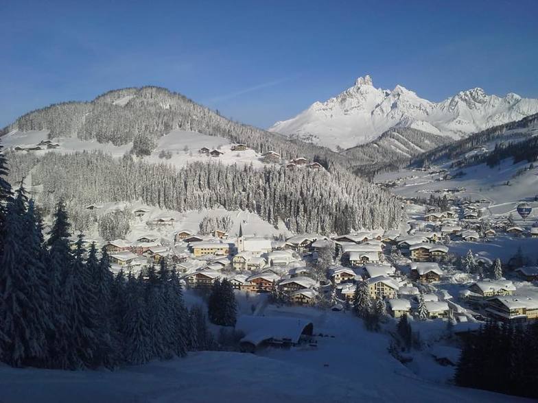
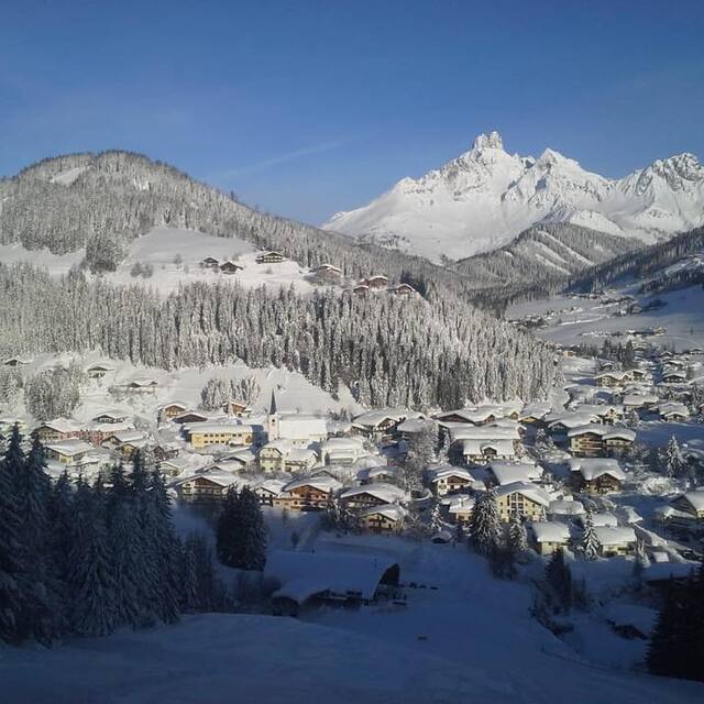
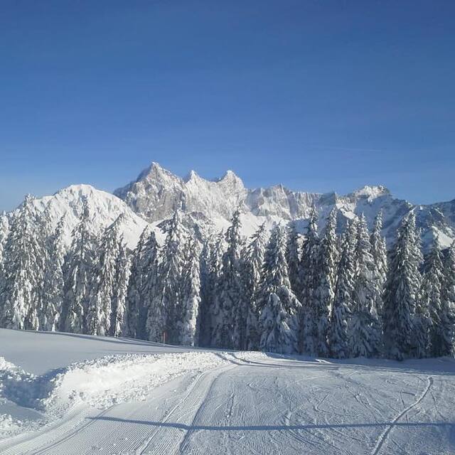
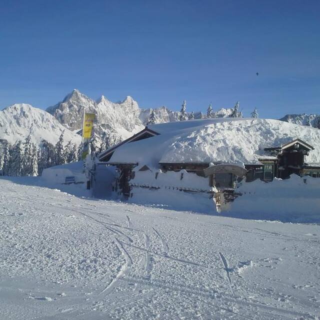
Gli ultimi report della neve vicino a Filzmoos:
| La profondità maggiore della neve é: | 0 cm |
|---|---|
| La profondità minore della neve é: | 0 cm |
| Fresh snowfall depth: | — |
| Quando ha nevicato l'ultima volta? | 10 Jun 2026 |
0.0 | Giorni neve fresca Neve fresca, prevalentemente soleggiato, vento debole. |
|---|---|
0.0 | Giorni neve fresca Fresh snow, limited sun, any wind. |
0.0 | Giorni Bluebird Neve media, prevalentemente soleggiato, vento debole. |
La tabella sopra da le previsioni meteo per Filzmoos a specifiche altezze 1645 m. I nostri sofisticati modelli meteo ci consentono di fornire previsioni neve per la vetta, l'area intermedia e a valle delle stazioni sciistiche di Filzmoos. Per accedere alle previsioni meteo ad altre altezze, per spostarti usa tab sopra la tabella. Per una visione meteo piu' ampia , controlla la mappa meteo di Austria.
Clicca qui per leggere ulteriori informazioni sullo zero termico e il nostro sistema di prevedere le temperature.
Complessivamente 4.3 Basato su 22 voti e 15 recensioni
This is our 9th year skiing in Filzmoos. Having skiied in many different resorts, we are always drawn back to this beautiful friendly village. Each year our group grows in size, this year there was 18 of us all staying at the Happy Filzmoos! The absolute best place to go for apres-ski! The Happy Filzmoos Hotel is homely and welcoming, the rooms are extremely clean, warm and cosy, the food is delicious! The Hotel is perfectly situated so that you walk from the boot room straight out to the chair lift. We look forward to going back again at the end of Feb for a short break! Proste!
Kay Hill da United Kingdom scrive:
This is our 9th year skiing in Filzmoos. Having skiied in many different resorts, we are always drawn back to this beautiful friendly village. Each year our group grows in size, this year there was 18 of us all staying at the Happy Filzmoos! The absolute best place to go for apres-ski! The Happy Filzmoos Hotel is homely and welcoming, the rooms are extremely clean, warm and cosy, the food is delicious! The Hotel is perfectly situated so that you walk from the boot room straight out to the chair lift. We look forward to going back again at the end of Feb for a short break! Proste!


 Nearest