Publicato da Snow-Forecast.com a:1 pm (ora locale) / 02 Aug 2026
Ultimi 6 giorniScorri a sinistra per gli ultimi 6 giorniOra
Next 3 days weather summary:
Pioggia moderata (totale 11.0mm), più pesante Domenica pomeriggio. Temperature moderate (max 18°C Lunedì pomeriggio, min 14°C Domenica notte). Vento sarà generalmente leggero.
Giorni 4-6 Alleghe sommario meteo
Pioggia abbondante (totale 20.0mm), più pesante durante Mercoledì pomeriggio. Temperature moderate (max 19°C Mercoledì pomeriggio, min 12°C Venerdì notte). Vento sarà generalmente leggero.
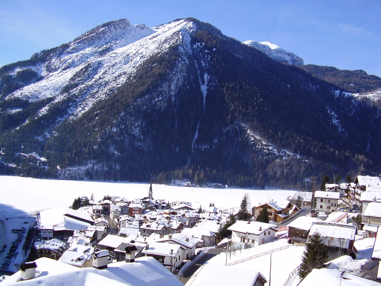
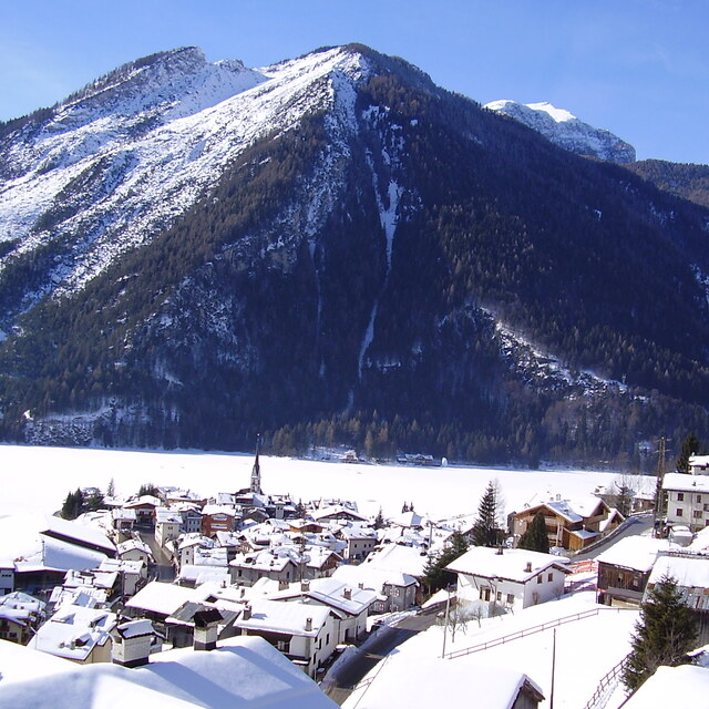
La tabella sopra da le previsioni meteo per Alleghe a specifiche altezze 2100 m. I nostri sofisticati modelli meteo ci consentono di fornire previsioni neve per la vetta, l'area intermedia e a valle delle stazioni sciistiche di Alleghe. Per accedere alle previsioni meteo ad altre altezze, per spostarti usa tab sopra la tabella. Per una visione meteo piu' ampia , controlla la mappa meteo di Italy.
Clicca qui per leggere ulteriori informazioni sullo zero termico e il nostro sistema di prevedere le temperature.
Recensioni dei visitatori di Alleghe
Complessivamente 3.7 Basato su 20 voti e 4 recensioni
I enjoyed reading the last two comments concerning this typical Italian resort. A wonderfully relaxed and quiet pace to the skiing. It's appreciable when you ski onto the Sella Ronda 'round' how frenetically stupid skiing can become.
I've used Alleghe now for several years as a gateway to backpack ski tour round the Dolomites. Here and Falcade are excellent gateways to start a tour staying at the mountain refugios. As an average intermediate skier it's quite easy to tour the Dolomites with a 30 litre pack, staying either in valley towns like this or in high altitude refugios perched at 1000 metres or so. You're very likely not to hear an English voice on the slopes in Falcade; come 2pm you'll have the slopes to yourself as the Italians will be sat in bars taking in the sun by then.
There again you can go to France, pay twice as much, queue up for hours to ski the same slopes and go back to the same chalet/hotel...
Complessivamente: 3.7 Basato su 20 voti e 4 recensioni
Snowsure
4.2
Varietà di piste
4.0
Fuoripista
2.8
Paesaggio
4.6
Apres-Ski
2.9
Rick Parker da United Kingdom scrive:
I enjoyed reading the last two comments concerning this typical Italian resort. A wonderfully relaxed and quiet pace to the skiing. It's appreciable when you ski onto the Sella Ronda 'round' how frenetically stupid skiing can become.
I've used Alleghe now for several years as a gateway to backpack ski tour round the Dolomites. Here and Falcade are excellent gateways to start a tour staying at the mountain refugios. As an average intermediate skier it's quite easy to tour the Dolomites with a 30 litre pack, staying either in valley towns like this or in high altitude refugios perched at 1000 metres or so. You're very likely not to hear an English voice on the slopes in Falcade; come 2pm you'll have the slopes to yourself as the Italians will be sat in bars taking in the sun by then.
There again you can go to France, pay twice as much, queue up for hours to ski the same slopes and go back to the same chalet/hotel...
Gratis Snow-Forecast.com weather widget per il tho sito
Il Alleghe widget meteo qui sotto è disponibile per essere incorporato su siti Web esterni a titolo gratuito. Esso fornisce un riepilogo giornaliero delle nostre Alleghe previsioni meteo neve e dati meteo. Basta andare alla pagina di configurazione e seguire 3 semplici passi per prendere il codice html personalizzato ed incollarlo nel tuo sito. È possibile scegliere l'elevazione di previsione di neve (vetta, metà o piede della montagna) e l'unità metrica/imperiale per le previsioni meteo neve adeguata al proprio sito Web Clicca qui per ottenere il codice


 Nearest