La tabella sopra da le previsioni meteo per Abtenau a specifiche altezze 1200 m. I nostri sofisticati modelli meteo ci consentono di fornire previsioni neve per la vetta, l'area intermedia e a valle delle stazioni sciistiche di Abtenau. Per accedere alle previsioni meteo ad altre altezze, per spostarti usa tab sopra la tabella. Per una visione meteo piu' ampia , controlla la mappa meteo di Austria.
Clicca qui per leggere ulteriori informazioni sullo zero termico e il nostro sistema di prevedere le temperature.
Recensioni dei visitatori di Abtenau
Complessivamente 3.6 Basato su 11 voti e 4 recensioni
Sandra Birkinshaw (Senior) da United Kingdom scrive:
I have been visiting Abtenau for the past 29 years. We have visited in spring, summer, autumn and last but not least the winter (all seasons are beautiful). I don't ski, but my husband and children all ski. My husband and children all learned to ski in Abtenau and indeed my son also takes his wife (Sandra) and his children for skiing in Abtenau. My son and his family do go to other countries to ski, but still love to go back to Abtenau every year. We get a very good hotel. It is quiet, the air is clean, lift pass prices are good, food and drink is good and reasonably priced and last but not least, the scenery is wonderful and breathtaking; you absorb all this and then say 'I will be back next year'.
The skiing is excellent for families, the pistes are always kept in an excellent condition as are the langlauf trails and for the people who would like something more challenging, it is only a very short trip on the local bus to a very vast ski region. Give Abtenau a go and you won't regret it.
Complessivamente: 3.6 Basato su 11 voti e 4 recensioni
Snowsure
2.3
Varietà di piste
2.5
Fuoripista
3.0
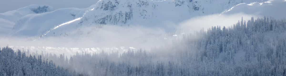
Paesaggio
4.0
Apres-Ski
2.2
Sandra Birkinshaw (Senior) da United Kingdom scrive:
I have been visiting Abtenau for the past 29 years. We have visited in spring, summer, autumn and last but not least the winter (all seasons are beautiful). I don't ski, but my husband and children all ski. My husband and children all learned to ski in Abtenau and indeed my son also takes his wife (Sandra) and his children for skiing in Abtenau. My son and his family do go to other countries to ski, but still love to go back to Abtenau every year. We get a very good hotel. It is quiet, the air is clean, lift pass prices are good, food and drink is good and reasonably priced and last but not least, the scenery is wonderful and breathtaking; you absorb all this and then say 'I will be back next year'.
The skiing is excellent for families, the pistes are always kept in an excellent condition as are the langlauf trails and for the people who would like something more challenging, it is only a very short trip on the local bus to a very vast ski region. Give Abtenau a go and you won't regret it.
Gratis Snow-Forecast.com weather widget per il tho sito
Il Abtenau widget meteo qui sotto è disponibile per essere incorporato su siti Web esterni a titolo gratuito. Esso fornisce un riepilogo giornaliero delle nostre Abtenau previsioni meteo neve e dati meteo. Basta andare alla pagina di configurazione e seguire 3 semplici passi per prendere il codice html personalizzato ed incollarlo nel tuo sito. È possibile scegliere l'elevazione di previsione di neve (vetta, metà o piede della montagna) e l'unità metrica/imperiale per le previsioni meteo neve adeguata al proprio sito Web Clicca qui per ottenere il codice


 Nearest