

America’s Next Indoor Snow Centre Takes Shape
Construction of a new indoor snow centre for skiers, boarders and tubers appears to be making good progress at Heritage Farm in Wayne County, West Virginia.

Next 3 days weather summary:Pioggia abbondante (totale 23.0mm), più pesante durante Martedì notte. Caldo (max 32°C Lunedì pomeriggio, min 16°C Martedì notte). Vento sarà generalmente leggero. | Giorni 4-6 Sundance sommario meteoPer lo più asciutto. Caldo (max 33°C Sabato pomeriggio, min 20°C Giovedì notte). Vento sarà generalmente leggero. | ||||||||||||||||
Lun 20 | Martedì 21 | Mercoledì 22 | Giovedì 23 | Venerdì 24 | Sabato 25 | ||||||||||||
PM | notte | AM | PM | notte | AM | PM | notte | AM | PM | notte | AM | PM | notte | AM | PM | notte | |
rovesci pioggia | rovesci pioggia | poche nuvole | rischio temporale | rovesci pioggia | pioggia leggera | rischio temporale | rovesci pioggia | limpido | limpido | limpido | limpido | limpido | limpido | limpido | limpido | limpido | |
km/h | |||||||||||||||||
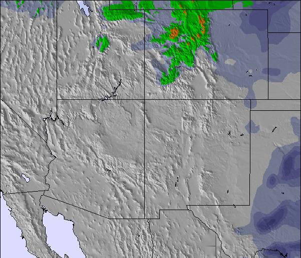
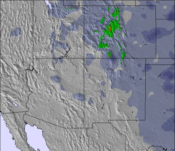
Mappa neve |  | 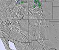 | 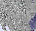 | 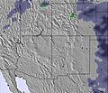 |  |  | |||||||||||
— | — | — | — | — | — | — | — | — | — | — | — | — | — | — | — | — | |
mm | 1 | 1 | — | 3 | 12 | 1 | 2 | 3 | — | — | — | — | — | — | — | — | — |
max °C | 32 | 21 | 29 | 28 | 17 | 24 | 27 | 19 | 26 | 29 | 23 | 30 | 32 | 25 | 31 | 33 | 26 |
min °C | 23 | 19 | 23 | 21 | 16 | 20 | 25 | 16 | 20 | 28 | 20 | 26 | 32 | 21 | 27 | 33 | 21 |
chill °C | 23 | 19 | 23 | 21 | 16 | 20 | 25 | 16 | 20 | 28 | 20 | 26 | 32 | 21 | 27 | 33 | 21 |
Umido. % | 25 | 47 | 46 | 35 | 74 | 72 | 46 | 78 | 68 | 33 | 39 | 33 | 21 | 34 | 29 | 19 | 24 |
Zero termico m | 5800 | 5650 | 5400 | 5700 | 5500 | 5300 | 5400 | 5250 | 5150 | 5500 | 5650 | 5600 | 5750 | 5700 | 5600 | 5750 | 5850 |
— | — | 6:13 | — | — | 6:13 | — | — | 6:15 | — | — | 6:16 | — | — | 6:16 | — | — | |
8:52 | — | — | 8:51 | — | — | 8:50 | — | — | 8:49 | — | — | 8:49 | — | — | 8:47 | — | |
Diventa pro e intaglia:
Informazioni valanghe: National Avalanche Center
Gli ultimi report della neve vicino a Sundance:
| La profondità maggiore della neve é: | — |
|---|---|
| La profondità minore della neve é: | — |
| Fresh snowfall depth: | — |
| Quando ha nevicato l'ultima volta? | 28 Jun 2026 |
0.0 | Giorni neve fresca Neve fresca, prevalentemente soleggiato, vento debole. |
|---|---|
0.0 | Giorni neve fresca Fresh snow, limited sun, any wind. |
0.0 | Giorni Bluebird Neve media, prevalentemente soleggiato, vento debole. |
La tabella sopra da le previsioni meteo per Sundance a specifiche altezze 1859 m. I nostri sofisticati modelli meteo ci consentono di fornire previsioni neve per la vetta, l'area intermedia e a valle delle stazioni sciistiche di Sundance. Per accedere alle previsioni meteo ad altre altezze, per spostarti usa tab sopra la tabella. Per una visione meteo piu' ampia , controlla la mappa meteo di United States.
Clicca qui per leggere ulteriori informazioni sullo zero termico e il nostro sistema di prevedere le temperature.
Complessivamente 3.2 Basato su 10 voti e 3 recensioni
As far as terrain goes, Sundance pales in comparison with other Utah resorts but the picturesque setting and quaint feel make up for the lack of snow and epic runs. Snow accumulation is not all that impressive but there's usually plenty to go around.
eb da United States scrive:
As far as terrain goes, Sundance pales in comparison with other Utah resorts but the picturesque setting and quaint feel make up for the lack of snow and epic runs. Snow accumulation is not all that impressive but there's usually plenty to go around.

 Nearest