Publicato da Snow-Forecast.com a:1 am (ora locale) / 03 Aug 2026
Ultimi 6 giorniScorri a sinistra per gli ultimi 6 giorniOra
Next 3 days weather summary:
Pioggia abbondante (totale 26.0mm), più pesante durante Martedì notte. Temperature moderate (max 10°C Martedì pomeriggio, min 8°C Lunedì mattina). Vento sarà generalmente leggero.
Giorni 4-6 Stubai Glacier sommario meteo
Pioggia abbondante (totale 51.0mm), più pesante durante Giovedì notte. Temperature moderate (max 8°C Giovedì mattina, min 5°C Giovedì notte). Vento sarà generalmente leggero.
La tabella sopra da le previsioni meteo per Stubai Glacier a specifiche altezze 3201 m. I nostri sofisticati modelli meteo ci consentono di fornire previsioni neve per la vetta, l'area intermedia e a valle delle stazioni sciistiche di Stubai Glacier. Per accedere alle previsioni meteo ad altre altezze, per spostarti usa tab sopra la tabella. Per una visione meteo piu' ampia , controlla la mappa meteo di Austria.
Clicca qui per leggere ulteriori informazioni sullo zero termico e il nostro sistema di prevedere le temperature.
Recensioni dei visitatori di Stubai Glacier
Complessivamente 4.1 Basato su 23 voti e 19 recensioni
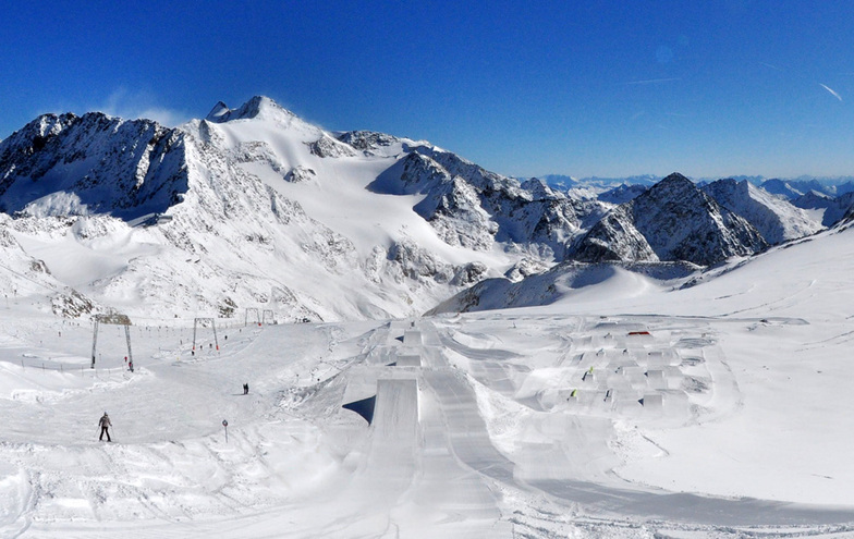
I've skied Stubai on 3 sperate days in the past 12 months and have to say the place is epic! It's so much more than a glacier with 110 km of marked pistes, many of which are non glacial. The snow is always great from the Dresdener Hut upwards and Ski Route (Itinerary)14 to the bottom is magnificent.
For hard core skiers the off-piste is virtually unlimited, with further challenges for ski-touring and couloir thrill seekers. There are crevasses but in the core season these are no issue, however, off-piste is a no-no in the summer months.
For beginners the area around Gamsgarten is perfect with dry snow guaranteed throughout the winter and well into April.
Great choice of restaurants on the mountain with the Dresdener Hut being great value.
Apres-ski at Gamsgarten is incredible, especially when they open the roof and everybody starts dancing on the tables, before de-camping down to the Mutterberger Alm at the bottom for more of the same! Classic Austrian party time.
Mutterberger Alm is also a great 4 star hotel and very reasonably priced for ski in-ski out lovers.
Complessivamente: 4.1 Basato su 23 voti e 19 recensioni
Snowsure
4.9
Varietà di piste
4.4
Fuoripista
3.9
Paesaggio
4.5
Apres-Ski
3.9
Tirolerhund da United Kingdom scrive:
I've skied Stubai on 3 sperate days in the past 12 months and have to say the place is epic! It's so much more than a glacier with 110 km of marked pistes, many of which are non glacial. The snow is always great from the Dresdener Hut upwards and Ski Route (Itinerary)14 to the bottom is magnificent.
For hard core skiers the off-piste is virtually unlimited, with further challenges for ski-touring and couloir thrill seekers. There are crevasses but in the core season these are no issue, however, off-piste is a no-no in the summer months.
For beginners the area around Gamsgarten is perfect with dry snow guaranteed throughout the winter and well into April.
Great choice of restaurants on the mountain with the Dresdener Hut being great value.
Apres-ski at Gamsgarten is incredible, especially when they open the roof and everybody starts dancing on the tables, before de-camping down to the Mutterberger Alm at the bottom for more of the same! Classic Austrian party time.
Mutterberger Alm is also a great 4 star hotel and very reasonably priced for ski in-ski out lovers.
Gratis Snow-Forecast.com weather widget per il tho sito
Il Stubai Glacier widget meteo qui sotto è disponibile per essere incorporato su siti Web esterni a titolo gratuito. Esso fornisce un riepilogo giornaliero delle nostre Stubai Glacier previsioni meteo neve e dati meteo. Basta andare alla pagina di configurazione e seguire 3 semplici passi per prendere il codice html personalizzato ed incollarlo nel tuo sito. È possibile scegliere l'elevazione di previsione di neve (vetta, metà o piede della montagna) e l'unità metrica/imperiale per le previsioni meteo neve adeguata al proprio sito Web Clicca qui per ottenere il codice


 Nearest