Ultimi 6 giorniScorri a sinistra per gli ultimi 6 giorniOra
Next 3 days weather summary:
Per lo più asciutto. Caldo (max 20°C Martedì pomeriggio, min 14°C Giovedì mattina). Principalmente forte vento.
Giorni 4-6 Snowy Range Ski and Recreation Area sommario meteo
Pioggia leggera (totale 4.0mm), per lo più che cade Domenica pomeriggio. Caldo (max 22°C Sabato pomeriggio, min 11°C Lunedì mattina). Principalmente forte vento.
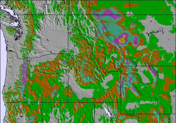
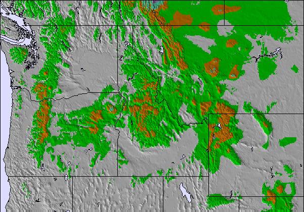
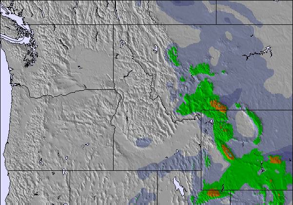
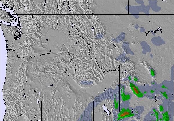
La tabella sopra da le previsioni meteo per Snowy Range Ski and Recreation Area a specifiche altezze 3045 m. I nostri sofisticati modelli meteo ci consentono di fornire previsioni neve per la vetta, l'area intermedia e a valle delle stazioni sciistiche di Snowy Range Ski and Recreation Area. Per accedere alle previsioni meteo ad altre altezze, per spostarti usa tab sopra la tabella. Per una visione meteo piu' ampia , controlla la mappa meteo di United States.
Clicca qui per leggere ulteriori informazioni sullo zero termico e il nostro sistema di prevedere le temperature.
Recensioni dei visitatori di Snowy Range Ski and Recreation Area
My first skiing experience was when I was 14 years old. That wasn't very long ago so I still remember everything. I came to snowy range with some family and had the time of my life. Skiing turned out to be my favorite memory of my life. Snowy Range has great helpers. I took ski lessons and learned a lot. My 2nd year, my cousin and I wore these outrageous hats, which we have made an annual thing, and the person running the ski lift at the top threw snowballs at us. The next we were prepared and had our own snowballs. The staff are friendly and it was the perfect place for me to grow up learning skiing. I took to skiing right away. The trails have about everything you could ever want from them. They have bumpy and smooth trails. They have nice long relaxing ones and really fun twisty trails.
Recensioni dei visitatori di Snowy Range Ski and Recreation Area
Torak da United States scrive:
My first skiing experience was when I was 14 years old. That wasn't very long ago so I still remember everything. I came to snowy range with some family and had the time of my life. Skiing turned out to be my favorite memory of my life. Snowy Range has great helpers. I took ski lessons and learned a lot. My 2nd year, my cousin and I wore these outrageous hats, which we have made an annual thing, and the person running the ski lift at the top threw snowballs at us. The next we were prepared and had our own snowballs. The staff are friendly and it was the perfect place for me to grow up learning skiing. I took to skiing right away. The trails have about everything you could ever want from them. They have bumpy and smooth trails. They have nice long relaxing ones and really fun twisty trails.
Gratis Snow-Forecast.com weather widget per il tho sito
Il Snowy Range Ski and Recreation Area widget meteo qui sotto è disponibile per essere incorporato su siti Web esterni a titolo gratuito. Esso fornisce un riepilogo giornaliero delle nostre Snowy Range Ski and Recreation Area previsioni meteo neve e dati meteo. Basta andare alla pagina di configurazione e seguire 3 semplici passi per prendere il codice html personalizzato ed incollarlo nel tuo sito. È possibile scegliere l'elevazione di previsione di neve (vetta, metà o piede della montagna) e l'unità metrica/imperiale per le previsioni meteo neve adeguata al proprio sito Web Clicca qui per ottenere il codice


 Nearest