Publicato da Snow-Forecast.com a:7 pm (ora locale) / 01 Aug 2026
Ultimi 6 giorniScorri a sinistra per gli ultimi 6 giorniOra
Next 4 days weather summary:
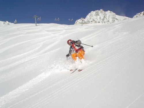
Pioggia moderata (totale 11.0mm), più pesante Martedì pomeriggio. Temperature moderate (max 16°C Domenica pomeriggio, min 12°C Sabato notte). Vento sarà generalmente leggero.
Giorni 5-7 Saint François Longchamp sommario meteo
Pioggia abbondante (totale 24.0mm), più pesante durante Giovedì notte. Temperature moderate (max 14°C Mercoledì pomeriggio, min 10°C Giovedì notte). Vento sarà generalmente leggero.
La tabella sopra da le previsioni meteo per Saint François Longchamp a specifiche altezze 2550 m. I nostri sofisticati modelli meteo ci consentono di fornire previsioni neve per la vetta, l'area intermedia e a valle delle stazioni sciistiche di Saint François Longchamp. Per accedere alle previsioni meteo ad altre altezze, per spostarti usa tab sopra la tabella. Per una visione meteo piu' ampia , controlla la mappa meteo di France.
Clicca qui per leggere ulteriori informazioni sullo zero termico e il nostro sistema di prevedere le temperature.
Il nome della localita' è scritto anche come Saint Francois Longchamp.
Recensioni dei visitatori di Saint François Longchamp
Complessivamente 4.4 Basato su 7 voti e 5 recensioni
I am fed up with so called experts running down resorts. I am 57 years old, have been skiing since I was 12 and have skied in excess of 35 resorts and Saint Francois Longchamp is very good. I am a qualified instructor in many aspects of the sport. Another reviewer needs to decide if the black leading off to the left, from the Luziere chair, just after a fresh fall, is challenging enough or they would rather have a top class night club where he can go on the piss until 2.00am. Make your mind up!
SFL and the Grand Domaine are very good; it is good for all standards. Skiing isn't about screaming down a few slopes as fast as you can but is an experience of the environment and the joy of sliding in control and enjoying yourself. I feel that the facilities for absolute beginners, although adequate, could improve. However, once you have mastered the basics the next step at SFL is very good. Wide green slopes enabling travel and technique improvement. High blues and a gentle decent are there if you want it. There are a couple or three of the long serving instructors who need to update their teaching techniques to take into account the change that has happened with the advances in equipment. For those who have skied maybe one or two weeks, before you can enjoy the Grand Domaine even further, improve your confidence and ability plus enjoyment with 'you' time on the snow.
The dammers at SFL work very hard to prepare your slopes to their best and are better prepared than the Valmorel side of the mountain.
If your idea of skiing is going on the piss until 2.00am or until you can't see, then this is not the resort for you. If you want to enjoy mountains, mountain life, enjoying the resort ambiance, developing your skiing and improving it and travelling in an area of 165 kilometres and what it offers then it is definitely for you. I can drive to pretty much anywhere from where I live in France but I will drive to SFL 1650 on Saturday.
Recensioni dei visitatori di Saint François Longchamp
Complessivamente: 4.4 Basato su 7 voti e 5 recensioni
Snowsure
4.1
Varietà di piste
4.7
Fuoripista
4.0
Paesaggio
4.6
Apres-Ski
4.1
Steve Taylor da France scrive:
I am fed up with so called experts running down resorts. I am 57 years old, have been skiing since I was 12 and have skied in excess of 35 resorts and Saint Francois Longchamp is very good. I am a qualified instructor in many aspects of the sport. Another reviewer needs to decide if the black leading off to the left, from the Luziere chair, just after a fresh fall, is challenging enough or they would rather have a top class night club where he can go on the piss until 2.00am. Make your mind up!
SFL and the Grand Domaine are very good; it is good for all standards. Skiing isn't about screaming down a few slopes as fast as you can but is an experience of the environment and the joy of sliding in control and enjoying yourself. I feel that the facilities for absolute beginners, although adequate, could improve. However, once you have mastered the basics the next step at SFL is very good. Wide green slopes enabling travel and technique improvement. High blues and a gentle decent are there if you want it. There are a couple or three of the long serving instructors who need to update their teaching techniques to take into account the change that has happened with the advances in equipment. For those who have skied maybe one or two weeks, before you can enjoy the Grand Domaine even further, improve your confidence and ability plus enjoyment with 'you' time on the snow.
The dammers at SFL work very hard to prepare your slopes to their best and are better prepared than the Valmorel side of the mountain.
If your idea of skiing is going on the piss until 2.00am or until you can't see, then this is not the resort for you. If you want to enjoy mountains, mountain life, enjoying the resort ambiance, developing your skiing and improving it and travelling in an area of 165 kilometres and what it offers then it is definitely for you. I can drive to pretty much anywhere from where I live in France but I will drive to SFL 1650 on Saturday.
Gratis Snow-Forecast.com weather widget per il tho sito
Il Saint François Longchamp widget meteo qui sotto è disponibile per essere incorporato su siti Web esterni a titolo gratuito. Esso fornisce un riepilogo giornaliero delle nostre Saint François Longchamp previsioni meteo neve e dati meteo. Basta andare alla pagina di configurazione e seguire 3 semplici passi per prendere il codice html personalizzato ed incollarlo nel tuo sito. È possibile scegliere l'elevazione di previsione di neve (vetta, metà o piede della montagna) e l'unità metrica/imperiale per le previsioni meteo neve adeguata al proprio sito Web Clicca qui per ottenere il codice


 Nearest