Una moderata caduta di neve, concentrandosi maggiormente Giovedì mattina. Le temperature saranno sotto lo zero (max -7°C Sabato notte, min -12°C Giovedì notte). Vento sarà generalmente leggero.
Giorni 4-6 Pitztal Glacier sommario meteo
Una leggera copertura di neve nuova, che ancora cade Lunedì mattina. Le temperature saranno sotto lo zero (max -7°C Martedì pomeriggio, min -14°C Lunedì pomeriggio). Vento sarà generalmente leggero.
Light rain reported from Flughafen Innsbruck Automatic Weather Station at 593 metres elevation 8 kms NNE of Axamer Lizum but it is forecast cold enough for snow at higher elevations in the ski area da Axamer Lizum
43km Assente da Pitztal Glacier
17 hours fa
Light rain reported from Flughafen Innsbruck Automatic Weather Station at 593 metres elevation 8 kms NNE of Axamer Lizum but it is forecast cold enough for snow at the ski area da Axamer Lizum
43km Assente da Pitztal Glacier
19 hours fa
Snow falling on the slopes above Ischgl. da Ischgl
La tabella sopra da le previsioni meteo per Pitztal Glacier a specifiche altezze 3440 m. I nostri sofisticati modelli meteo ci consentono di fornire previsioni neve per la vetta, l'area intermedia e a valle delle stazioni sciistiche di Pitztal Glacier. Per accedere alle previsioni meteo ad altre altezze, per spostarti usa tab sopra la tabella. Per una visione meteo piu' ampia , controlla la mappa meteo di Austria.
Clicca qui per leggere ulteriori informazioni sullo zero termico e il nostro sistema di prevedere le temperature.
Recensioni dei visitatori di Pitztal Glacier
Complessivamente 4.4 Basato su 19 voti e 3 recensioni
I will be short.
If you are into: 1) spectacular scenery and views; 2) massive glaciers and a high-mountain environment; 3) off-piste skiing and ski-alpinism; 4) pristine and uncontaminated alpine valley; 5) friendly locals; 6) no queues; and 7) great value for money, then this is THE place for you. Look no further. Pitztal has it all.
If on the other hand you are after showing off, discos, apres-ski and drunken crowds avoid this place altogether. Go to nearby Soelden if skiing is still important or head to Ischgl if partying is top priority.
If great food is your priority, avoid Austria altogether I am afraid. Head for the Reschen Pass (nearby) or the Brenner and ski Italy.
Complessivamente: 4.4 Basato su 19 voti e 3 recensioni
Snowsure
5.0
Varietà di piste
4.1
Fuoripista
4.7
Paesaggio
4.4
Apres-Ski
3.1
A-ski da Luxembourg scrive:
I will be short.
If you are into: 1) spectacular scenery and views; 2) massive glaciers and a high-mountain environment; 3) off-piste skiing and ski-alpinism; 4) pristine and uncontaminated alpine valley; 5) friendly locals; 6) no queues; and 7) great value for money, then this is THE place for you. Look no further. Pitztal has it all.
If on the other hand you are after showing off, discos, apres-ski and drunken crowds avoid this place altogether. Go to nearby Soelden if skiing is still important or head to Ischgl if partying is top priority.
If great food is your priority, avoid Austria altogether I am afraid. Head for the Reschen Pass (nearby) or the Brenner and ski Italy.
Gratis Snow-Forecast.com weather widget per il tho sito
Il Pitztal Glacier widget meteo qui sotto è disponibile per essere incorporato su siti Web esterni a titolo gratuito. Esso fornisce un riepilogo giornaliero delle nostre Pitztal Glacier previsioni meteo neve e dati meteo. Basta andare alla pagina di configurazione e seguire 3 semplici passi per prendere il codice html personalizzato ed incollarlo nel tuo sito. È possibile scegliere l'elevazione di previsione di neve (vetta, metà o piede della montagna) e l'unità metrica/imperiale per le previsioni meteo neve adeguata al proprio sito Web Clicca qui per ottenere il codice

 ski hire exclusive discount


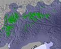
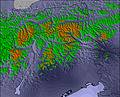


 Snow
 Previsioni neve orarie e a 16 giorni


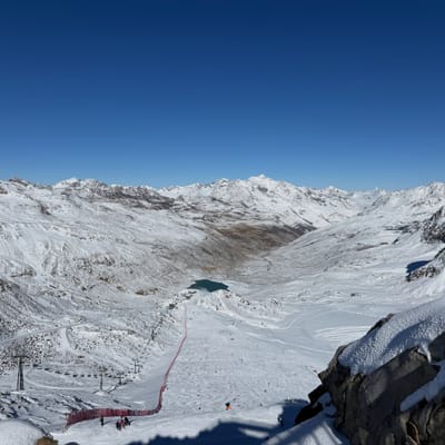

 Iscriviti o Accedi
 Scarica una nuova foto

 Nearest