Ultimi 6 giorniScorri a sinistra per gli ultimi 6 giorniOra
Next 3 days weather summary:
Pioggia abbondante (totale 22.0mm), più pesante durante Domenica pomeriggio. Temperature moderate (max 11°C Sabato pomeriggio, min 5°C Domenica pomeriggio). Vento sarà generalmente leggero.
Giorni 4-6 Obertauern sommario meteo
Pioggia leggera (totale 8.0mm) All'inizio, poi diventa più freddo con una spolverata di neve Giovedì pomeriggio. Condizioni di gelo e disgelo (max 6°C Mercoledì pomeriggio, min 0°C Martedì notte). Vento sarà generalmente leggero.
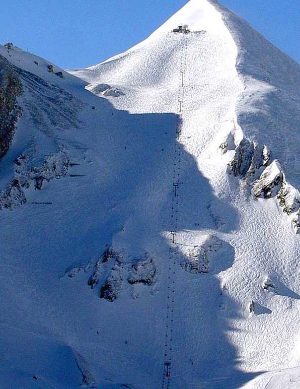
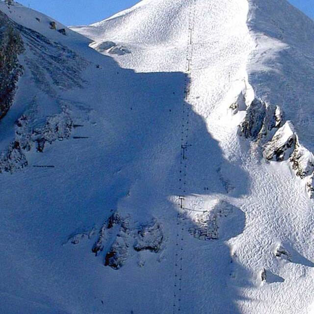
La tabella sopra da le previsioni meteo per Obertauern a specifiche altezze 2350 m. I nostri sofisticati modelli meteo ci consentono di fornire previsioni neve per la vetta, l'area intermedia e a valle delle stazioni sciistiche di Obertauern. Per accedere alle previsioni meteo ad altre altezze, per spostarti usa tab sopra la tabella. Per una visione meteo piu' ampia , controlla la mappa meteo di Austria.
Clicca qui per leggere ulteriori informazioni sullo zero termico e il nostro sistema di prevedere le temperature.
Recensioni dei visitatori di Obertauern
Complessivamente 4.2 Basato su 29 voti e 21 recensioni
I have skiied in Obertauern for the past 6 years and it gets better and better every year. The pistes are accessible and varied plus the resort is snow sure from December to May!
There is fabulous apres-ski at "the Lurzer" and up the mountain at "the Hochalm" not to mention lots of choice for eating out.
The real jewel was the outstanding 'Steinadler Aparthaus' across the road from the Zehnerkar lift station. The apartment was spacious, warm and very luxurious with all the amenities necessary for a really great holiday. You can ski in / out or just walk across to the ski lift in 5 minutes.
All in all, Obertauern is fabulous!
Complessivamente: 4.2 Basato su 29 voti e 21 recensioni
Snowsure
4.9
Varietà di piste
4.3
Fuoripista
4.0
Paesaggio
4.4
Apres-Ski
4.7
simon da United Kingdom scrive:
I have skiied in Obertauern for the past 6 years and it gets better and better every year. The pistes are accessible and varied plus the resort is snow sure from December to May!
There is fabulous apres-ski at "the Lurzer" and up the mountain at "the Hochalm" not to mention lots of choice for eating out.
The real jewel was the outstanding 'Steinadler Aparthaus' across the road from the Zehnerkar lift station. The apartment was spacious, warm and very luxurious with all the amenities necessary for a really great holiday. You can ski in / out or just walk across to the ski lift in 5 minutes.
All in all, Obertauern is fabulous!
Gratis Snow-Forecast.com weather widget per il tho sito
Il Obertauern widget meteo qui sotto è disponibile per essere incorporato su siti Web esterni a titolo gratuito. Esso fornisce un riepilogo giornaliero delle nostre Obertauern previsioni meteo neve e dati meteo. Basta andare alla pagina di configurazione e seguire 3 semplici passi per prendere il codice html personalizzato ed incollarlo nel tuo sito. È possibile scegliere l'elevazione di previsione di neve (vetta, metà o piede della montagna) e l'unità metrica/imperiale per le previsioni meteo neve adeguata al proprio sito Web Clicca qui per ottenere il codice


 Nearest