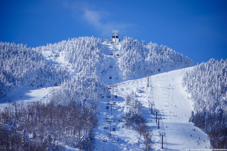
La tabella sopra da le previsioni meteo per Mont Orford a specifiche altezze 313 m. I nostri sofisticati modelli meteo ci consentono di fornire previsioni neve per la vetta, l'area intermedia e a valle delle stazioni sciistiche di Mont Orford. Per accedere alle previsioni meteo ad altre altezze, per spostarti usa tab sopra la tabella. Per una visione meteo piu' ampia , controlla la mappa meteo di Canada.
Clicca qui per leggere ulteriori informazioni sullo zero termico e il nostro sistema di prevedere le temperature.
Recensioni dei visitatori di Mont Orford
Complessivamente 4.0 Basato su 3 voti e 1 recensione
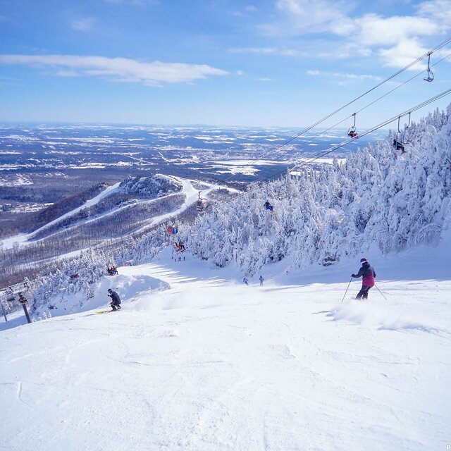
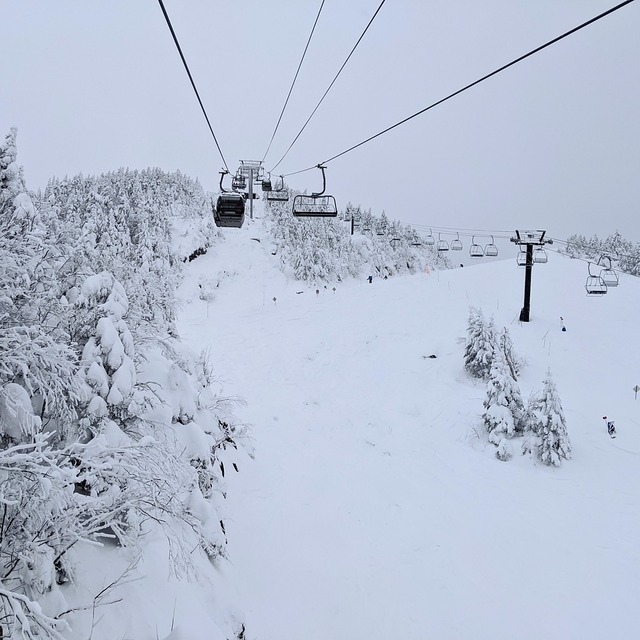
Skied Mont Orford for the first time Dec 30/19 to Jan 2/19. Family of 5: 2 adults, 2 youth(13 & 16), 1 child(10yo), all of whom have been skiing for about 7 years (Bristol Mtn, Gore, Mt Ste. Anne, Massif, Tremblant). Very icy the first day but got a great dump of snow for the next three days. Stuck to the greens and blues as the blacks were very icy due to wind. The 4km and Famiiliale were quite good as well as Magog. The kids loved Escapade and Foret Magique. There is only one real building but it is large and we had no problems finding space for our stuff. There is a microwave in the basement along with nice washrooms. There were really only two lifts: express quad and an express hybrid (6 seat lift/8 seat gondola). There was a triple working every once in a while part way up the main hill. The lift lines can get long, especially for the quad - lots of switchbacks. The staff was exceptionally nice and put up with my terrible French and switched to English with no problems. It is nice buying lift tickets inside rather than waiting in the cold. There was only a long line on our last day but it moved very quickly. The views from the summits are gorgeous. You can see across the valley and the lake to Owl's Head, another resort. The town of Magog is larger than you think and has everything you need (multiple grocery stores, CTC, Walmart). There is also a 2.5km ice skating trail down by the lake that is free (parking costs a little bit).
Complessivamente: 4.0 Basato su 3 voti e 1 recensione
Snowsure
4.0
Varietà di piste
4.7
Fuoripista
2.7
Paesaggio
4.7
Apres-Ski
4.0
Andrea da Canada scrive:
Skied Mont Orford for the first time Dec 30/19 to Jan 2/19. Family of 5: 2 adults, 2 youth(13 & 16), 1 child(10yo), all of whom have been skiing for about 7 years (Bristol Mtn, Gore, Mt Ste. Anne, Massif, Tremblant). Very icy the first day but got a great dump of snow for the next three days. Stuck to the greens and blues as the blacks were very icy due to wind. The 4km and Famiiliale were quite good as well as Magog. The kids loved Escapade and Foret Magique. There is only one real building but it is large and we had no problems finding space for our stuff. There is a microwave in the basement along with nice washrooms. There were really only two lifts: express quad and an express hybrid (6 seat lift/8 seat gondola). There was a triple working every once in a while part way up the main hill. The lift lines can get long, especially for the quad - lots of switchbacks. The staff was exceptionally nice and put up with my terrible French and switched to English with no problems. It is nice buying lift tickets inside rather than waiting in the cold. There was only a long line on our last day but it moved very quickly. The views from the summits are gorgeous. You can see across the valley and the lake to Owl's Head, another resort. The town of Magog is larger than you think and has everything you need (multiple grocery stores, CTC, Walmart). There is also a 2.5km ice skating trail down by the lake that is free (parking costs a little bit).
Gratis Snow-Forecast.com weather widget per il tho sito
Il Mont Orford widget meteo qui sotto è disponibile per essere incorporato su siti Web esterni a titolo gratuito. Esso fornisce un riepilogo giornaliero delle nostre Mont Orford previsioni meteo neve e dati meteo. Basta andare alla pagina di configurazione e seguire 3 semplici passi per prendere il codice html personalizzato ed incollarlo nel tuo sito. È possibile scegliere l'elevazione di previsione di neve (vetta, metà o piede della montagna) e l'unità metrica/imperiale per le previsioni meteo neve adeguata al proprio sito Web Clicca qui per ottenere il codice


 Nearest