

America’s Next Indoor Snow Centre Takes Shape
Construction of a new indoor snow centre for skiers, boarders and tubers appears to be making good progress at Heritage Farm in Wayne County, West Virginia.

Next 3 days weather summary:Pioggia leggera (totale 5.0mm), per lo più che cade Giovedì mattina. Caldo (max 20°C Sabato mattina, min 10°C Giovedì mattina). Vento sarà generalmente leggero. | Giorni 4-6 Lenggries sommario meteoPioggia moderata (totale 13.0mm), più pesante Lunedì mattina. Caldo (max 24°C Sabato pomeriggio, min 12°C Lunedì mattina). Venti decrescenti (venti freschi da ONO Domenica pomeriggio, calma per Lunedì notte). | ||||||||||||||||
Mer 22 | Giovedì 23 | Venerdì 24 | Sabato 25 | Domenica 26 | Lunedì 27 | ||||||||||||
PM | notte | AM | PM | notte | AM | PM | notte | AM | PM | notte | AM | PM | notte | AM | PM | notte | |
limpido | poche nuvole | pioggia leggera | pioggia leggera | rovesci pioggia | limpido | limpido | poche nuvole | limpido | limpido | rovesci pioggia | rovesci pioggia | rovesci pioggia | pioggia leggera | pioggia leggera | pioggia leggera | rovesci pioggia | |
km/h | |||||||||||||||||
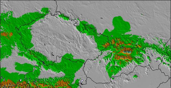
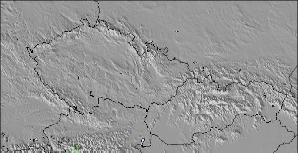
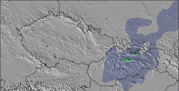
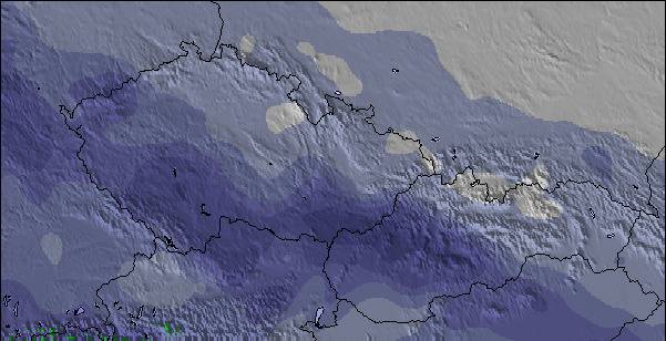
Mappa neve |  |  |  |  |  |  | |||||||||||
— | — | — | — | — | — | — | — | — | — | — | — | — | — | — | — | — | |
mm | — | — | 2 | 2 | 1 | — | — | — | — | — | 1 | 1 | 2 | 3 | 3 | 2 | 1 |
max °C | 17 | 15 | 11 | 15 | 13 | 14 | 18 | 16 | 20 | 24 | 22 | 18 | 19 | 17 | 13 | 17 | 16 |
min °C | 16 | 11 | 10 | 14 | 10 | 11 | 16 | 15 | 17 | 23 | 18 | 17 | 19 | 14 | 12 | 16 | 15 |
chill °C | 16 | 10 | 9 | 13 | 9 | 11 | 16 | 15 | 17 | 23 | 18 | 16 | 18 | 14 | 10 | 16 | 15 |
Umido. % | 43 | 67 | 82 | 56 | 68 | 52 | 36 | 47 | 37 | 28 | 53 | 58 | 52 | 73 | 90 | 73 | 76 |
Zero termico m | 3100 | 3050 | 2900 | 2950 | 2850 | 3350 | 3700 | 3950 | 3950 | 4150 | 3950 | 3600 | 3550 | 3400 | 3550 | 3800 | 4300 |
— | — | 5:39 | — | — | 5:39 | — | — | 5:41 | — | — | 5:41 | — | — | 5:43 | — | — | |
— | 9:00 | — | — | 9:00 | — | — | 8:59 | — | — | 8:58 | — | — | 8:57 | — | — | 8:54 | |
Diventa pro e intaglia:
Informazioni valanghe: European Avalanche Warning Services (EAWS)
Gli ultimi report della neve vicino a Lenggries:
| La profondità maggiore della neve é: | 0 cm |
|---|---|
| La profondità minore della neve é: | 0 cm |
| Fresh snowfall depth: | — |
| Quando ha nevicato l'ultima volta? | 16 May 2026 |
0.0 | Giorni neve fresca Neve fresca, prevalentemente soleggiato, vento debole. |
|---|---|
0.0 | Giorni neve fresca Fresh snow, limited sun, any wind. |
0.0 | Giorni Bluebird Neve media, prevalentemente soleggiato, vento debole. |
La tabella sopra da le previsioni meteo per Lenggries a specifiche altezze 1200 m. I nostri sofisticati modelli meteo ci consentono di fornire previsioni neve per la vetta, l'area intermedia e a valle delle stazioni sciistiche di Lenggries. Per accedere alle previsioni meteo ad altre altezze, per spostarti usa tab sopra la tabella. Per una visione meteo piu' ampia , controlla la mappa meteo di Germany.
Clicca qui per leggere ulteriori informazioni sullo zero termico e il nostro sistema di prevedere le temperature.
Complessivamente 4.2 Basato su 11 voti e 2 recensioni
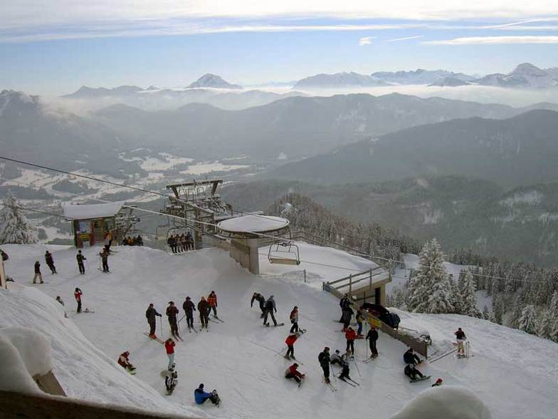
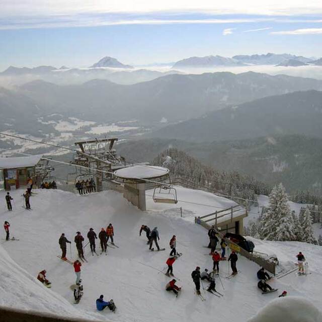
I was a military brat that had the privalidge to grow up and spend 17 years in the Bad Toelz/ Lenggries area. My last 5 years in Germany I lived in Lenggries and can tell you it was an awesome experience. The locals are great and welcoming. I also know many of the bar/restaurant owners personally in town and, more importantly, on the ski slopes. I haven't been to very many resorts/towns in Germany. Austria, Italy or the USA that still have that hometown feeling and are not yet commercialized as if skiing into a McDonalds on the slopes. Lenggries is a very traditional town and yet only 1 hour by train from Munich, which makes it a very popular destination for people in that region. Sure there are larger and more popular resorts to ski in the area, but you can't beat that Bavarian Gemuetlichkeit in Lenggries and the lift ticket prices compared to Garmisch or some of the other larger resorts. I have skied many resorts in southern Europe and am always drawn back to Lenggries every year for that typical Bavarian charm.
GLENN JENSEN da United States scrive:
I was a military brat that had the privalidge to grow up and spend 17 years in the Bad Toelz/ Lenggries area. My last 5 years in Germany I lived in Lenggries and can tell you it was an awesome experience. The locals are great and welcoming. I also know many of the bar/restaurant owners personally in town and, more importantly, on the ski slopes. I haven't been to very many resorts/towns in Germany. Austria, Italy or the USA that still have that hometown feeling and are not yet commercialized as if skiing into a McDonalds on the slopes. Lenggries is a very traditional town and yet only 1 hour by train from Munich, which makes it a very popular destination for people in that region. Sure there are larger and more popular resorts to ski in the area, but you can't beat that Bavarian Gemuetlichkeit in Lenggries and the lift ticket prices compared to Garmisch or some of the other larger resorts. I have skied many resorts in southern Europe and am always drawn back to Lenggries every year for that typical Bavarian charm.

 Nearest