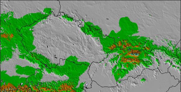
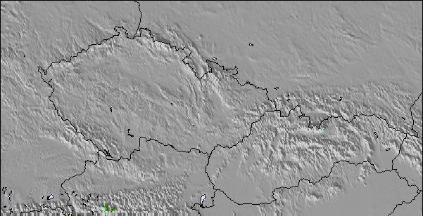
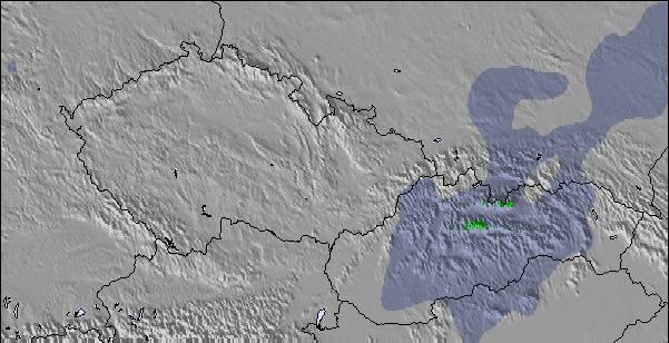
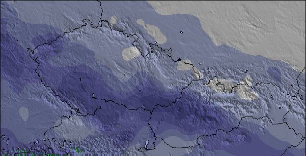
La tabella sopra da le previsioni meteo per Lenggries a specifiche altezze 700 m. I nostri sofisticati modelli meteo ci consentono di fornire previsioni neve per la vetta, l'area intermedia e a valle delle stazioni sciistiche di Lenggries. Per accedere alle previsioni meteo ad altre altezze, per spostarti usa tab sopra la tabella. Per una visione meteo piu' ampia , controlla la mappa meteo di Germany.
Clicca qui per leggere ulteriori informazioni sullo zero termico e il nostro sistema di prevedere le temperature.
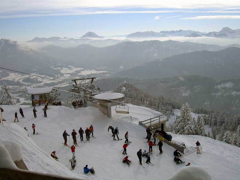
Recensioni dei visitatori di Lenggries
Complessivamente 4.2 Basato su 11 voti e 2 recensioni
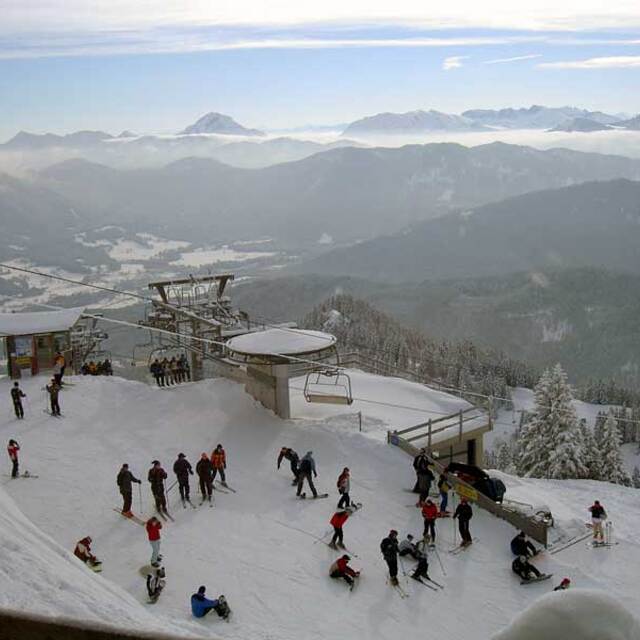
A great working bavarian village, an hours drive from Munich airport, probably more suited to a long weekend rather than a week. Our children learnt to ski on the small uncrowded, and cheap runs of the wegshied. Very limited skiing for the Big kids, just a couple of blacks and a handful of reds on the brauneck, all skied in a morning. However as a first ski for kids it cannot be faulted, it is very child friendly. when youve had enough skiing hire a toboggan or go to the swimming pool/spa (half inside, half outside)and swim whilst admiring the slopes. Great restaurants, not crowded or overpriced. Great Bavarian fodder...filling with a sprinkling of lederhosen. We thoroughly recommend the 'bunker' for a great meal by an open fire, and schwarz on the crossing for strudel and hot chocolates. Lots of good accomodation to be found. Chocolate box houses, and very large apartments. We have stayed in a couple, very clean and very reasonably priced even at Easter/half term. If you go self catering use the small shops rather than the supermarket...much more fun even if your German is limited. Important to note...little english spoken(hooray!) and credit cards not readily accepted...they like their cash!!
As a ski experience it is very different from the tour packages, full of locals doing what locals do,and the odd ski bodies like our good selves.Don't expect wild apres ski!
Finally if you get there and the snow disappears, head south to Austria....Seefeld only an hours drive away and also great for kids.
Garmish and kitzbul are aslo close if you are easily lured to the glitzy resorts...we know which we prefer.
Hope you enjoy your stay.
Complessivamente: 4.2 Basato su 11 voti e 2 recensioni
Snowsure
3.1
Varietà di piste
4.1
Fuoripista
3.0
Paesaggio
5.0
Apres-Ski
3.2
t tHOMPSON da United Kingdom scrive:
A great working bavarian village, an hours drive from Munich airport, probably more suited to a long weekend rather than a week. Our children learnt to ski on the small uncrowded, and cheap runs of the wegshied. Very limited skiing for the Big kids, just a couple of blacks and a handful of reds on the brauneck, all skied in a morning. However as a first ski for kids it cannot be faulted, it is very child friendly. when youve had enough skiing hire a toboggan or go to the swimming pool/spa (half inside, half outside)and swim whilst admiring the slopes. Great restaurants, not crowded or overpriced. Great Bavarian fodder...filling with a sprinkling of lederhosen. We thoroughly recommend the 'bunker' for a great meal by an open fire, and schwarz on the crossing for strudel and hot chocolates. Lots of good accomodation to be found. Chocolate box houses, and very large apartments. We have stayed in a couple, very clean and very reasonably priced even at Easter/half term. If you go self catering use the small shops rather than the supermarket...much more fun even if your German is limited. Important to note...little english spoken(hooray!) and credit cards not readily accepted...they like their cash!!
As a ski experience it is very different from the tour packages, full of locals doing what locals do,and the odd ski bodies like our good selves.Don't expect wild apres ski!
Finally if you get there and the snow disappears, head south to Austria....Seefeld only an hours drive away and also great for kids.
Garmish and kitzbul are aslo close if you are easily lured to the glitzy resorts...we know which we prefer.
Hope you enjoy your stay.
Gratis Snow-Forecast.com weather widget per il tho sito
Il Lenggries widget meteo qui sotto è disponibile per essere incorporato su siti Web esterni a titolo gratuito. Esso fornisce un riepilogo giornaliero delle nostre Lenggries previsioni meteo neve e dati meteo. Basta andare alla pagina di configurazione e seguire 3 semplici passi per prendere il codice html personalizzato ed incollarlo nel tuo sito. È possibile scegliere l'elevazione di previsione di neve (vetta, metà o piede della montagna) e l'unità metrica/imperiale per le previsioni meteo neve adeguata al proprio sito Web Clicca qui per ottenere il codice


 Nearest