Ultimi 6 giorniScorri a sinistra per gli ultimi 6 giorniOra
Next 3 days weather summary:
Pioggia abbondante (totale 56.0mm), più pesante durante Venerdì mattina. Temperature moderate (max 18°C Giovedì pomeriggio, min 10°C Venerdì mattina). Vento sarà generalmente leggero.
Giorni 4-6 Lauchernalp - Lötschental sommario meteo
Pioggia moderata (totale 12.0mm), più pesante Sabato pomeriggio. Temperature moderate (max 12°C Sabato pomeriggio, min 5°C Lunedì notte). Vento sarà generalmente leggero.
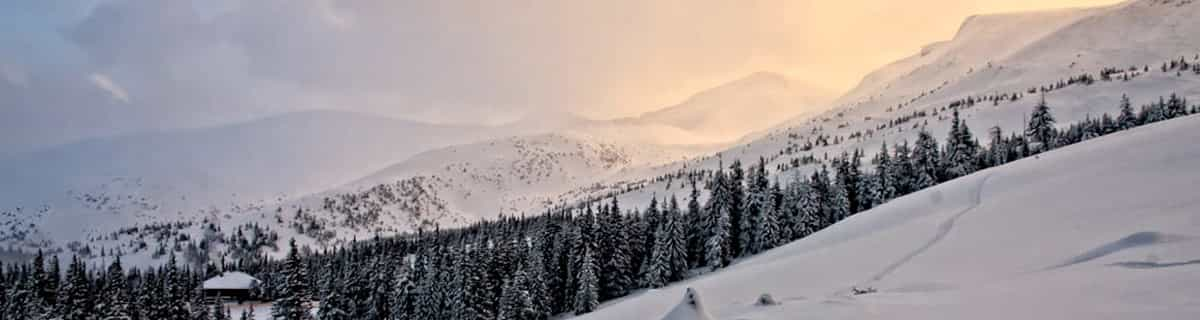
La tabella sopra da le previsioni meteo per Lauchernalp - Lötschental a specifiche altezze 2126 m. I nostri sofisticati modelli meteo ci consentono di fornire previsioni neve per la vetta, l'area intermedia e a valle delle stazioni sciistiche di Lauchernalp - Lötschental. Per accedere alle previsioni meteo ad altre altezze, per spostarti usa tab sopra la tabella. Per una visione meteo piu' ampia , controlla la mappa meteo di Switzerland.
Clicca qui per leggere ulteriori informazioni sullo zero termico e il nostro sistema di prevedere le temperature.
Il nome della localita' è scritto anche come Lauchernalp - Lotschental.
Recensioni dei visitatori di Lauchernalp - Lötschental
Complessivamente 4.0 Basato su 20 voti e 2 recensioni
The area is not that big. Skiing is nice. The slopes are long and some are very technical. Large off-pise area. Mostly is skiing to the village of Wiler (bottom station) not possible. The views are very nice. The valley is beautiful. Large tracks for langlaufen and hiking. In the evening you can see the mountain goats east of Eisden (small village near Blatten).
The buses are free with a skipass. Buses drive between the station of Goppenstein and Blatten and they stop, of course, at the bottom station of the cable car. The restaurants are ok, the food also. Only a few hotels which are not big hotels. Much possiblllity to rent chalet in every village.
Reaching the valley from the south is possible by car. From the north you have to go with the car on the train at the station of Kandersteg.
The airfield of Zurich is, I think, 2 hours by train. Never done that.
Recensioni dei visitatori di Lauchernalp - Lötschental
Complessivamente: 4.0 Basato su 20 voti e 2 recensioni
Snowsure
5.0
Varietà di piste
4.2
Fuoripista
4.8
Paesaggio
4.9
Apres-Ski
3.1
Jacco da The Netherlands scrive:
The area is not that big. Skiing is nice. The slopes are long and some are very technical. Large off-pise area. Mostly is skiing to the village of Wiler (bottom station) not possible. The views are very nice. The valley is beautiful. Large tracks for langlaufen and hiking. In the evening you can see the mountain goats east of Eisden (small village near Blatten).
The buses are free with a skipass. Buses drive between the station of Goppenstein and Blatten and they stop, of course, at the bottom station of the cable car. The restaurants are ok, the food also. Only a few hotels which are not big hotels. Much possiblllity to rent chalet in every village.
Reaching the valley from the south is possible by car. From the north you have to go with the car on the train at the station of Kandersteg.
The airfield of Zurich is, I think, 2 hours by train. Never done that.
Gratis Snow-Forecast.com weather widget per il tho sito
Il Lauchernalp - Lötschental widget meteo qui sotto è disponibile per essere incorporato su siti Web esterni a titolo gratuito. Esso fornisce un riepilogo giornaliero delle nostre Lauchernalp - Lötschental previsioni meteo neve e dati meteo. Basta andare alla pagina di configurazione e seguire 3 semplici passi per prendere il codice html personalizzato ed incollarlo nel tuo sito. È possibile scegliere l'elevazione di previsione di neve (vetta, metà o piede della montagna) e l'unità metrica/imperiale per le previsioni meteo neve adeguata al proprio sito Web Clicca qui per ottenere il codice


 Nearest