La tabella sopra da le previsioni meteo per Lauchernalp - Lötschental a specifiche altezze 1142 m. I nostri sofisticati modelli meteo ci consentono di fornire previsioni neve per la vetta, l'area intermedia e a valle delle stazioni sciistiche di Lauchernalp - Lötschental. Per accedere alle previsioni meteo ad altre altezze, per spostarti usa tab sopra la tabella. Per una visione meteo piu' ampia , controlla la mappa meteo di Switzerland.
Clicca qui per leggere ulteriori informazioni sullo zero termico e il nostro sistema di prevedere le temperature.
Il nome della localita' è scritto anche come Lauchernalp - Lotschental.
Recensioni dei visitatori di Lauchernalp - Lötschental
Complessivamente 4.0 Basato su 20 voti e 2 recensioni
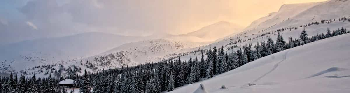
A friend and I were planning on skiing Kandersteg one day coming down from Interlaken. However, as the train wound its way through the mountains and arrived at Kandersteg, no one got off. So, in a moment's decision, we decided to follow the crowd. In this case, following the crowd was a good decision. Everyone seemed to get off at one station and immediately started loading buses, so we followed everyone off the train and onto the buses. It turned out to be the best decision we made that trip. The mountain at Lauchernalp - Lötschental was amazing, the village was picturesque, and the sun shone all day. We spent a lot of time in the off-piste on the far skier's left side of the mountain. It was an amazing experience and some apres-ski Bier und Goulasch Suppe was a great way to end the day. We went in mid March and the weather was perfectly sunny all day, the temperature at the base hovering around 0 C. Go. It's wonderful.
Recensioni dei visitatori di Lauchernalp - Lötschental
Complessivamente: 4.0 Basato su 20 voti e 2 recensioni
Snowsure
5.0
Varietà di piste
4.2
Fuoripista
4.8
Paesaggio
4.9
Apres-Ski
3.1
Zach da United States scrive:
A friend and I were planning on skiing Kandersteg one day coming down from Interlaken. However, as the train wound its way through the mountains and arrived at Kandersteg, no one got off. So, in a moment's decision, we decided to follow the crowd. In this case, following the crowd was a good decision. Everyone seemed to get off at one station and immediately started loading buses, so we followed everyone off the train and onto the buses. It turned out to be the best decision we made that trip. The mountain at Lauchernalp - Lötschental was amazing, the village was picturesque, and the sun shone all day. We spent a lot of time in the off-piste on the far skier's left side of the mountain. It was an amazing experience and some apres-ski Bier und Goulasch Suppe was a great way to end the day. We went in mid March and the weather was perfectly sunny all day, the temperature at the base hovering around 0 C. Go. It's wonderful.
Gratis Snow-Forecast.com weather widget per il tho sito
Il Lauchernalp - Lötschental widget meteo qui sotto è disponibile per essere incorporato su siti Web esterni a titolo gratuito. Esso fornisce un riepilogo giornaliero delle nostre Lauchernalp - Lötschental previsioni meteo neve e dati meteo. Basta andare alla pagina di configurazione e seguire 3 semplici passi per prendere il codice html personalizzato ed incollarlo nel tuo sito. È possibile scegliere l'elevazione di previsione di neve (vetta, metà o piede della montagna) e l'unità metrica/imperiale per le previsioni meteo neve adeguata al proprio sito Web Clicca qui per ottenere il codice


 Nearest