Ultimi 6 giorniScorri a sinistra per gli ultimi 6 giorniOra
Next 4 days weather summary:
Pioggia abbondante (totale 39.0mm), più pesante durante Venerdì notte. Caldo (max 23°C Giovedì pomeriggio, min 12°C Mercoledì notte). Vento sarà generalmente leggero.
Giorni 5-7 Königsleiten sommario meteo
Pioggia abbondante (totale 37.0mm), più pesante durante Domenica pomeriggio. Temperature moderate (max 19°C Lunedì pomeriggio, min 7°C Domenica notte). Vento sarà generalmente leggero.
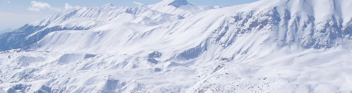
La tabella sopra da le previsioni meteo per Königsleiten a specifiche altezze 1300 m. I nostri sofisticati modelli meteo ci consentono di fornire previsioni neve per la vetta, l'area intermedia e a valle delle stazioni sciistiche di Königsleiten. Per accedere alle previsioni meteo ad altre altezze, per spostarti usa tab sopra la tabella. Per una visione meteo piu' ampia , controlla la mappa meteo di Austria.
Clicca qui per leggere ulteriori informazioni sullo zero termico e il nostro sistema di prevedere le temperature.
Il nome della localita' è scritto anche come Konigsleiten.
Recensioni dei visitatori di Königsleiten
Complessivamente 4.0 Basato su 1 vote e 2 recensioni
At the far end of the magnificent Zillertal Arena you'll find this fantastic ski resort. Although it's purpose built, it stil breathes the typical Austrian "gemütlichkeit"! If you want a less crowdy and noisy village (compared to party town Gerlos, for instance), but still well facilitated, this is the place to be. Après-ski is still possible, with the very cosy Schirmbar (party every night!) and several bars and a discotheque. And if you want to have a nice evening in Gerlos, it is just a 20 minute drive.
It's very suitable for families with kids as well, with the piste in the middle of the village and several ski schools for the youngsters.
Because the village itself is set at 1600m above sea level, snow is assured up until the end of March. From most appartments you can just click on your ski's and glide to the Sonnwendkopfbahn to enter the Zillertal Arena, or the Plattenkogel X-press to the Gerlosplatte (this is a very good option late season, it's on the north side and no direct sun on the slopes). Once in the Z'tal Arena you can make wonderful tours to the Gerlos and Zell am Ziller areas. I've been there twice now and it's a great place to spend your holiday. I will return there for sure!!
Complessivamente: 4.0 Basato su 1 vote e 2 recensioni
Snowsure
4.0
Varietà di piste
4.0
Fuoripista
3.0
Paesaggio
5.0
Apres-Ski
3.0
Steven Vogel da The Netherlands scrive:
At the far end of the magnificent Zillertal Arena you'll find this fantastic ski resort. Although it's purpose built, it stil breathes the typical Austrian "gemütlichkeit"! If you want a less crowdy and noisy village (compared to party town Gerlos, for instance), but still well facilitated, this is the place to be. Après-ski is still possible, with the very cosy Schirmbar (party every night!) and several bars and a discotheque. And if you want to have a nice evening in Gerlos, it is just a 20 minute drive.
It's very suitable for families with kids as well, with the piste in the middle of the village and several ski schools for the youngsters.
Because the village itself is set at 1600m above sea level, snow is assured up until the end of March. From most appartments you can just click on your ski's and glide to the Sonnwendkopfbahn to enter the Zillertal Arena, or the Plattenkogel X-press to the Gerlosplatte (this is a very good option late season, it's on the north side and no direct sun on the slopes). Once in the Z'tal Arena you can make wonderful tours to the Gerlos and Zell am Ziller areas. I've been there twice now and it's a great place to spend your holiday. I will return there for sure!!
Gratis Snow-Forecast.com weather widget per il tho sito
Il Königsleiten widget meteo qui sotto è disponibile per essere incorporato su siti Web esterni a titolo gratuito. Esso fornisce un riepilogo giornaliero delle nostre Königsleiten previsioni meteo neve e dati meteo. Basta andare alla pagina di configurazione e seguire 3 semplici passi per prendere il codice html personalizzato ed incollarlo nel tuo sito. È possibile scegliere l'elevazione di previsione di neve (vetta, metà o piede della montagna) e l'unità metrica/imperiale per le previsioni meteo neve adeguata al proprio sito Web Clicca qui per ottenere il codice


 Nearest