Kanzelwand-Fellhorn (Kleinwalsertal) Previsioni Neve
Lat./Long.: 47.33° N10.20° E
Previsione meteo per Kanzelwand-Fellhorn (Kleinwalsertal) a1949m altitudine
Emesso: 1 am 15 Jul 2026 (ora locale)
Previsione neve aggiornata in ora min
View forecast
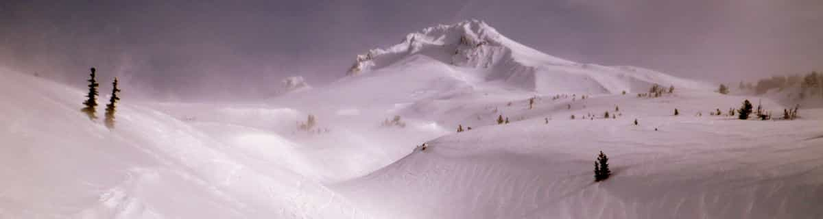
Kanzelwand-Fellhorn (Kleinwalsertal)at 1949 m altitudine
Publicato da Snow-Forecast.com a:1 am (ora locale) / 15 Jul 2026
Ultimi 6 giorniScorri a sinistra per gli ultimi 6 giorniOra
Next 3 days weather summary:
Pioggia abbondante (totale 38.0mm), più pesante durante Mercoledì notte. Temperature moderate (max 19°C Giovedì pomeriggio, min 11°C Venerdì notte). Vento sarà generalmente leggero.
Giorni 4-6 Kanzelwand-Fellhorn (Kleinwalsertal) sommario meteo
Pioggia abbondante (totale 30.0mm), più pesante durante Sabato notte. Temperature moderate (max 14°C Lunedì pomeriggio, min 8°C Domenica notte). Vento sarà generalmente leggero.
La tabella sopra da le previsioni meteo per Kanzelwand-Fellhorn (Kleinwalsertal) a specifiche altezze 1949 m. I nostri sofisticati modelli meteo ci consentono di fornire previsioni neve per la vetta, l'area intermedia e a valle delle stazioni sciistiche di Kanzelwand-Fellhorn (Kleinwalsertal). Per accedere alle previsioni meteo ad altre altezze, per spostarti usa tab sopra la tabella. Per una visione meteo piu' ampia , controlla la mappa meteo di Austria.
Clicca qui per leggere ulteriori informazioni sullo zero termico e il nostro sistema di prevedere le temperature.
Recensioni dei visitatori di Kanzelwand-Fellhorn (Kleinwalsertal)
Complessivamente 3.9 Basato su 1 vote e 1 recensione
A skiing area that is part of the Oberstdorf / Kleinwalsertal resort. It's not huge in size, but there are some very nice and well-maintained pistes, mostly quite high up. We visited in February '12, and as in most of the Alps there was loads of snow - so much that for a couple of days all the upper lifts were closed due to avalanche risk.
The skiing area straddles the German / Austrian border and most of the skiing is just on the German side. There are two ways of starting skiing here: one way from Oberstdorf is drive up the Kleinwalsertal road into Austria to Riezlern and catch the long gondola (signs for Kanzelwandbahn) to the top. There is a long (about 4.5Km) red piste that comes to the bottom there with a small fun park. At the top you can then link to the Fellhorn area in Germany which has a similar length but to my mind slightly steeper piste down to the German valley. To start skiing from the German side (there's slightly more parking) head for the signs to Fellhorn or Skiflugschanze. This will take you past the cross country skiing area and the huge ski flying stadium (not the ski-jumping Erdinger arena on the other side of town). It's about the same distance either way.
Up the mountain the uplift is fairly standard, mostly chairs. There are some unpisted "Skirouten" which demand some technique and some nice cruisy reds and blues. One or two bits are labelled black but aren't very long or too demanding. There is a largish fun park (Almdudler sponsored, so follow those signs). There are nice huts - I liked the one just down the Austrian side for its stunning views.
There are some good webcams and livecams on das-hoechste.de which also provides latest piste status and info.
All in all, I liked it here. Good family skiing.
Recensioni dei visitatori di Kanzelwand-Fellhorn (Kleinwalsertal)
Complessivamente: 3.9 Basato su 1 vote e 1 recensione
Snowsure
4.0
Varietà di piste
3.0
Fuoripista
3.0
Paesaggio
4.0
Apres-Ski
4.0
Andrew da United Kingdom scrive:
A skiing area that is part of the Oberstdorf / Kleinwalsertal resort. It's not huge in size, but there are some very nice and well-maintained pistes, mostly quite high up. We visited in February '12, and as in most of the Alps there was loads of snow - so much that for a couple of days all the upper lifts were closed due to avalanche risk.
The skiing area straddles the German / Austrian border and most of the skiing is just on the German side. There are two ways of starting skiing here: one way from Oberstdorf is drive up the Kleinwalsertal road into Austria to Riezlern and catch the long gondola (signs for Kanzelwandbahn) to the top. There is a long (about 4.5Km) red piste that comes to the bottom there with a small fun park. At the top you can then link to the Fellhorn area in Germany which has a similar length but to my mind slightly steeper piste down to the German valley. To start skiing from the German side (there's slightly more parking) head for the signs to Fellhorn or Skiflugschanze. This will take you past the cross country skiing area and the huge ski flying stadium (not the ski-jumping Erdinger arena on the other side of town). It's about the same distance either way.
Up the mountain the uplift is fairly standard, mostly chairs. There are some unpisted "Skirouten" which demand some technique and some nice cruisy reds and blues. One or two bits are labelled black but aren't very long or too demanding. There is a largish fun park (Almdudler sponsored, so follow those signs). There are nice huts - I liked the one just down the Austrian side for its stunning views.
There are some good webcams and livecams on das-hoechste.de which also provides latest piste status and info.
All in all, I liked it here. Good family skiing.
Gratis Snow-Forecast.com weather widget per il tho sito
Il Kanzelwand-Fellhorn (Kleinwalsertal) widget meteo qui sotto è disponibile per essere incorporato su siti Web esterni a titolo gratuito. Esso fornisce un riepilogo giornaliero delle nostre Kanzelwand-Fellhorn (Kleinwalsertal) previsioni meteo neve e dati meteo. Basta andare alla pagina di configurazione e seguire 3 semplici passi per prendere il codice html personalizzato ed incollarlo nel tuo sito. È possibile scegliere l'elevazione di previsione di neve (vetta, metà o piede della montagna) e l'unità metrica/imperiale per le previsioni meteo neve adeguata al proprio sito Web Clicca qui per ottenere il codice


 Nearest