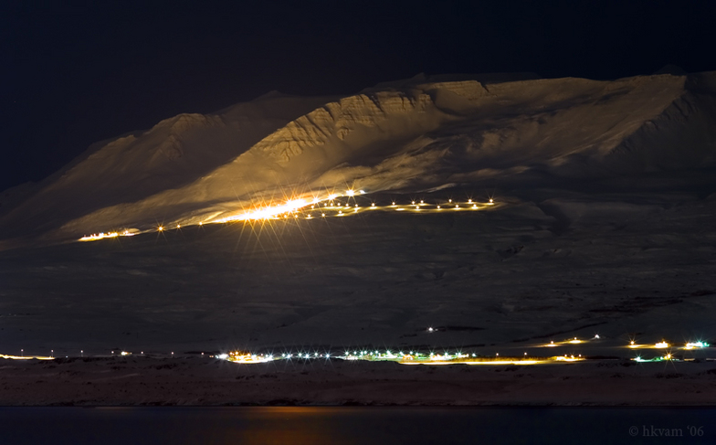


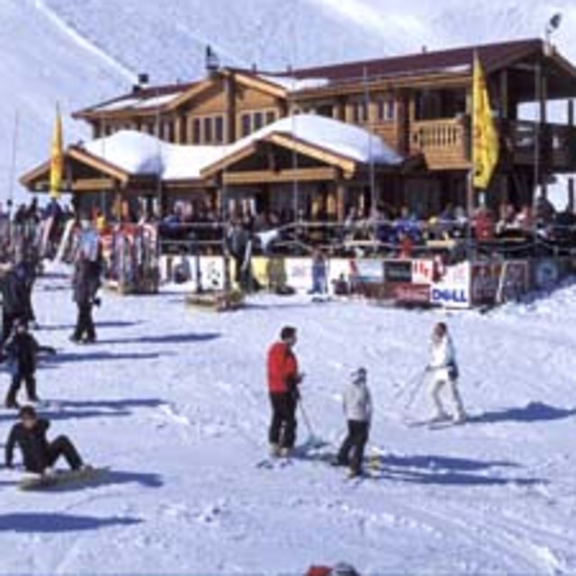
Portillo Re-Opens To Guests Arriving By Helicopter
Chile’s famous Portillo ski resort is reported to have re-opened to guests arriving by helicopter after being cut off by road for more than two weeks by over 6m/20 feet of snowfall.

Next 3 days weather summary:Per lo più asciutto. Temperature moderate (max 11°C Lunedì pomeriggio, min 7°C Lunedì notte). Vento sarà generalmente leggero. | Giorni 4-6 Hlíðarfjall Akureyri sommario meteoPioggia abbondante (totale 33.0mm), più pesante durante Giovedì notte. Diventa più freddo con una spolverata di neve Venerdì pomeriggio. Condizioni di gelo e disgelo (max 7°C Giovedì pomeriggio, min -1°C Venerdì notte). Vento sarà generalmente leggero. | |||||||||||||||||
Lunedì 3 | Martedì 4 | Mercoledì 5 | Giovedì 6 | Venerdì 7 | Sabato 8 | |||||||||||||
AM | PM | notte | AM | PM | notte | AM | PM | notte | AM | PM | notte | AM | PM | notte | AM | PM | notte | |
poche nuvole | poche nuvole | limpido | poche nuvole | poche nuvole | nuvol- oso | poche nuvole | nuvol- oso | nuvol- oso | pioggia leggera | pioggia moderata | forte pioggia | pioggia moderata | neve leggera | neve leggera | neve leggera | neve leggera | nuvol- oso | |
km/h | ||||||||||||||||||
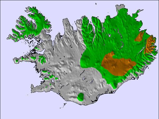
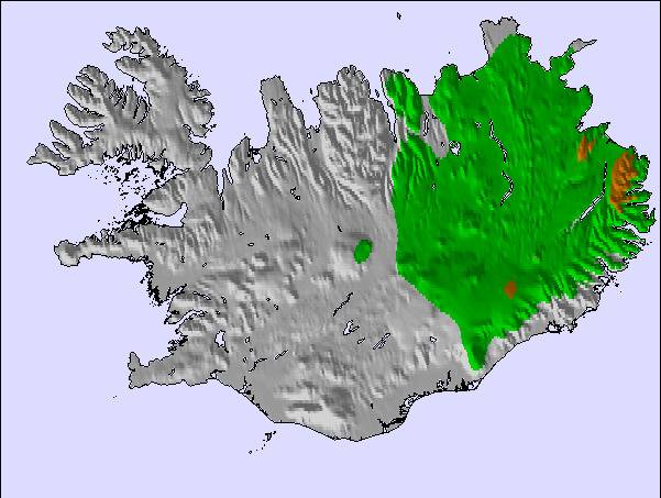
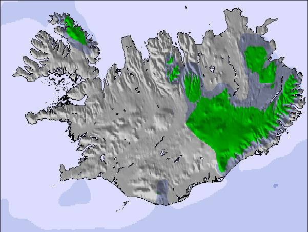
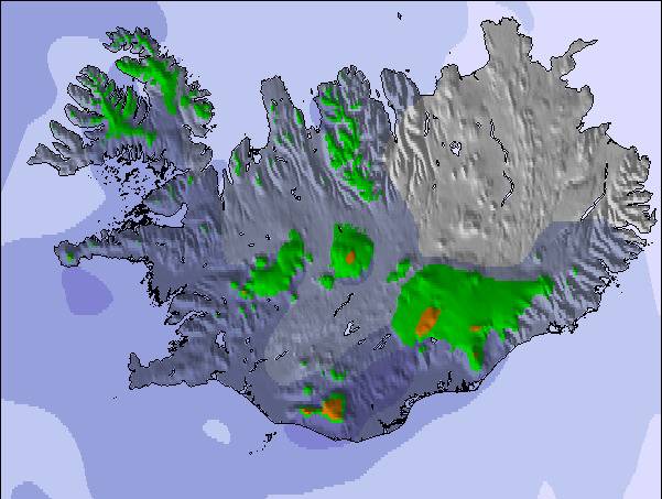
Mappa neve |  |  |  |  | 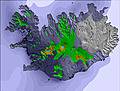 | 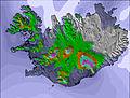 | ||||||||||||
— | — | — | — | — | — | — | — | — | — | — | — | — | — | 1 | — | — | — | |
mm | — | — | — | — | — | — | — | — | — | 5 | 6 | 15 | 6 | 1 | — | — | — | — |
max °C | 9 | 11 | 9 | 10 | 10 | 9 | 11 | 10 | 8 | 6 | 7 | 6 | 3 | 2 | 1 | 0 | 1 | 1 |
min °C | 8 | 11 | 7 | 8 | 10 | 8 | 9 | 10 | 7 | 6 | 7 | 4 | 3 | 2 | -1 | 0 | 1 | 1 |
chill °C | 8 | 11 | 7 | 8 | 10 | 7 | 8 | 10 | 7 | 6 | 6 | 1 | -1 | -3 | -6 | -5 | -4 | -2 |
Umido. % | 69 | 63 | 80 | 82 | 72 | 77 | 61 | 62 | 79 | 94 | 97 | 100 | 98 | 98 | 99 | 95 | 91 | 95 |
Zero termico m | 2000 | 2150 | 2250 | 2250 | 2500 | 2650 | 2500 | 2550 | 2350 | 1950 | 2000 | 1850 | 1250 | 1100 | 700 | 650 | 800 | 850 |
4:07 | — | — | 4:11 | — | — | 4:16 | — | — | 4:18 | — | — | 4:22 | — | — | 4:26 | — | — | |
— | — | 10:25 | — | — | 10:22 | — | — | 10:17 | — | — | 10:14 | — | — | 10:09 | — | — | 10:07 | |
Diventa pro e intaglia:
Gli ultimi report della neve vicino a Hlíðarfjall Akureyri:
| La profondità maggiore della neve é: | — |
|---|---|
| La profondità minore della neve é: | — |
| Fresh snowfall depth: | — |
| Quando ha nevicato l'ultima volta? | 19 Jun 2026 |
0.0 | Giorni neve fresca Neve fresca, prevalentemente soleggiato, vento debole. |
|---|---|
0.0 | Giorni neve fresca Fresh snow, limited sun, any wind. |
0.0 | Giorni Bluebird Neve media, prevalentemente soleggiato, vento debole. |
La tabella sopra da le previsioni meteo per Hlíðarfjall Akureyri a specifiche altezze 710 m. I nostri sofisticati modelli meteo ci consentono di fornire previsioni neve per la vetta, l'area intermedia e a valle delle stazioni sciistiche di Hlíðarfjall Akureyri. Per accedere alle previsioni meteo ad altre altezze, per spostarti usa tab sopra la tabella. Per una visione meteo piu' ampia , controlla la mappa meteo di Iceland.
Clicca qui per leggere ulteriori informazioni sullo zero termico e il nostro sistema di prevedere le temperature.
Il nome della localita' è scritto anche come Hlidarfjall Akureyri.
Complessivamente 3.7 Basato su 2 voti e 2 recensioni
Akureyri is definitively Iceland's best ski resort that although not huge, has some really good slack country and steeps that can be hiked to. Akureyri is also very close to world class ski touring terrain on the Troll Peninsula in the north and the Hidden land to the north east, where folks can enjoy touring as well as awesome heli skiing.
Steven Koch da Afghanistan scrive:
Akureyri is definitively Iceland's best ski resort that although not huge, has some really good slack country and steeps that can be hiked to. Akureyri is also very close to world class ski touring terrain on the Troll Peninsula in the north and the Hidden land to the north east, where folks can enjoy touring as well as awesome heli skiing.
Leggi 1 più recensioni di Hlíðarfjall Akureyri o invia la tua

 Nearest