Ultimi 6 giorniScorri a sinistra per gli ultimi 6 giorniOra
Next 4 days weather summary:
Pioggia abbondante (totale 37.0mm), più pesante durante Mercoledì notte. Temperature moderate (max 18°C Venerdì pomeriggio, min 10°C Sabato pomeriggio). Vento sarà generalmente leggero.
Giorni 5-7 Gerlitzen sommario meteo
Pioggia abbondante (totale 32.0mm), più pesante durante Domenica notte. Temperature moderate (max 13°C Domenica pomeriggio, min 7°C Martedì pomeriggio). Vento sarà generalmente leggero.
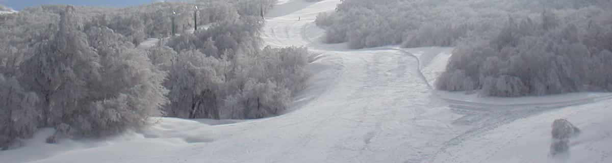
La tabella sopra da le previsioni meteo per Gerlitzen a specifiche altezze 1911 m. I nostri sofisticati modelli meteo ci consentono di fornire previsioni neve per la vetta, l'area intermedia e a valle delle stazioni sciistiche di Gerlitzen. Per accedere alle previsioni meteo ad altre altezze, per spostarti usa tab sopra la tabella. Per una visione meteo piu' ampia , controlla la mappa meteo di Austria.
Clicca qui per leggere ulteriori informazioni sullo zero termico e il nostro sistema di prevedere le temperature.
Recensioni dei visitatori di Gerlitzen
Complessivamente 3.9 Basato su 14 voti e 5 recensioni
We have come back to Gerlitzen for a second time having visited with our young family back in 2012. Our kids are now a little older and we have come with other family members this time (7 kids and 8 adults!) I cannot recommend this lovely family friendly resort enough. Austrian people are very kind and welcoming and our children thrived in the very well run but still very personable ski school. The mountain itself is extremely well run, the pistes are immaculate and the lifts are excellent. There is a great deal of skiing available for a small resort and everything is run with great efficiency and courtesy. Unlike some big resorts in France and Switzerland there is a real personal feel to the whole resort, from ski hire, ski school and every bar or hostelry on the mountain. The prices are excellent and seeing what goes into keeping the pistes in great shape (snow machines, piste machines working all hours) I believe he price of skiing to be very good value here. Likewise, one can eat and drink on the mountain for very reasonable prices. A delicious goulash soup with bread is only 4.90 euros and a pint of the local (and very good) Villacher beer is only 3.80 euros. That's less than my local pub and we are halfway up a mountain!
I have nothing but praise for this excellent resort and cannot recommend it highly enough.
Complessivamente: 3.9 Basato su 14 voti e 5 recensioni
Snowsure
3.9
Varietà di piste
3.8
Fuoripista
2.0
Paesaggio
4.5
Apres-Ski
3.1
Will Gooda da Austria scrive:
We have come back to Gerlitzen for a second time having visited with our young family back in 2012. Our kids are now a little older and we have come with other family members this time (7 kids and 8 adults!) I cannot recommend this lovely family friendly resort enough. Austrian people are very kind and welcoming and our children thrived in the very well run but still very personable ski school. The mountain itself is extremely well run, the pistes are immaculate and the lifts are excellent. There is a great deal of skiing available for a small resort and everything is run with great efficiency and courtesy. Unlike some big resorts in France and Switzerland there is a real personal feel to the whole resort, from ski hire, ski school and every bar or hostelry on the mountain. The prices are excellent and seeing what goes into keeping the pistes in great shape (snow machines, piste machines working all hours) I believe he price of skiing to be very good value here. Likewise, one can eat and drink on the mountain for very reasonable prices. A delicious goulash soup with bread is only 4.90 euros and a pint of the local (and very good) Villacher beer is only 3.80 euros. That's less than my local pub and we are halfway up a mountain!
I have nothing but praise for this excellent resort and cannot recommend it highly enough.
Gratis Snow-Forecast.com weather widget per il tho sito
Il Gerlitzen widget meteo qui sotto è disponibile per essere incorporato su siti Web esterni a titolo gratuito. Esso fornisce un riepilogo giornaliero delle nostre Gerlitzen previsioni meteo neve e dati meteo. Basta andare alla pagina di configurazione e seguire 3 semplici passi per prendere il codice html personalizzato ed incollarlo nel tuo sito. È possibile scegliere l'elevazione di previsione di neve (vetta, metà o piede della montagna) e l'unità metrica/imperiale per le previsioni meteo neve adeguata al proprio sito Web Clicca qui per ottenere il codice


 Nearest