

Portillo Re-Opens To Guests Arriving By Helicopter
Chile’s famous Portillo ski resort is reported to have re-opened to guests arriving by helicopter after being cut off by road for more than two weeks by over 6m/20 feet of snowfall.

Next 3 days weather summary:Pioggia abbondante (totale 23.0mm), più pesante durante Mercoledì notte. Caldo (max 33°C Lunedì pomeriggio, min 17°C Martedì notte). Vento sarà generalmente leggero. | Giorni 4-6 Ellmau (SkiWelt) sommario meteoPioggia abbondante (totale 41.0mm), più pesante durante Giovedì notte. Caldo (max 29°C Giovedì pomeriggio, min 15°C Venerdì notte). Vento sarà generalmente leggero. | ||||||||||||||||
Lun 3 | Martedì 4 | Mercoledì 5 | Giovedì 6 | Venerdì 7 | Sabato 8 | ||||||||||||
PM | notte | AM | PM | notte | AM | PM | notte | AM | PM | notte | AM | PM | notte | AM | PM | notte | |
rovesci pioggia | poche nuvole | limpido | limpido | rovesci pioggia | limpido | rischio temporale | rovesci pioggia | rischio temporale | rischio temporale | forte pioggia | pioggia moderata | rischio temporale | rovesci pioggia | limpido | rischio temporale | rovesci pioggia | |
km/h | |||||||||||||||||
Mappa neve |  |  |  |  |  |  | |||||||||||
— | — | — | — | — | — | — | — | — | — | — | — | — | — | — | — | — | |
mm | 1 | — | — | — | 1 | — | 3 | 17 | 1 | 3 | 23 | 8 | 2 | 2 | — | 2 | 1 |
max °C | 33 | 22 | 29 | 32 | 22 | 27 | 30 | 23 | 26 | 29 | 19 | 17 | 23 | 19 | 23 | 26 | 20 |
min °C | 22 | 18 | 22 | 29 | 17 | 21 | 27 | 18 | 20 | 25 | 16 | 17 | 22 | 15 | 17 | 23 | 15 |
chill °C | 22 | 18 | 22 | 29 | 17 | 21 | 27 | 18 | 20 | 25 | 16 | 17 | 22 | 15 | 17 | 23 | 15 |
Umido. % | 57 | 57 | 43 | 41 | 66 | 62 | 60 | 89 | 60 | 66 | 93 | 94 | 74 | 92 | 72 | 70 | 83 |
Zero termico m | 4550 | 4550 | 4500 | 4600 | 4550 | 4450 | 4500 | 4450 | 4350 | 4300 | 3950 | 3800 | 4000 | 4050 | 3950 | 4000 | 4100 |
— | — | 5:50 | — | — | 5:52 | — | — | 5:54 | — | — | 5:54 | — | — | 5:56 | — | — | |
— | 8:43 | — | — | 8:40 | — | — | 8:39 | — | — | 8:37 | — | — | 8:37 | — | — | 8:35 | |
Diventa pro e intaglia:
Informazioni valanghe: European Avalanche Warning Services (EAWS)
Gli ultimi report della neve vicino a Ellmau (SkiWelt):
| La profondità maggiore della neve é: | — |
|---|---|
| La profondità minore della neve é: | — |
| Fresh snowfall depth: | — |
| Quando ha nevicato l'ultima volta? | 16 May 2026 |
0.0 | Giorni neve fresca Neve fresca, prevalentemente soleggiato, vento debole. |
|---|---|
0.0 | Giorni neve fresca Fresh snow, limited sun, any wind. |
0.0 | Giorni Bluebird Neve media, prevalentemente soleggiato, vento debole. |
La tabella sopra da le previsioni meteo per Ellmau (SkiWelt) a specifiche altezze 620 m. I nostri sofisticati modelli meteo ci consentono di fornire previsioni neve per la vetta, l'area intermedia e a valle delle stazioni sciistiche di Ellmau (SkiWelt). Per accedere alle previsioni meteo ad altre altezze, per spostarti usa tab sopra la tabella. Per una visione meteo piu' ampia , controlla la mappa meteo di Austria.
Clicca qui per leggere ulteriori informazioni sullo zero termico e il nostro sistema di prevedere le temperature.
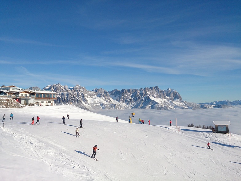
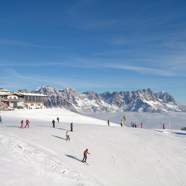
Il nome della localita' è scritto anche come Ellmau.
Complessivamente 4.1 Basato su 8 voti e 10 recensioni
Had a fabulous week early January 2011 in Ellmau. Normally ski in France so was really impressed with the infastructure on the mountains. Whilst we didn't have any snowfall the week we stayed, the pistes were very well maintained. Plenty of mountain restaurants to eat in at lunchtime - far cheaper than the French. Stayed in private accommodation located on the web, very pleased with the apartment, great location, easy access to village, lifts and fenicular train. Planning on going back to Austria for Christmas 2011 as we enjoyed ourselves so much. Lots of apres-ski bars by the fenicular train - great atmosphere all 'round.
richard da United Kingdom scrive:
Had a fabulous week early January 2011 in Ellmau. Normally ski in France so was really impressed with the infastructure on the mountains. Whilst we didn't have any snowfall the week we stayed, the pistes were very well maintained. Plenty of mountain restaurants to eat in at lunchtime - far cheaper than the French. Stayed in private accommodation located on the web, very pleased with the apartment, great location, easy access to village, lifts and fenicular train. Planning on going back to Austria for Christmas 2011 as we enjoyed ourselves so much. Lots of apres-ski bars by the fenicular train - great atmosphere all 'round.


 Nearest