

Portillo Storm Snowfall Total Passes 5m / 17 Feet
A snow storm that has now continued for nine days has taken Chilean ski resort Portillo to a snowfall total of 5.2 metres (17 feet) so far, with more snow forecast.

Next 4 days weather summary:Per lo più asciutto. Caldo (max 25°C Giovedì pomeriggio, min 18°C Martedì notte). Vento sarà generalmente leggero. | Giorni 5-7 Champoussin sommario meteoPioggia leggera (totale 6.0mm), per lo più che cade Sabato mattina. Caldo (max 24°C Domenica pomeriggio, min 18°C Sabato mattina). Vento sarà generalmente leggero. | |||||||||||||||
Mercoledì 29 | Giovedì 30 | Venerdì 31 | Sabato 1 | Domenica 2 | ||||||||||||
notte | AM | PM | notte | AM | PM | notte | AM | PM | notte | AM | PM | notte | AM | PM | notte | |
limpido | limpido | limpido | limpido | limpido | limpido | nuvol- oso | poche nuvole | poche nuvole | rovesci pioggia | rovesci pioggia | limpido | rovesci pioggia | limpido | limpido | poche nuvole | |
km/h | ||||||||||||||||
Mappa neve |  |  |  |  |  |  | ||||||||||
— | — | — | — | — | — | — | — | — | — | — | — | — | — | — | — | |
mm | — | — | — | — | — | — | — | — | — | 1 | 2 | — | 1 | — | — | — |
max °C | 20 | 20 | 23 | 22 | 23 | 25 | 23 | 23 | 25 | 20 | 19 | 23 | 21 | 21 | 24 | 23 |
min °C | 18 | 18 | 22 | 21 | 21 | 25 | 21 | 21 | 20 | 19 | 18 | 22 | 18 | 19 | 23 | 19 |
chill °C | 18 | 18 | 22 | 21 | 21 | 25 | 21 | 21 | 20 | 19 | 18 | 22 | 18 | 19 | 23 | 19 |
Umido. % | 55 | 47 | 29 | 29 | 25 | 25 | 37 | 35 | 47 | 48 | 53 | 40 | 55 | 43 | 32 | 47 |
Zero termico m | 4500 | 4400 | 4500 | 4700 | 4600 | 4700 | 4750 | 4650 | 4450 | 4600 | 4400 | 4550 | 4600 | 4500 | 4650 | 4550 |
— | 6:09 | — | — | 6:11 | — | — | 6:11 | — | — | 6:13 | — | — | 6:13 | — | — | |
— | — | — | 9:07 | — | — | 9:06 | — | — | 9:05 | — | — | 9:02 | — | — | 9:01 | |
Diventa pro e intaglia:
Informazioni valanghe: European Avalanche Warning Services (EAWS)
Gli ultimi report della neve vicino a Champoussin:
No information received. Another glorious day. da La Giettaz en Aravis
| La profondità maggiore della neve é: | — |
|---|---|
| La profondità minore della neve é: | — |
| Fresh snowfall depth: | — |
| Quando ha nevicato l'ultima volta? | 16 May 2026 |
0.0 | Giorni neve fresca Neve fresca, prevalentemente soleggiato, vento debole. |
|---|---|
0.0 | Giorni neve fresca Fresh snow, limited sun, any wind. |
0.0 | Giorni Bluebird Neve media, prevalentemente soleggiato, vento debole. |
La tabella sopra da le previsioni meteo per Champoussin a specifiche altezze 1730 m. I nostri sofisticati modelli meteo ci consentono di fornire previsioni neve per la vetta, l'area intermedia e a valle delle stazioni sciistiche di Champoussin. Per accedere alle previsioni meteo ad altre altezze, per spostarti usa tab sopra la tabella. Per una visione meteo piu' ampia , controlla la mappa meteo di Switzerland.
Clicca qui per leggere ulteriori informazioni sullo zero termico e il nostro sistema di prevedere le temperature.
Complessivamente 4.1 Basato su 6 voti e 7 recensioni
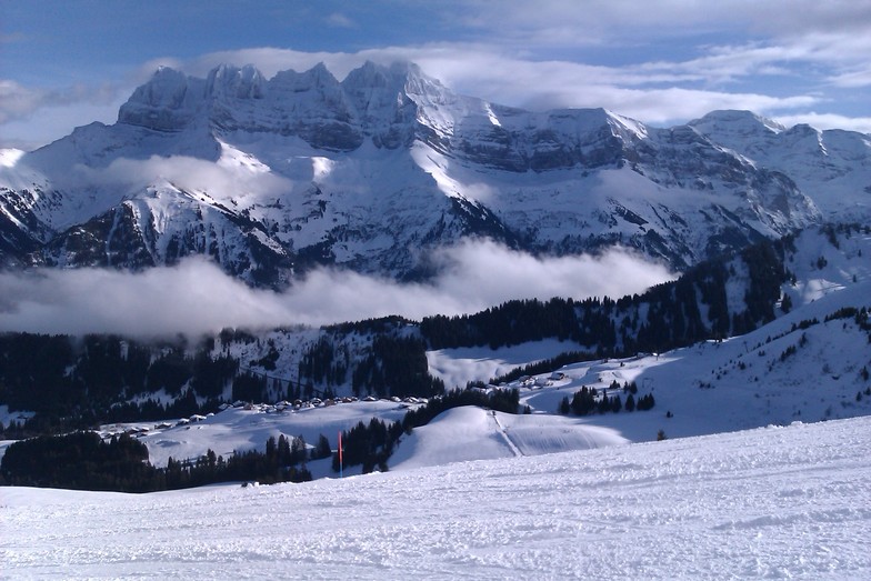
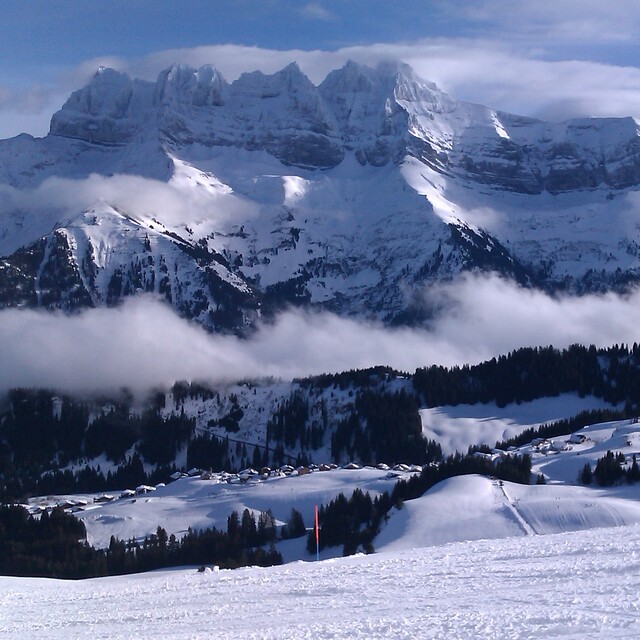
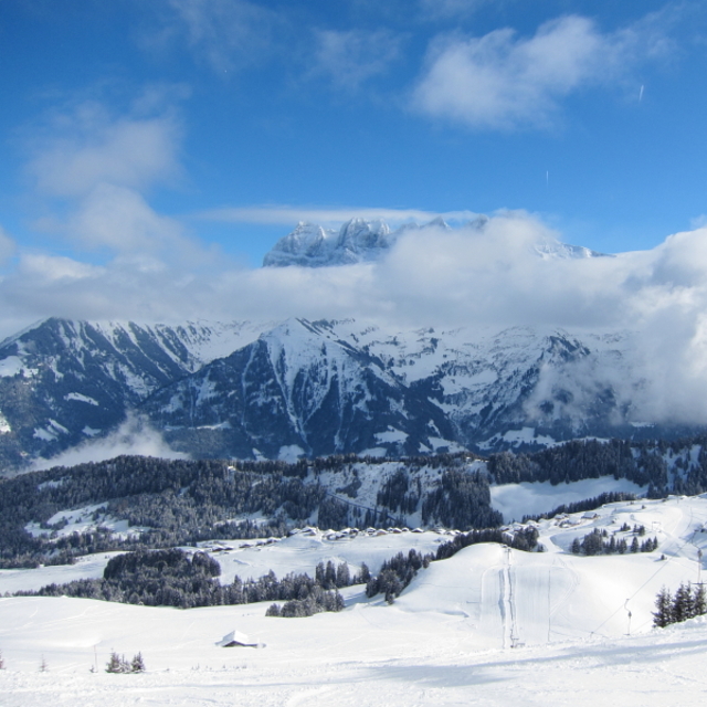
A gem of peace and great skiing with access to the full Porte du Soleil. As of winter 2017/18 the Morgins and Champoussin ski areas are now under new management and over the next few years the lifts and snow making facilities will all be hugely improved which will no doubt bring the crowds so go now whilst it's still relatively undiscovered. Slopes are quiet and a mix for all levels. For apres-ski and lunch/dinner the fabulous Italian "Amici" is the top pick (great food and location) followed by Le Poussin. The views are stunning and it's a great choice for families with quiet sunny nursery slopes and a great ski school next to the Amici Restaurant.
Gareth Lewis da United Kingdom scrive:
A gem of peace and great skiing with access to the full Porte du Soleil. As of winter 2017/18 the Morgins and Champoussin ski areas are now under new management and over the next few years the lifts and snow making facilities will all be hugely improved which will no doubt bring the crowds so go now whilst it's still relatively undiscovered. Slopes are quiet and a mix for all levels. For apres-ski and lunch/dinner the fabulous Italian "Amici" is the top pick (great food and location) followed by Le Poussin. The views are stunning and it's a great choice for families with quiet sunny nursery slopes and a great ski school next to the Amici Restaurant.


 Nearest