

Portillo Storm Snowfall Total Passes 5m / 17 Feet
A snow storm that has now continued for nine days has taken Chilean ski resort Portillo to a snowfall total of 5.2 metres (17 feet) so far, with more snow forecast.

Next 3 days weather summary:Pioggia leggera (totale 4.0mm), per lo più che cade Domenica pomeriggio. Caldo (max 25°C Mercoledì mattina, min 10°C Domenica notte). Vento sarà generalmente leggero. | Giorni 4-6 Champoussin sommario meteoPioggia leggera (totale 5.0mm), per lo più che cade Venerdì notte. Caldo (max 32°C Venerdì pomeriggio, min 18°C Venerdì notte). Vento sarà generalmente leggero. | ||||||||||||||||
Dom 26 | Lunedì 27 | Martedì 28 | Mercoledì 29 | Giovedì 30 | Venerdì 31 | ||||||||||||
PM | notte | AM | PM | notte | AM | PM | notte | AM | PM | notte | AM | PM | notte | AM | PM | notte | |
pioggia leggera | rovesci pioggia | poche nuvole | poche nuvole | limpido | limpido | limpido | poche nuvole | limpido | limpido | limpido | limpido | limpido | limpido | limpido | limpido | pioggia leggera | |
km/h | |||||||||||||||||
Mappa neve |  |  |  |  |  |  | |||||||||||
— | — | — | — | — | — | — | — | — | — | — | — | — | — | — | — | — | |
mm | 2 | 2 | — | — | — | — | — | — | — | — | — | — | — | — | — | — | 4 |
max °C | 16 | 15 | 17 | 20 | 17 | 21 | 24 | 21 | 25 | 27 | 23 | 27 | 30 | 25 | 29 | 32 | 22 |
min °C | 13 | 10 | 13 | 18 | 12 | 15 | 24 | 18 | 19 | 27 | 19 | 20 | 29 | 20 | 21 | 31 | 18 |
chill °C | 13 | 10 | 13 | 18 | 12 | 15 | 24 | 18 | 19 | 27 | 19 | 20 | 29 | 20 | 21 | 31 | 18 |
Umido. % | 64 | 64 | 72 | 54 | 71 | 51 | 44 | 55 | 45 | 33 | 34 | 27 | 24 | 35 | 28 | 23 | 47 |
Zero termico m | 3500 | 3500 | 4150 | 4500 | 4800 | 4700 | 4600 | 4500 | 4450 | 4550 | 4700 | 4650 | 4800 | 4750 | 4800 | 4900 | 4700 |
— | — | 6:07 | — | — | 6:09 | — | — | 6:09 | — | — | 6:11 | — | — | 6:11 | — | — | |
— | 9:10 | — | — | 9:09 | — | — | 9:07 | — | — | 9:07 | — | — | 9:06 | — | — | 9:05 | |
Diventa pro e intaglia:
Informazioni valanghe: European Avalanche Warning Services (EAWS)
Gli ultimi report della neve vicino a Champoussin:
| La profondità maggiore della neve é: | — |
|---|---|
| La profondità minore della neve é: | — |
| Fresh snowfall depth: | — |
| Quando ha nevicato l'ultima volta? | 16 May 2026 |
0.0 | Giorni neve fresca Neve fresca, prevalentemente soleggiato, vento debole. |
|---|---|
0.0 | Giorni neve fresca Fresh snow, limited sun, any wind. |
0.0 | Giorni Bluebird Neve media, prevalentemente soleggiato, vento debole. |
La tabella sopra da le previsioni meteo per Champoussin a specifiche altezze 1310 m. I nostri sofisticati modelli meteo ci consentono di fornire previsioni neve per la vetta, l'area intermedia e a valle delle stazioni sciistiche di Champoussin. Per accedere alle previsioni meteo ad altre altezze, per spostarti usa tab sopra la tabella. Per una visione meteo piu' ampia , controlla la mappa meteo di Switzerland.
Clicca qui per leggere ulteriori informazioni sullo zero termico e il nostro sistema di prevedere le temperature.
Complessivamente 4.1 Basato su 6 voti e 7 recensioni
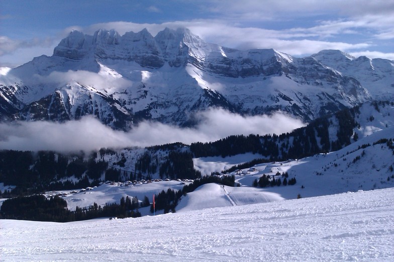
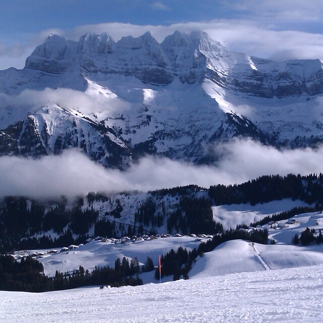
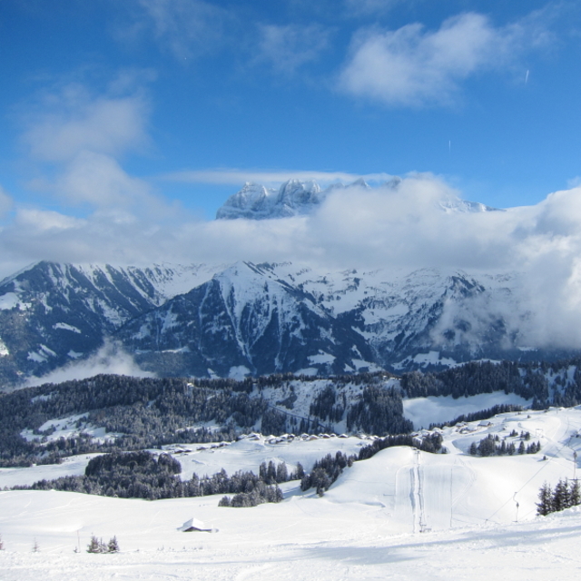
Champoussin was originally built around a Nederlands Ski-Club shed (now derelict), there are still more Dutch visitors than other nationalities, but increasing numbers of English as well in the last five years (we have an apartment there!). Skiing is best for intermediate skiers, with easy half-day access to a good variety of blue and red runs and a couple of black, between Les Crosets and Morgins. There are also short and highly visible off-piste areas. Go out for the day, and you have the full Portes de Soleil in reach. Nowhere in Champoussin is more than 100m from the piste. There are also snow-shoe trails, and a 3km sledge run (return by bus). The village has half a dozen bars and restaurants, but is mainly a family resort. There are a couple of ski shops, and a single general supplies shop. The road to Champoussin is narrow and winding, but locals (including the bus) drive it as if on a motorway. The nearest towns (Champery and Monthey) are 30 min by car – but snow chains may be needed (20% probability?) if you have no snow tyres. Geneva airport is 1h40m by car in good conditions, but can be reached by public transport in 3 hours (bus to Val d’Illiez, funicular to Aigle and main-line train to Geneva airport). Tim Lowe, Surrey
Tim Lowe da United Kingdom scrive:
Champoussin was originally built around a Nederlands Ski-Club shed (now derelict), there are still more Dutch visitors than other nationalities, but increasing numbers of English as well in the last five years (we have an apartment there!). Skiing is best for intermediate skiers, with easy half-day access to a good variety of blue and red runs and a couple of black, between Les Crosets and Morgins. There are also short and highly visible off-piste areas. Go out for the day, and you have the full Portes de Soleil in reach. Nowhere in Champoussin is more than 100m from the piste. There are also snow-shoe trails, and a 3km sledge run (return by bus). The village has half a dozen bars and restaurants, but is mainly a family resort. There are a couple of ski shops, and a single general supplies shop. The road to Champoussin is narrow and winding, but locals (including the bus) drive it as if on a motorway. The nearest towns (Champery and Monthey) are 30 min by car – but snow chains may be needed (20% probability?) if you have no snow tyres. Geneva airport is 1h40m by car in good conditions, but can be reached by public transport in 3 hours (bus to Val d’Illiez, funicular to Aigle and main-line train to Geneva airport).
Tim Lowe, Surrey


 Nearest