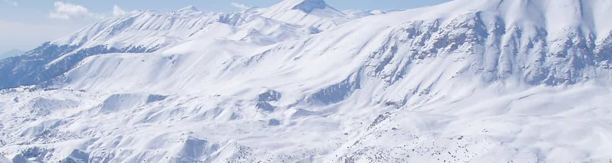
Previsione meteo per Champorcher a1975m altitudine
Emesso: 7 am 25 Jul 2026 (ora locale)
Previsione neve aggiornata in ora min
View forecast
Champorcherat 1975 m altitudine
Publicato da Snow-Forecast.com a:7 am (ora locale) / 25 Jul 2026
Ultimi 6 giorniScorri a sinistra per gli ultimi 6 giorniOra
Next 3 days weather summary:
Pioggia abbondante (totale 25.0mm), più pesante durante Domenica mattina. Temperature moderate (max 18°C Lunedì pomeriggio, min 9°C Domenica mattina). Vento sarà generalmente leggero.
Giorni 4-6 Champorcher sommario meteo
Pioggia leggera (totale 6.0mm), per lo più che cade Mercoledì pomeriggio. Caldo (max 22°C Giovedì pomeriggio, min 14°C Martedì mattina). Vento sarà generalmente leggero.
La tabella sopra da le previsioni meteo per Champorcher a specifiche altezze 1975 m. I nostri sofisticati modelli meteo ci consentono di fornire previsioni neve per la vetta, l'area intermedia e a valle delle stazioni sciistiche di Champorcher. Per accedere alle previsioni meteo ad altre altezze, per spostarti usa tab sopra la tabella. Per una visione meteo piu' ampia , controlla la mappa meteo di Italy.
Clicca qui per leggere ulteriori informazioni sullo zero termico e il nostro sistema di prevedere le temperature.
Recensioni dei visitatori di Champorcher
Complessivamente 3.9 Basato su 3 voti e 1 recensione
We visited Champorcher in February of 2019 just for the day. The drive up from Pont St Martin is really nice and the Valley really lovely. The Cable Car is 5 minutes on from Champorcher at Chardoney and is an attractive old village with a few bars and a couple of hotels. Unfortunately, the snowfall was less than recent years and upon arrival we noticed a few runs were closed including the long black down to Chardoney which looked quite testing from our view going up in the old gondola. With a few of the runs being closed we expected slushy and pretty basic skiing to be had but were really surprised. It was a Saturday and quite busy with day trippers and school ski clubs but basically just used the 2 lifts up after the gondola. The resort is, basically, a big bowl though very pretty and the skiing was quite challenging and steeper than we had expected and the snow was pretty good. Only a couple of canteen style restaurants to be had but plenty to keep any visitors busy for a weekend or 3 day break and i'd imagine very good for families. There is a long piste set aside also for ski tourers up past the Rifugio Dondena that would be great to try if we'd have had time. But would certainly recommend a weekend without hesitation. We stayed just outside of Champorcher in the bed and breakfast: De Grand Maman run by the very friendly Massimiliano which again we would recommend without hesitation.
Complessivamente: 3.9 Basato su 3 voti e 1 recensione
Snowsure
4.0
Varietà di piste
4.7
Fuoripista
4.0
Paesaggio
5.0
Apres-Ski
4.0
David Legget da United Kingdom scrive:
We visited Champorcher in February of 2019 just for the day. The drive up from Pont St Martin is really nice and the Valley really lovely. The Cable Car is 5 minutes on from Champorcher at Chardoney and is an attractive old village with a few bars and a couple of hotels. Unfortunately, the snowfall was less than recent years and upon arrival we noticed a few runs were closed including the long black down to Chardoney which looked quite testing from our view going up in the old gondola. With a few of the runs being closed we expected slushy and pretty basic skiing to be had but were really surprised. It was a Saturday and quite busy with day trippers and school ski clubs but basically just used the 2 lifts up after the gondola. The resort is, basically, a big bowl though very pretty and the skiing was quite challenging and steeper than we had expected and the snow was pretty good. Only a couple of canteen style restaurants to be had but plenty to keep any visitors busy for a weekend or 3 day break and i'd imagine very good for families. There is a long piste set aside also for ski tourers up past the Rifugio Dondena that would be great to try if we'd have had time. But would certainly recommend a weekend without hesitation. We stayed just outside of Champorcher in the bed and breakfast: De Grand Maman run by the very friendly Massimiliano which again we would recommend without hesitation.
Gratis Snow-Forecast.com weather widget per il tho sito
Il Champorcher widget meteo qui sotto è disponibile per essere incorporato su siti Web esterni a titolo gratuito. Esso fornisce un riepilogo giornaliero delle nostre Champorcher previsioni meteo neve e dati meteo. Basta andare alla pagina di configurazione e seguire 3 semplici passi per prendere il codice html personalizzato ed incollarlo nel tuo sito. È possibile scegliere l'elevazione di previsione di neve (vetta, metà o piede della montagna) e l'unità metrica/imperiale per le previsioni meteo neve adeguata al proprio sito Web Clicca qui per ottenere il codice


 Nearest