La tabella sopra da le previsioni meteo per Champéry a specifiche altezze 1658 m. I nostri sofisticati modelli meteo ci consentono di fornire previsioni neve per la vetta, l'area intermedia e a valle delle stazioni sciistiche di Champéry. Per accedere alle previsioni meteo ad altre altezze, per spostarti usa tab sopra la tabella. Per una visione meteo piu' ampia , controlla la mappa meteo di Switzerland.
Clicca qui per leggere ulteriori informazioni sullo zero termico e il nostro sistema di prevedere le temperature.
Il nome della localita' è scritto anche come Champery.
Recensioni dei visitatori di Champéry
Complessivamente 4.1 Basato su 20 voti e 12 recensioni
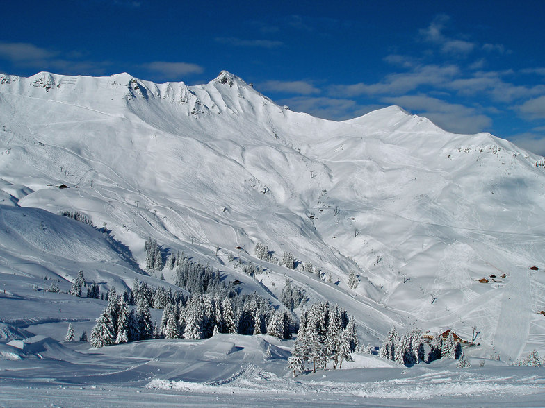
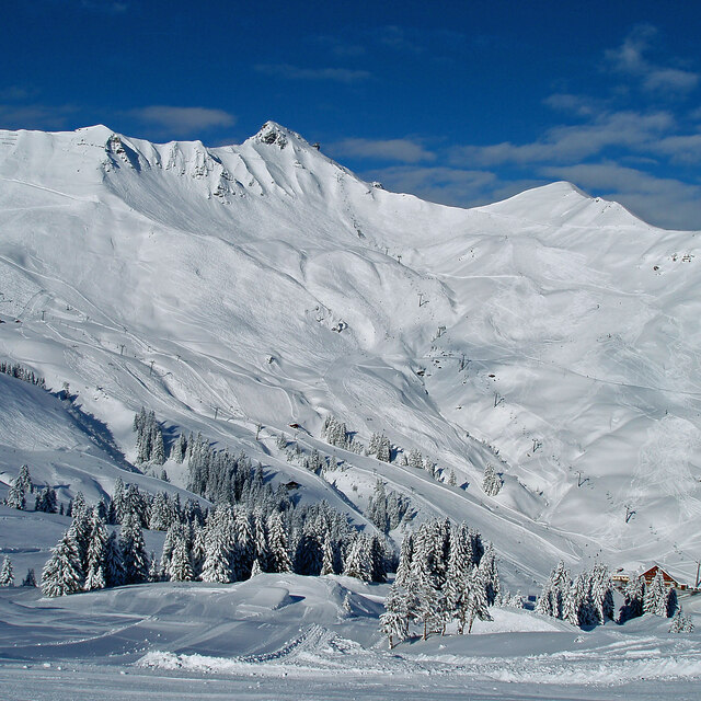
Champery is one of the best places from which to ski the Portes du Soleil ski area with masses of fast lifts and over 600km of well-treated pistes. It's easy to get right over to Les Gets, Avoriaz, Morzine, Chatel and Morgins. There is masses of new accommodation to rent from Avanthay or MDK immobiliers, (we stayed at Chamath with four bedrooms and sleeps 8 from Avanthays).
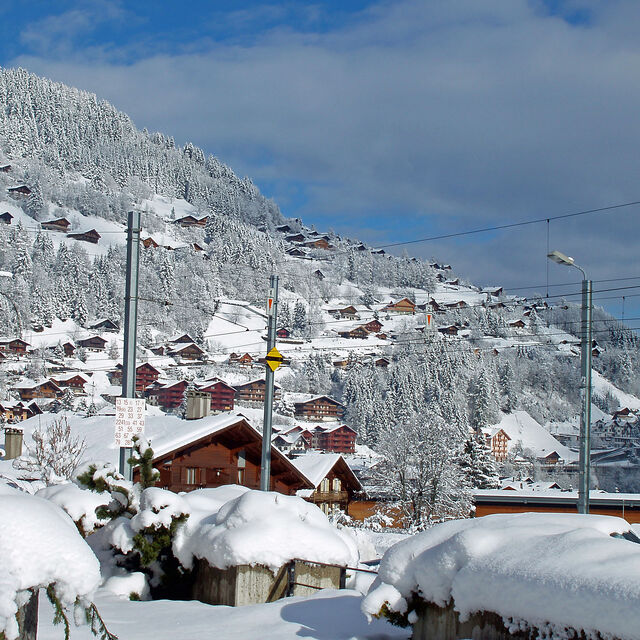
Champery has become much livelier in the past few years with great restaurants and enough night-life and bars but without losing its village charm and beauty. It was just about the first ski village to be established over a century ago.
If you only want to ski for 5 hours or half a day you can buy a 'Swiss side only' pass which covers Champery, Crozets, Champoussin, Morgins and right over to Torgon which overlooks Lake Geneva. And don't forget the famous Swiss Wall, one of the toughest black runs in Europe; not to be attempted after a long liquid lunch in one of the many restaurants on the pistes!. There are, of course, plenty of blues and reds with a few blacks to test you.
Good luck and happy skiing.
Complessivamente: 4.1 Basato su 20 voti e 12 recensioni
Snowsure
4.2
Varietà di piste
4.9
Fuoripista
4.0
Paesaggio
5.0
Apres-Ski
3.6
Ross da United Kingdom scrive:
Champery is one of the best places from which to ski the Portes du Soleil ski area with masses of fast lifts and over 600km of well-treated pistes. It's easy to get right over to Les Gets, Avoriaz, Morzine, Chatel and Morgins. There is masses of new accommodation to rent from Avanthay or MDK immobiliers, (we stayed at Chamath with four bedrooms and sleeps 8 from Avanthays).
Champery has become much livelier in the past few years with great restaurants and enough night-life and bars but without losing its village charm and beauty. It was just about the first ski village to be established over a century ago.
If you only want to ski for 5 hours or half a day you can buy a 'Swiss side only' pass which covers Champery, Crozets, Champoussin, Morgins and right over to Torgon which overlooks Lake Geneva. And don't forget the famous Swiss Wall, one of the toughest black runs in Europe; not to be attempted after a long liquid lunch in one of the many restaurants on the pistes!. There are, of course, plenty of blues and reds with a few blacks to test you.
Good luck and happy skiing.
Gratis Snow-Forecast.com weather widget per il tho sito
Il Champéry widget meteo qui sotto è disponibile per essere incorporato su siti Web esterni a titolo gratuito. Esso fornisce un riepilogo giornaliero delle nostre Champéry previsioni meteo neve e dati meteo. Basta andare alla pagina di configurazione e seguire 3 semplici passi per prendere il codice html personalizzato ed incollarlo nel tuo sito. È possibile scegliere l'elevazione di previsione di neve (vetta, metà o piede della montagna) e l'unità metrica/imperiale per le previsioni meteo neve adeguata al proprio sito Web Clicca qui per ottenere il codice


 Nearest