
Europe Weekly Snow Roundup #321
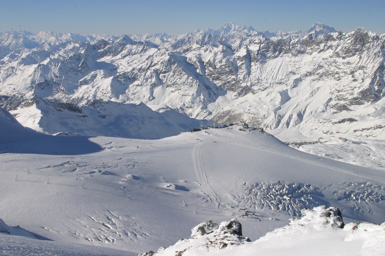
Weekly Snow News for Europe, updated 2 July 2026: Fresh snowfall has been reported on high terrain in the Alps after the very warm end to June. Les 2 Alps ends its 7 months plus season this week.

Next 3 days weather summary:Pioggia leggera (totale 4.0mm), per lo più che cade Martedì pomeriggio. Caldo (max 20°C Mercoledì pomeriggio, min 7°C Martedì notte). Vento sarà generalmente leggero. | Giorni 4-6 Breuil-Cervinia Valtournenche sommario meteoPioggia moderata (totale 17.0mm), più pesante Sabato pomeriggio. Caldo (max 21°C Venerdì pomeriggio, min 8°C Domenica notte). Vento sarà generalmente leggero. | ||||||||||||||||
Mar 21 | Mercoledì 22 | Giovedì 23 | Venerdì 24 | Sabato 25 | Domenica 26 | ||||||||||||
PM | notte | AM | PM | notte | AM | PM | notte | AM | PM | notte | AM | PM | notte | AM | PM | notte | |
rischio temporale | rovesci pioggia | limpido | limpido | limpido | poche nuvole | limpido | limpido | limpido | limpido | limpido | poche nuvole | rischio temporale | pioggia moderata | rovesci pioggia | rovesci pioggia | rovesci pioggia | |
km/h | |||||||||||||||||
Mappa neve |  |  |  |  |  |  | |||||||||||
— | — | — | — | — | — | — | — | — | — | — | — | — | — | — | — | — | |
mm | 3 | 1 | — | — | — | — | — | — | — | — | — | — | 3 | 7 | 3 | 3 | 1 |
max °C | 19 | 15 | 17 | 20 | 16 | 17 | 19 | 16 | 18 | 21 | 18 | 20 | 21 | 15 | 15 | 16 | 14 |
min °C | 18 | 7 | 11 | 19 | 8 | 13 | 19 | 8 | 13 | 21 | 11 | 16 | 18 | 11 | 12 | 16 | 8 |
chill °C | 18 | 6 | 11 | 19 | 6 | 12 | 19 | 7 | 13 | 21 | 11 | 16 | 18 | 11 | 12 | 16 | 6 |
Umido. % | 51 | 77 | 35 | 42 | 60 | 40 | 40 | 67 | 23 | 35 | 60 | 38 | 72 | 94 | 74 | 71 | 87 |
Zero termico m | 3800 | 3650 | 3850 | 4100 | 3800 | 3700 | 3950 | 3950 | 4250 | 4450 | 4350 | 4400 | 4050 | 3550 | 3600 | 3700 | 3650 |
— | — | 6:00 | — | — | 6:01 | — | — | 6:01 | — | — | 6:03 | — | — | 6:03 | — | — | |
— | 9:12 | — | — | 9:10 | — | — | 9:09 | — | — | 9:08 | — | — | 9:07 | — | — | 9:06 | |
Diventa pro e intaglia:
Informazioni valanghe: European Avalanche Warning Services (EAWS)
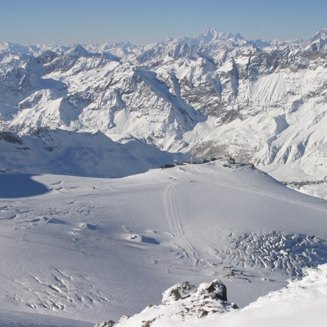
Gli ultimi report della neve vicino a Breuil-Cervinia Valtournenche:
| La profondità maggiore della neve é: | 100 cm |
|---|---|
| La profondità minore della neve é: | — |
| Fresh snowfall depth: | — |
| Quando ha nevicato l'ultima volta? | 10 Jun 2026 |
0.0 | Giorni neve fresca Neve fresca, prevalentemente soleggiato, vento debole. |
|---|---|
0.0 | Giorni neve fresca Fresh snow, limited sun, any wind. |
0.0 | Giorni Bluebird Neve media, prevalentemente soleggiato, vento debole. |
La tabella sopra da le previsioni meteo per Breuil-Cervinia Valtournenche a specifiche altezze 1524 m. I nostri sofisticati modelli meteo ci consentono di fornire previsioni neve per la vetta, l'area intermedia e a valle delle stazioni sciistiche di Breuil-Cervinia Valtournenche. Per accedere alle previsioni meteo ad altre altezze, per spostarti usa tab sopra la tabella. Per una visione meteo piu' ampia , controlla la mappa meteo di Italy.
Clicca qui per leggere ulteriori informazioni sullo zero termico e il nostro sistema di prevedere le temperature.
Il nome della localita' è scritto anche come Cervinia.
Complessivamente 4.0 Basato su 39 voti e 37 recensioni
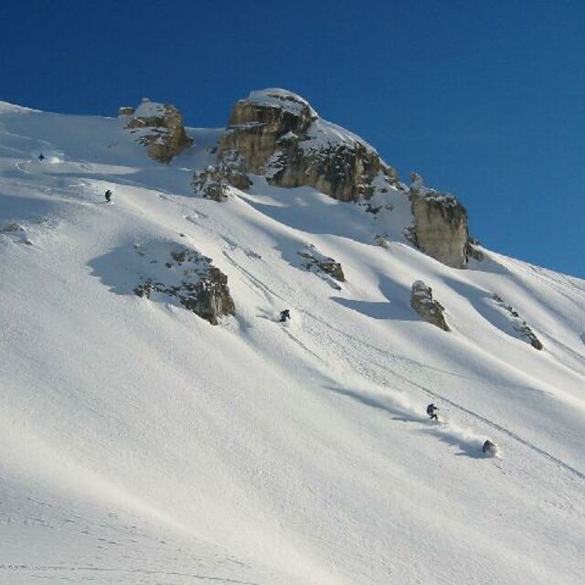
Just found this great site so thought I would add my review too. Cervinia is a two tone resort-high altitude so good snow, lovely easy runs and super views. But it is really not a pretty town, the lift system is somewhat outdated and it is nearly as expensive as Zermatt where I was 4 years ago. Zermatt is in a different class. It's pristine, varied and frankly not much more expensive.
Joel Nick da United Kingdom scrive:
Just found this great site so thought I would add my review too.
Cervinia is a two tone resort-high altitude so good snow, lovely easy runs and super views. But it is really not a pretty town, the lift system is somewhat outdated and it is nearly as expensive as Zermatt where I was 4 years ago. Zermatt is in a different class. It's pristine, varied and frankly not much more expensive.
Leggi 36 più recensioni di Breuil-Cervinia Valtournenche o invia la tua


 Nearest