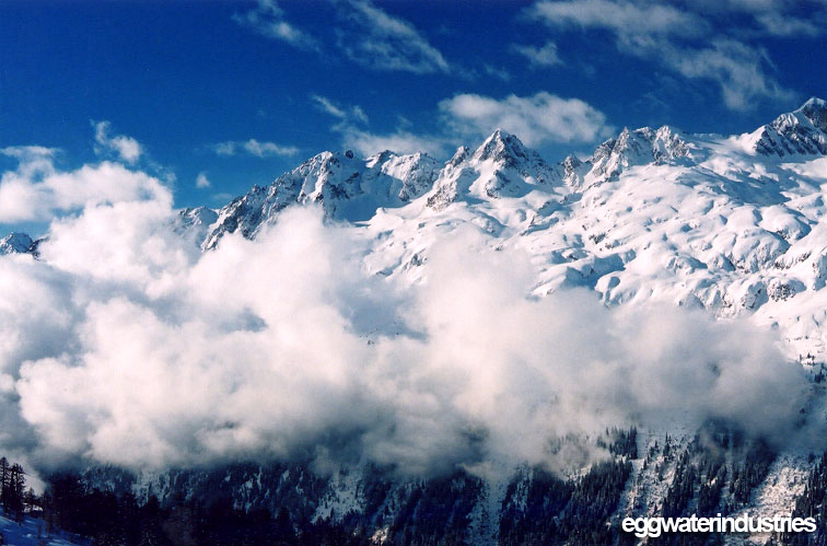


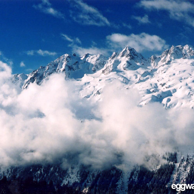
Portillo Re-Opens To Guests Arriving By Helicopter
Chile’s famous Portillo ski resort is reported to have re-opened to guests arriving by helicopter after being cut off by road for more than two weeks by over 6m/20 feet of snowfall.

Next 3 days weather summary:Pioggia abbondante (totale 24.0mm), più pesante durante Giovedì pomeriggio. Temperature moderate (max 10°C Lunedì pomeriggio, min 6°C Mercoledì mattina). Vento sarà generalmente leggero. | Giorni 4-6 Argentiere sommario meteoPioggia moderata (totale 10.0mm), più pesante Giovedì pomeriggio. Temperature moderate (max 8°C Sabato notte, min 5°C Giovedì notte). Vento sarà generalmente leggero. | ||||||||||||||||
Lun 3 | Martedì 4 | Mercoledì 5 | Giovedì 6 | Venerdì 7 | Sabato 8 | ||||||||||||
PM | notte | AM | PM | notte | AM | PM | notte | AM | PM | notte | AM | PM | notte | AM | PM | notte | |
rischio temporale | rovesci pioggia | rischio temporale | rischio temporale | rovesci pioggia | limpido | rischio temporale | rovesci pioggia | limpido | pioggia moderata | rovesci pioggia | limpido | poche nuvole | limpido | limpido | limpido | limpido | |
km/h | |||||||||||||||||
Mappa neve |  |  |  |  |  |  | |||||||||||
— | — | — | — | — | — | — | — | — | — | — | — | — | — | — | — | — | |
mm | 3 | 4 | 1 | 6 | 4 | — | 5 | 1 | — | 6 | 4 | — | — | — | — | — | — |
max °C | 10 | 8 | 8 | 8 | 7 | 6 | 7 | 8 | 7 | 6 | 6 | 6 | 6 | 7 | 6 | 7 | 8 |
min °C | 8 | 8 | 8 | 7 | 7 | 6 | 7 | 7 | 7 | 6 | 5 | 5 | 5 | 6 | 6 | 7 | 7 |
chill °C | 8 | 6 | 7 | 5 | 6 | 6 | 7 | 6 | 6 | 5 | 3 | 5 | 5 | 5 | 5 | 6 | 6 |
Umido. % | 72 | 66 | 64 | 78 | 72 | 86 | 89 | 43 | 66 | 91 | 62 | 53 | 90 | 51 | 41 | 69 | 33 |
Zero termico m | 4500 | 4500 | 4450 | 4450 | 4400 | 4300 | 4400 | 4450 | 4300 | 4200 | 4200 | 4100 | 4200 | 4300 | 4300 | 4350 | 4500 |
— | — | 6:16 | — | — | 6:18 | — | — | 6:18 | — | — | 6:20 | — | — | 6:22 | — | — | |
— | 8:59 | — | — | 8:58 | — | — | 8:57 | — | — | 8:54 | — | — | 8:53 | — | — | 8:52 | |
Diventa pro e intaglia:
Informazioni valanghe: European Avalanche Warning Services (EAWS)
Gli ultimi report della neve vicino a Argentiere:
| La profondità maggiore della neve é: | 0 cm |
|---|---|
| La profondità minore della neve é: | 0 cm |
| Fresh snowfall depth: | — |
| Quando ha nevicato l'ultima volta? | 10 Jun 2026 |
0.0 | Giorni neve fresca Neve fresca, prevalentemente soleggiato, vento debole. |
|---|---|
0.3 | Giorni neve fresca Fresh snow, limited sun, any wind. |
0.4 | Giorni Bluebird Neve media, prevalentemente soleggiato, vento debole. |
La tabella sopra da le previsioni meteo per Argentiere a specifiche altezze 3275 m. I nostri sofisticati modelli meteo ci consentono di fornire previsioni neve per la vetta, l'area intermedia e a valle delle stazioni sciistiche di Argentiere. Per accedere alle previsioni meteo ad altre altezze, per spostarti usa tab sopra la tabella. Per una visione meteo piu' ampia , controlla la mappa meteo di France.
Clicca qui per leggere ulteriori informazioni sullo zero termico e il nostro sistema di prevedere le temperature.
Complessivamente 3.9 Basato su 23 voti e 16 recensioni
Very sad to say one of my favorite places to ski has become a bit of a joke. At the moment the lift to the top of Grand Montets is shut for at least 2 years but probably 3, Bochard lift is shut now for the second week running and the information flow to skiers is awful. A great shame that a wonderful area is being ruined by real mismanagement.
Rob da United Kingdom scrive:
Very sad to say one of my favorite places to ski has become a bit of a joke. At the moment the lift to the top of Grand Montets is shut for at least 2 years but probably 3, Bochard lift is shut now for the second week running and the information flow to skiers is awful.
A great shame that a wonderful area is being ruined by real mismanagement.


 Nearest