Ultimi 6 giorniScorri a sinistra per gli ultimi 6 giorniOra
Next 3 days weather summary:
Pioggia leggera (totale 4.0mm), per lo più che cade Venerdì notte. Temperature moderate (max 10°C Giovedì pomeriggio, min 7°C Venerdì notte). Vento sarà generalmente leggero.
Giorni 4-6 Alpe d'Huez sommario meteo
Pioggia moderata (totale 16.0mm), più pesante Lunedì notte. Temperature moderate (max 10°C Lunedì pomeriggio, min 6°C Martedì notte). Vento sarà generalmente leggero.
La tabella sopra da le previsioni meteo per Alpe d'Huez a specifiche altezze 3350 m. I nostri sofisticati modelli meteo ci consentono di fornire previsioni neve per la vetta, l'area intermedia e a valle delle stazioni sciistiche di Alpe d'Huez. Per accedere alle previsioni meteo ad altre altezze, per spostarti usa tab sopra la tabella. Per una visione meteo piu' ampia , controlla la mappa meteo di France.
Clicca qui per leggere ulteriori informazioni sullo zero termico e il nostro sistema di prevedere le temperature.
Recensioni dei visitatori di Alpe d'Huez
Complessivamente 4.0 Basato su 82 voti e 110 recensioni
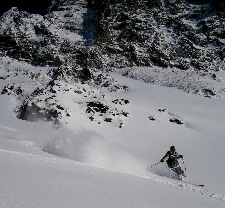
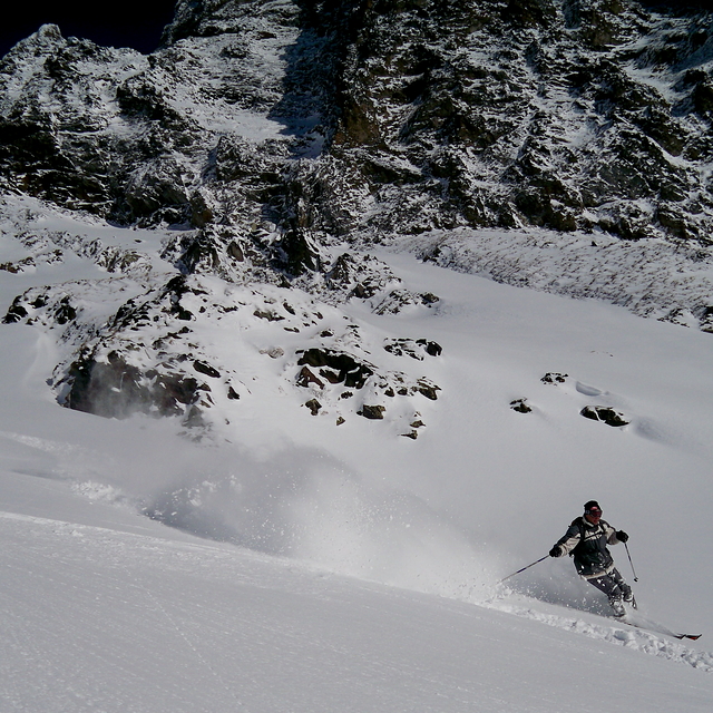
I hadn't been to Alpe d'Huez for a while and visited there for a few weeks in March and early April this season (2022). They have clearly invested a fair bit in the lift system over the intervening period. Many new high speed lifts around.
The area itself is still basically the same, and is really what you would expect from a large alpine resort in the French Alps. A high degree of variety in terrain, runs, off-piste and aspect of slope and lots of ski-in ski-out options. Skiing around town is all easy stuff really and offers a perfect domain for people that are starting out, or have not got much skill yet. But as mentioned the options for up to expert level are also excellent.
The on-mountain facilities are rather decent and well maintained including toilets, restaurants, information and the general maintenance of the resort to a high standard including grooming and prep work of pistes / lifts. The snowpark in Alpe d'Huez has improved significantly from the last time I went there. They now have a very decent setup. There was an extensive area for intermediates and loads of rails and boxes around. Their large line had a couple of decent booters. Then in the run up to the French Freeski Slopestyle Champs at the end of March they built up two insanely large, very poppy kickers to go with the two large kickers that were there before. The comp jumps basically became little more than decorative following the comp, but they were there if anyone felt either mental or exceedingly brave. The park is very popular, no doubt owing to location and design. The location of the park is perfect, being as it is about 2100m elevation and west facing, meaning the kickers don't get the sun on their take off in the afternoons, and the landings will soften in the sun, which is exactly what you want. This season has been rather unseasonably warm, but even so the park was skiing beautifully until 08th April.
The main downside for Alpe d'Huez, I would say, is the car parking situation, if you are travelling there by car. It is almost all paid for parking in the town, which I'm sure helps the residents, but is a pain in the you know what if you're holidaying there. And there simply isn't enough. But difficulty finding a space is not an uncommon thing in ski resorts generally...
All things considered I would not hesitate in recommending Alpe d'Huez to anyone for a trip as it will not disappoint any level of skier/boarder. The resort is also mainly above 1800m making it fairly well snow sure for the vast majority of any season, even ones like this one which was very low snowfall and warmer than average generally.
Complessivamente: 4.0 Basato su 82 voti e 110 recensioni
Snowsure
4.3
Varietà di piste
4.4
Fuoripista
4.0
Paesaggio
4.1
Apres-Ski
4.1
Baz da United Kingdom scrive:
I hadn't been to Alpe d'Huez for a while and visited there for a few weeks in March and early April this season (2022). They have clearly invested a fair bit in the lift system over the intervening period. Many new high speed lifts around.
The area itself is still basically the same, and is really what you would expect from a large alpine resort in the French Alps. A high degree of variety in terrain, runs, off-piste and aspect of slope and lots of ski-in ski-out options. Skiing around town is all easy stuff really and offers a perfect domain for people that are starting out, or have not got much skill yet. But as mentioned the options for up to expert level are also excellent.
The on-mountain facilities are rather decent and well maintained including toilets, restaurants, information and the general maintenance of the resort to a high standard including grooming and prep work of pistes / lifts. The snowpark in Alpe d'Huez has improved significantly from the last time I went there. They now have a very decent setup. There was an extensive area for intermediates and loads of rails and boxes around. Their large line had a couple of decent booters. Then in the run up to the French Freeski Slopestyle Champs at the end of March they built up two insanely large, very poppy kickers to go with the two large kickers that were there before. The comp jumps basically became little more than decorative following the comp, but they were there if anyone felt either mental or exceedingly brave. The park is very popular, no doubt owing to location and design. The location of the park is perfect, being as it is about 2100m elevation and west facing, meaning the kickers don't get the sun on their take off in the afternoons, and the landings will soften in the sun, which is exactly what you want. This season has been rather unseasonably warm, but even so the park was skiing beautifully until 08th April.
The main downside for Alpe d'Huez, I would say, is the car parking situation, if you are travelling there by car. It is almost all paid for parking in the town, which I'm sure helps the residents, but is a pain in the you know what if you're holidaying there. And there simply isn't enough. But difficulty finding a space is not an uncommon thing in ski resorts generally...
All things considered I would not hesitate in recommending Alpe d'Huez to anyone for a trip as it will not disappoint any level of skier/boarder. The resort is also mainly above 1800m making it fairly well snow sure for the vast majority of any season, even ones like this one which was very low snowfall and warmer than average generally.
Gratis Snow-Forecast.com weather widget per il tho sito
Il Alpe d'Huez widget meteo qui sotto è disponibile per essere incorporato su siti Web esterni a titolo gratuito. Esso fornisce un riepilogo giornaliero delle nostre Alpe d'Huez previsioni meteo neve e dati meteo. Basta andare alla pagina di configurazione e seguire 3 semplici passi per prendere il codice html personalizzato ed incollarlo nel tuo sito. È possibile scegliere l'elevazione di previsione di neve (vetta, metà o piede della montagna) e l'unità metrica/imperiale per le previsioni meteo neve adeguata al proprio sito Web Clicca qui per ottenere il codice


 Nearest