

Portillo Re-Opens To Guests Arriving By Helicopter
Chile’s famous Portillo ski resort is reported to have re-opened to guests arriving by helicopter after being cut off by road for more than two weeks by over 6m/20 feet of snowfall.

Next 3 days weather summary:Per lo più asciutto. Temperature moderate (max 18°C Lunedì pomeriggio, min 4°C Lunedì notte). Venti in aumento (calma Lunedì notte, venti freschi da ONO per Mercoledì pomeriggio). | Giorni 4-6 Winter Park sommario meteoPer lo più asciutto. Temperature moderate (max 19°C Venerdì pomeriggio, min 11°C Giovedì notte). Vento sarà generalmente leggero. | |||||||||||||||||
Lunedì 3 | Martedì 4 | Mercoledì 5 | Giovedì 6 | Venerdì 7 | Sabato 8 | |||||||||||||
AM | PM | notte | AM | PM | notte | AM | PM | notte | AM | PM | notte | AM | PM | notte | AM | PM | notte | |
limpido | nuvol- oso | poche nuvole | limpido | nuvol- oso | poche nuvole | limpido | poche nuvole | limpido | limpido | nuvol- oso | limpido | limpido | poche nuvole | limpido | limpido | nuvol- oso | poche nuvole | |
km/h | ||||||||||||||||||
Mappa neve |  |  |  | 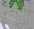 | 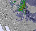 | 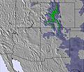 | ||||||||||||
— | — | — | — | — | — | — | — | — | — | — | — | — | — | — | — | — | — | |
mm | — | — | — | — | — | — | — | — | — | — | — | — | — | — | — | — | — | — |
max °C | 17 | 18 | 9 | 15 | 17 | 8 | 13 | 15 | 11 | 14 | 17 | 13 | 17 | 19 | 15 | 18 | 19 | 12 |
min °C | 15 | 16 | 4 | 11 | 14 | 6 | 10 | 15 | 8 | 12 | 17 | 11 | 14 | 18 | 11 | 15 | 16 | 11 |
chill °C | 14 | 15 | 2 | 9 | 13 | 3 | 7 | 13 | 6 | 10 | 16 | 11 | 14 | 18 | 11 | 15 | 16 | 11 |
Umido. % | 25 | 27 | 43 | 33 | 25 | 60 | 19 | 10 | 18 | 17 | 15 | 17 | 14 | 15 | 22 | 22 | 20 | 33 |
Zero termico m | 5500 | 5650 | 4800 | 5200 | 5500 | 4850 | 5100 | 5450 | 5050 | 5200 | 5500 | 5200 | 5400 | 5600 | 5250 | 5400 | 5650 | 5300 |
6:03 | — | — | 6:03 | — | — | 6:05 | — | — | 6:05 | — | — | 6:05 | — | — | 6:07 | — | — | |
— | 8:14 | — | — | 8:13 | — | — | 8:12 | — | — | 8:10 | — | — | 8:09 | — | — | 8:07 | — | |
Diventa pro e intaglia:
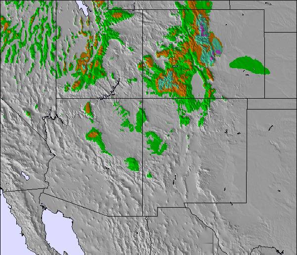
Informazioni valanghe: Colorado Avalanche Information Center
Gli ultimi report della neve vicino a Winter Park:
| La profondità maggiore della neve é: | 0 cm |
|---|---|
| La profondità minore della neve é: | 0 cm |
| Fresh snowfall depth: | — |
| Quando ha nevicato l'ultima volta? | 22 May 2026 |
0.0 | Giorni neve fresca Neve fresca, prevalentemente soleggiato, vento debole. |
|---|---|
0.0 | Giorni neve fresca Fresh snow, limited sun, any wind. |
0.0 | Giorni Bluebird Neve media, prevalentemente soleggiato, vento debole. |
La tabella sopra da le previsioni meteo per Winter Park a specifiche altezze 3674 m. I nostri sofisticati modelli meteo ci consentono di fornire previsioni neve per la vetta, l'area intermedia e a valle delle stazioni sciistiche di Winter Park. Per accedere alle previsioni meteo ad altre altezze, per spostarti usa tab sopra la tabella. Per una visione meteo piu' ampia , controlla la mappa meteo di United States.
Clicca qui per leggere ulteriori informazioni sullo zero termico e il nostro sistema di prevedere le temperature.
Complessivamente 4.1 Basato su 22 voti e 6 recensioni
I went to Winter Park in March, 2014. Loved. I had 17 hours of snowboarding classes that should be group, but it was only myself and the teacher. I passed from beginner level to intermediate. I went by myself and on the day before the last I broke my arm. The doctors and all the crew were so kind and helped me with everything. I had insurance, so I did not have to spend any more money. And they gave me back 142 dollars for I could not use the resort for a day. Locals are really friendly and I made some friends over there. It is sooooo beautiful. But, the pistes are more ski like than snowboarding. And the snow..! Powder most of the days! Good amount of snow fall! Loved. Recommend.
Graziela da Brazil scrive:
I went to Winter Park in March, 2014. Loved. I had 17 hours of snowboarding classes that should be group, but it was only myself and the teacher. I passed from beginner level to intermediate. I went by myself and on the day before the last I broke my arm. The doctors and all the crew were so kind and helped me with everything. I had insurance, so I did not have to spend any more money. And they gave me back 142 dollars for I could not use the resort for a day. Locals are really friendly and I made some friends over there. It is sooooo beautiful. But, the pistes are more ski like than snowboarding. And the snow..! Powder most of the days! Good amount of snow fall! Loved. Recommend.

 Nearest