
Uludağ sommario (Uludag)
Statistiche pendenza
2322m
555m
1767m
- Acri di pista da scii:-
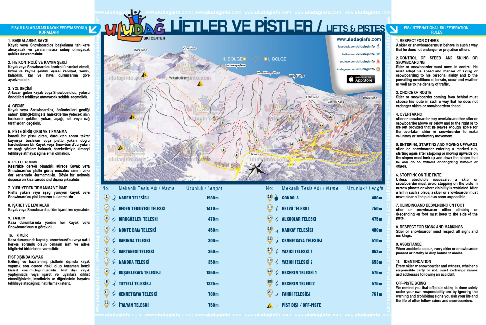
- Piste:26
- Innevamento:Yes
- Halfpipe:0
- Terrain Parks:1
- Campestre:20 km
- Principiante45%
- Intermedio35%
- Avanzato20%

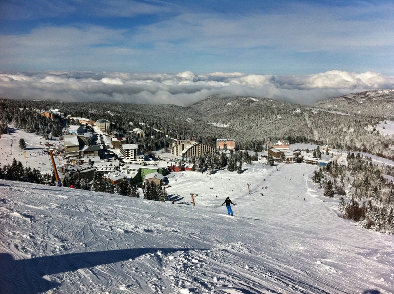
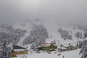
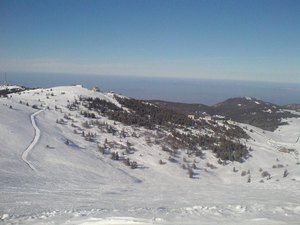
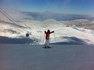
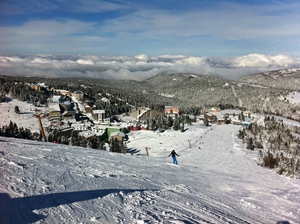
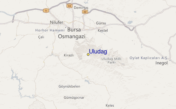
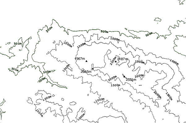
Uludağ is the fabled Mount Olympus of Mysia. It is known in mythology as the place where the gods watched the Trojan war. It is a western extension of the Pontic mountain ranges. Its name means 'Big mountain' - the highest mountain in Western Anatolia, culminating at Kara Tepe (2543m). The ski centre, in the Uludağ National Park, is 36km south of Bursa (a city of 600,000 people) accessible, either along a sealed road, or else by a combined cable-car/bus route that may be preferable when the road is icy. The skiing at Uludağ is mostly intermediate on lightly forested slopes that are usually open from December until late March. Heli-skiing is also available and there are vast off-piste bowls to explore, albeit a threat to conservation within the national park. There are 27 hotels, 15 of which are privately owned, providing over 3000 beds at present. Further development is underway.
Viaggio
- Aeroporto di pertinenza:Istanbul
- Treno:Istanbul
- Telefono:90 549 788 87 88
- Website della località:www.uludaginfo.com
- versante accom.:sì
 14
14 -
-
Impianti risalita
- Apertura stagione:20 Dec 2025
- Chiusura stagione:31 Mar 2026
- Lifts:22 (1 gondola, 5 chairlifts, 16 surface lifts)
 1
1 5
5 16
16
Annunci del manager di Uludağ
Uludağ Official Website: www.uludaginfo.com
Online Skipass Sales: www.uludagshop.com
Contact Information
Mail: [email protected]
Phone: +90 (549) 788 87 88
Ultimo bollettino nevevisualizza il bollettino neve completo
- Emesso:
- Ultima nevicata:—
- Manto Nevoso (superiore):–
- Manto Nevoso (inferiore):–
- Piste:—
- Fuori pista:—
Meteo di Oggi (2044 m)Visualizza previsioni complete neve
| AM | 13 °C | F-Level 4100 m | ||
| PM | 14 °C | F-Level 4250 m | ||
| notte | 14 °C | F-Level 4400 m |
Tra le località vicine a Uludağ (Uludag) ci sono:
- Kartepe 102km
- Bozdag 216km
- Kartalkaya 233km
- Davraz 297km
- Denizli Kayak Merkezi 304km
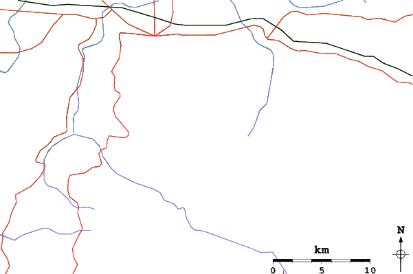
Uludağ Mappe del Luogo


(vedi anche la nostra dettagliata mappa meteo attorno a Uludağ, che vi dara' una visione d'insieme delle attuali e future condizioni neve)
Recensioni dei visitatori di Uludağ
Tonguç da Turkey scrive:
İstanbul'a yakınlığından dolayı her sene bir kez şansımı denerim. Hava mükemmel ve işletmenin pistleri düzeltmemek için hiçbir bahanesi kalmadıysa iyi şartlarla karşılaşma ihtimaliniz var. Ancak %90 ihtimalle bakamsız pistler, bakımsız liftler, ilgisiz personel, fahiş fiyatlar sizi bekliyor olacak.
Biraz kızak, biraz telesiyej manzarası, biraz sosyalleşme, sucuk ekmek, bangır bangır müzik eşliğinde etrafı seyretmece, karlarda yuvarlanmaca diyorsanız güzel zaman geçirebilirsiniz. Ancak insan gibi kayak/snowboard yapmak gibi bir beklentiniz varsa hayal kırıklığına uğrama ihtimaliniz çok yüksek.
Tavsiye etmem.
 Previsioni della città piu’ vicina per Uludağ
- Bursa, Turkey12km
- Kestel, Turkey13km
- Inegeul, Turkey33km
- Cius, Turkey37km
- Orhangazi, Turkey45km
 più vicina destinazione per surf per Uludağ
- Ağlayankaya Plajı (Aglayankaya), Turkey126km
- Kumcağız (Kumcagiz), Turkey149km
- Karasu, Turkey174km
- Silistar, Bulgaria233km
- Ahtopol, Bulgaria243km
 Vette montagne
più vicine a Uludağ
- Uludag, Turkey4km
- Elati (mountain), Turkey168km
- Kula (volcano), Turkey177km
- Mount Ida (Turkey), Turkey201km
- Mahya Dagl, Turkey226km
Nelle vicinanze delle località Uludağ (Uludag)
 Nearest