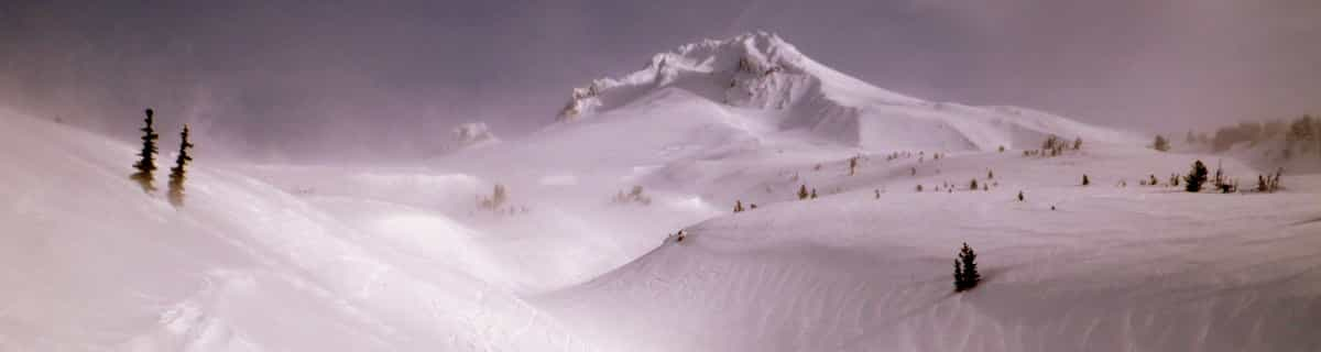
comScore pixel
snowy resort image
Sci USA - Iowa

Sundown Mountain Previsioni Neve

Previsione meteo per Sundown Mountain a 287 m
Emesso: 6 am  13 Apr 2026 (ora locale)

Le previsioni neve per Sundown Mountain sono Pioggia abbondante (totale 48.0mm), più pesante durante Martedì notte. Caldo (max 24°C Martedì pomeriggio, min 14°C Mercoledì notte). Principalmente venti freschi.

Sundown Mountain Weather (Next 3 days): The snow forecast for Sundown Mountain is: Pioggia abbondante (totale 48.0mm), più pesante durante Martedì notte. Caldo (max 24°C Martedì pomeriggio, min 14°C Mercoledì notte). Principalmente venti freschi.

Sundown Mountain Weather (Days 4-6): Pioggia moderata (totale 12.0mm), più pesante Venerdì notte. Condizioni di gelo e disgelo (max 23°C Venerdì pomeriggio, min -2°C Sabato notte). Venti in aumento (calma Giovedì notte, forte vento da SSW per Venerdì notte).


Sundown Mountain Live neve

AltezzaSpessore della neveTemp. (°C)Vento (km/h)Meteo
Cima: 
17
15
part cloud
Fondo: 
16
15
part cloud
6 Day Forecast
Emesso: 6 am 13 Apr 2026 / Updates in ::
Change Forecast Height
Last 6 daysScroll left for last 6 daysNow
Monday
13
Tuesday
14
Wednesday
15
Thursday
16
Friday
17
Saturday
18
AM
PM
notte
AM
PM
notte
AM
PM
notte
AM
PM
notte
AM
PM
notte
AM
PM
notte
thunderstorm
thunderstorm
thunderstorm
cloud
thunderstorm
heavy rain
thunderstorm
mod rain
thunderstorm
part cloud
clear
part cloud
cloud
part cloud
thunderstorm
part cloud
part cloud
part cloud
rischio temporale
rischio temporale
rischio temporale
nuvol-
oso
rischio temporale
forte pioggia
rischio temporale
pioggia moderata
rischio temporale
poche nuvole
limpid­o
poche nuvole
nuvol-
oso
poche nuvole
rischio temporale
poche nuvole
poche nuvole
poche nuvole
 km/h
20
SW
30
SSW
30
SW
15
SW
30
SW
5
WNW
10
S
25
SW
15
SW
20
WSW
20
WNW
5
SSE
25
S
35
S
45
SSW
35
WNW
35
W
35
W
Snow map
2
2
4
6
13
2
9
10
12
max °C
21
23
21
22
24
18
21
21
18
20
22
17
22
23
20
6
9
6
min °C
20
22
20
21
23
16
17
19
14
16
20
15
20
20
10
6
8
-2
20
22
20
21
23
16
17
19
13
15
20
14
20
19
7
1
4
-10
82
80
82
78
70
84
95
78
83
77
57
80
70
59
85
69
46
46
3600
3800
3700
3800
3750
3550
3550
3600
3250
2950
3200
3500
3500
3550
3650
1100
1200
950
Sea lvl1000m2000m3000m4000m5000m
2122202123161920161821162021156822023202224161921161922152122148103
6:24
6:24
6:22
6:20
6:18
6:16
7:42
7:43
7:44
7:45
7:46
7:47

Radar Neve

Gli ultimi report della neve vicino a Sundown Mountain:

Non ci sono report recenti di neve

Non ci sono report recenti di neve

Sundown Mountain Condizioni della neve

La profondità maggiore della neve é:
La profondità minore della neve é:
Fresh snowfall depth:
Quando ha nevicato l'ultima volta?17 Mar 2026
Altre località in USA - Iowa stanno segnalando: neve fresca (0) / buona pista (0)


Storia della neve

Settimana 2 di April ha in media:
0.0
Giorni neve fresca
Neve fresca, prevalentemente soleggiato, vento debole.
0.0
Giorni neve fresca
Fresh snow, limited sun, any wind.
0.1
Giorni Bluebird
Neve media, prevalentemente soleggiato, vento debole.

Map placeholder