

America’s Next Indoor Snow Centre Takes Shape
Construction of a new indoor snow centre for skiers, boarders and tubers appears to be making good progress at Heritage Farm in Wayne County, West Virginia.

Next 3 days weather summary:Per lo più asciutto. Caldo (max 24°C Sabato mattina, min 10°C Mercoledì notte). Vento sarà generalmente leggero. | Giorni 4-6 Mottaret sommario meteoPioggia abbondante (totale 25.0mm), più pesante durante Sabato notte. Caldo (max 25°C Sabato pomeriggio, min 11°C Domenica notte). Vento sarà generalmente leggero. | ||||||||||||||||
Mer 22 | Giovedì 23 | Venerdì 24 | Sabato 25 | Domenica 26 | Lunedì 27 | ||||||||||||
PM | notte | AM | PM | notte | AM | PM | notte | AM | PM | notte | AM | PM | notte | AM | PM | notte | |
limpido | limpido | poche nuvole | limpido | limpido | limpido | limpido | limpido | limpido | poche nuvole | forte pioggia | rovesci pioggia | rovesci pioggia | rovesci pioggia | limpido | limpido | limpido | |
km/h | |||||||||||||||||
Mappa neve |  |  |  |  |  |  | |||||||||||
— | — | — | — | — | — | — | — | — | — | — | — | — | — | — | — | — | |
mm | — | — | — | — | — | — | — | — | — | — | 18 | 3 | 3 | 1 | — | — | — |
max °C | 21 | 17 | 18 | 21 | 17 | 19 | 23 | 19 | 24 | 25 | 18 | 17 | 20 | 17 | 19 | 22 | 19 |
min °C | 21 | 10 | 13 | 20 | 10 | 13 | 22 | 14 | 18 | 25 | 12 | 14 | 19 | 11 | 13 | 22 | 14 |
chill °C | 21 | 10 | 13 | 20 | 10 | 13 | 22 | 14 | 18 | 25 | 12 | 14 | 19 | 11 | 13 | 22 | 14 |
Umido. % | 33 | 51 | 40 | 31 | 60 | 33 | 28 | 35 | 23 | 33 | 96 | 62 | 51 | 70 | 50 | 45 | 74 |
Zero termico m | 4050 | 4100 | 3900 | 3850 | 4200 | 4450 | 4400 | 4450 | 4450 | 4400 | 3650 | 3750 | 3950 | 4000 | 4250 | 4450 | 4650 |
— | — | 6:07 | — | — | 6:07 | — | — | 6:09 | — | — | 6:09 | — | — | 6:11 | — | — | |
— | 9:13 | — | — | 9:12 | — | — | 9:10 | — | — | 9:09 | — | — | 9:08 | — | — | 9:07 | |
Diventa pro e intaglia:
Informazioni valanghe: European Avalanche Warning Services (EAWS)
Gli ultimi report della neve vicino a Mottaret:
| La profondità maggiore della neve é: | — |
|---|---|
| La profondità minore della neve é: | — |
| Fresh snowfall depth: | — |
| Quando ha nevicato l'ultima volta? | 4 Jun 2026 |
0.0 | Giorni neve fresca Neve fresca, prevalentemente soleggiato, vento debole. |
|---|---|
0.0 | Giorni neve fresca Fresh snow, limited sun, any wind. |
0.0 | Giorni Bluebird Neve media, prevalentemente soleggiato, vento debole. |
La tabella sopra da le previsioni meteo per Mottaret a specifiche altezze 1450 m. I nostri sofisticati modelli meteo ci consentono di fornire previsioni neve per la vetta, l'area intermedia e a valle delle stazioni sciistiche di Mottaret. Per accedere alle previsioni meteo ad altre altezze, per spostarti usa tab sopra la tabella. Per una visione meteo piu' ampia , controlla la mappa meteo di France.
Clicca qui per leggere ulteriori informazioni sullo zero termico e il nostro sistema di prevedere le temperature.
Complessivamente 4.3 Basato su 6 voti e 10 recensioni
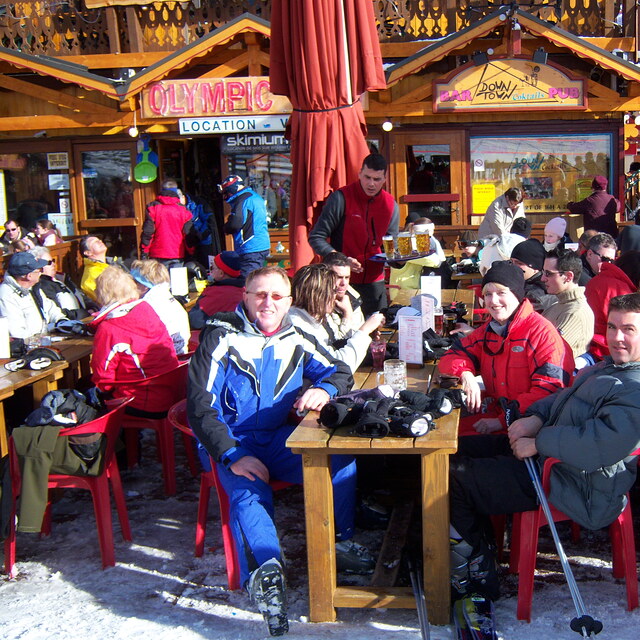
If you want to go to the most expensive ski area in France (Mottaret) during the peak season as we have to, but are not lucky enough to have the cash to pay for expensive accommodation, then the Le Hameu ticks all the right boxes for ski in - ski out, locality of slopes, shops, ski hire, free transport to Meribel and a bar which has a happy hour with a roaring fire. We have stayed there 3 times so far and we have booked for Feb half term this year. The apartments have always been clean and warm, with lots of hot water and very quiet. Last year we stayed in the Pierre Vacances by the ski meeting area in Mottaret and to be honest with you the accommodation was smaller and we had a long trek up lifts along balconies and then up more stairs to get back to our apartments, and of course, we had to do all this with our luggage on arrival and departure also. Admittedly the Hameau does need serious refurbishment and if we booked with a tour operator and paid masses for it, we would be annoyed, but we book independently and pay about half of what the tour operators charge.
Laura and Paul da United Kingdom scrive:
If you want to go to the most expensive ski area in France (Mottaret) during the peak season as we have to, but are not lucky enough to have the cash to pay for expensive accommodation, then the Le Hameu ticks all the right boxes for ski in - ski out, locality of slopes, shops, ski hire, free transport to Meribel and a bar which has a happy hour with a roaring fire. We have stayed there 3 times so far and we have booked for Feb half term this year. The apartments have always been clean and warm, with lots of hot water and very quiet.
Last year we stayed in the Pierre Vacances by the ski meeting area in Mottaret and to be honest with you the accommodation was smaller and we had a long trek up lifts along balconies and then up more stairs to get back to our apartments, and of course, we had to do all this with our luggage on arrival and departure also.
Admittedly the Hameau does need serious refurbishment and if we booked with a tour operator and paid masses for it, we would be annoyed, but we book independently and pay about half of what the tour operators charge.


 Nearest