
 ski hire exclusive discount
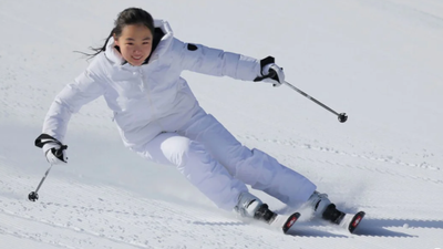

Kim Jong Un’s Daughter Goes Skiing
North Korean leader Kim Jong Un’s daughter, Kim Ju Ae, has been pictured skiing at a new mountain resort under development in the country’s far north.

Mercoledì 18 | Giovedì 19 | Venerdì 20 | Sabato 21 | Domenica 22 | Lunedì 23 | |||||||||||||
AM | PM | notte | AM | PM | notte | AM | PM | notte | AM | PM | notte | AM | PM | notte | AM | PM | notte | |
 | |  |  |  |  | | | |  | |  | | | |  | |  | |
neve leggera | neve leggera | neve mod. | forte nevicata | neve mod. | forte nevicata | neve leggera | forte nevicata | forte nevicata | poche nuvole | poche nuvole | neve leggera | neve leggera | neve mod. | neve mod. | rovesci neve | poche nuvole | limpido | |
km/h | ||||||||||||||||||
Mappa neve |  |  | 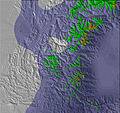 | 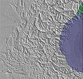 | 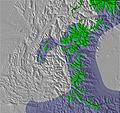 | 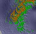 | ||||||||||||
 cm | 4 | 3 | 7 | 12 | 6 | 20 | 5 | 14 | 11 | — | — | 1 | 5 | 8 | 9 | — | — | — |
mm | — | — | — | — | — | — | — | — | — | — | — | — | — | — | — | — | — | — |
max °C | -2 | -3 | -1 | -3 | -4 | -5 | -5 | -4 | -4 | -3 | -3 | -2 | -3 | -3 | -5 | -4 | -4 | -4 |
min °C | -3 | -3 | -3 | -5 | -5 | -6 | -5 | -4 | -6 | -5 | -4 | -3 | -3 | -4 | -7 | -5 | -5 | -5 |
chill °C | -9 | -9 | -7 | -11 | -11 | -11 | -10 | -10 | -11 | -9 | -4 | -6 | -6 | -9 | -12 | -9 | -5 | -5 |
Umido. % | 97 | 97 | 86 | 97 | 97 | 97 | 96 | 97 | 96 | 78 | 42 | 20 | 93 | 97 | 97 | 50 | 44 | 20 |
Zero termico m | 2050 | 1900 | 1950 | 1900 | 1700 | 1600 | 1600 | 1650 | 1600 | 1500 | 1550 | 1350 | 1550 | 1800 | 1450 | 1350 | 1250 | 700 |
 | 7:35 | — | — | 7:35 | — | — | 7:37 | — | — | 7:39 | — | — | 7:39 | — | — | 7:41 | — | — |
 | — | 4:59 | — | — | 4:58 | — | — | 4:57 | — | — | 4:57 | — | — | 4:55 | — | — | 4:54 | — |
Next 3 days weather summary:Una pesante caduta di neve, più pesante durante Venerdì pomeriggio. Le temperature saranno sotto lo zero (max -1°C Mercoledì notte, min -6°C Giovedì notte). Vento sarà generalmente leggero. | Giorni 4-6 Les Arcs sommario meteoUna pesante caduta di neve, più pesante durante Domenica pomeriggio. Le temperature saranno sotto lo zero (max -2°C Sabato notte, min -7°C Domenica notte). Vento sarà generalmente leggero. | |||||||||||||||||
 SnowPro
 Previsioni neve orarie e a 16 giorniVedi il meteo passatoNavigazione veloce senza pubblicitàPrevisioni passate e Storia della neve
Informazioni valanghe: European Avalanche Warning Services (EAWS)

Gli ultimi report della neve vicino a Les Arcs:

Snowing heavily in Tignes. da Tignes
Snowing above Champagny. da Champagny

Resort not yet open. Snow expected on upper slopes. da La Giettaz en Aravis

Drizzle reported from Aosta Airport at 546 metres elevation 5 kms NE of Pila but it is forecast cold enough for snow at higher elevations in the ski area da Pila
It is snowing steadily above Tignes. da Tignes
| La profondità maggiore della neve é: | — |
|---|---|
| La profondità minore della neve é: | — |
| Fresh snowfall depth: | 20 cm |
| Quando ha nevicato l'ultima volta? | 17 Nov 2026 |
0.8 | Giorni neve fresca Neve fresca, prevalentemente soleggiato, vento debole. |
|---|---|
0.9 | Giorni neve fresca Fresh snow, limited sun, any wind. |
1.0 | Giorni Bluebird Neve media, prevalentemente soleggiato, vento debole. |
La tabella sopra da le previsioni meteo per Les Arcs a specifiche altezze 2390 m. I nostri sofisticati modelli meteo ci consentono di fornire previsioni neve per la vetta, l'area intermedia e a valle delle stazioni sciistiche di Les Arcs. Per accedere alle previsioni meteo ad altre altezze, per spostarti usa tab sopra la tabella. Per una visione meteo piu' ampia , controlla la mappa meteo di France.
Clicca qui per leggere ulteriori informazioni sullo zero termico e il nostro sistema di prevedere le temperature.
Complessivamente 4.2 Basato su 87 voti e 84 recensioni
I learnt here 50 years ago and we have intermittently visited to see its development over the years. Now we go every year as it really suits us and we never feel let-down. Great ski-in, ski-out, espcially in 1800. New lifts being added every year, New TransArc 2 years ago, New Vallandry 3 years ago, new Villaroger 10 person bubble this year. It could do with more capacity up to the Aiguille Rouge to reduce queues but I guess the receding glacier doesn't really justify this. Very snow sure and snow-making is comprehensive (but it is also a B Corp and very environmentally conscious). The number of tree-runs around Peisey Vallandry means white-outs are still ski-able. We often pop over to Val d'Isere/Tignes and Courchevel/Meribel and are very pleased to come back to Les Arcs. Les crowded, less glitzy, more focused on skiing. Plus you have the Intermediate dream of La Plagne available on the same lift-pass. The timber clad and distinctive buildings are unique among custom resorts and are officially part of the French Patrimoine, Charloote Perignan (designer) was a true pioneer. Overall, for the range of facilities, range of slopes, and variety of accommodation we think Les Arcs is right up there in terms of value for money amongst the major ski destinations, and we have skied all over the USA, Canada, Japan and Europe.
David da United Kingdom scrive:
I learnt here 50 years ago and we have intermittently visited to see its development over the years. Now we go every year as it really suits us and we never feel let-down. Great ski-in, ski-out, espcially in 1800. New lifts being added every year, New TransArc 2 years ago, New Vallandry 3 years ago, new Villaroger 10 person bubble this year. It could do with more capacity up to the Aiguille Rouge to reduce queues but I guess the receding glacier doesn't really justify this. Very snow sure and snow-making is comprehensive (but it is also a B Corp and very environmentally conscious). The number of tree-runs around Peisey Vallandry means white-outs are still ski-able. We often pop over to Val d'Isere/Tignes and Courchevel/Meribel and are very pleased to come back to Les Arcs. Les crowded, less glitzy, more focused on skiing. Plus you have the Intermediate dream of La Plagne available on the same lift-pass. The timber clad and distinctive buildings are unique among custom resorts and are officially part of the French Patrimoine, Charloote Perignan (designer) was a true pioneer. Overall, for the range of facilities, range of slopes, and variety of accommodation we think Les Arcs is right up there in terms of value for money amongst the major ski destinations, and we have skied all over the USA, Canada, Japan and Europe.

 Iscriviti o Accedi
 Scarica una nuova foto
 Nearest