

America’s Next Indoor Snow Centre Takes Shape
Construction of a new indoor snow centre for skiers, boarders and tubers appears to be making good progress at Heritage Farm in Wayne County, West Virginia.

Next 3 days weather summary:Pioggia leggera (totale 9.0mm), per lo più che cade Martedì mattina. Temperature moderate (max 12°C Mercoledì pomeriggio, min 7°C Martedì notte). Vento sarà generalmente leggero. | Giorni 4-6 Le Tour sommario meteoPioggia abbondante (totale 37.0mm), più pesante durante Sabato notte. Temperature moderate (max 17°C Sabato pomeriggio, min 6°C Domenica notte). Vento sarà generalmente leggero. | |||||||||||||||||
Martedì 21 | Mercoledì 22 | Giovedì 23 | Venerdì 24 | Sabato 25 | Domenica 26 | |||||||||||||
AM | PM | notte | AM | PM | notte | AM | PM | notte | AM | PM | notte | AM | PM | notte | AM | PM | notte | |
rischio temporale | rischio temporale | rovesci pioggia | limpido | limpido | limpido | nuvol- oso | poche nuvole | limpido | limpido | limpido | limpido | poche nuvole | poche nuvole | forte pioggia | rovesci pioggia | pioggia leggera | pioggia moderata | |
km/h | ||||||||||||||||||
Mappa neve |  |  |  |  |  |  | ||||||||||||
— | — | — | — | — | — | — | — | — | — | — | — | — | — | — | — | — | — | |
mm | 5 | 3 | 1 | — | — | — | — | — | — | — | — | — | — | — | 25 | 1 | 5 | 6 |
max °C | 10 | 11 | 9 | 11 | 12 | 11 | 10 | 11 | 9 | 12 | 14 | 13 | 16 | 17 | 12 | 9 | 9 | 7 |
min °C | 9 | 11 | 7 | 8 | 12 | 8 | 9 | 11 | 8 | 10 | 13 | 12 | 13 | 16 | 8 | 9 | 8 | 6 |
chill °C | 7 | 10 | 7 | 8 | 12 | 7 | 8 | 10 | 8 | 10 | 13 | 11 | 12 | 16 | 6 | 8 | 7 | 4 |
Umido. % | 65 | 64 | 54 | 30 | 52 | 41 | 46 | 54 | 45 | 22 | 43 | 27 | 35 | 49 | 88 | 79 | 79 | 98 |
Zero termico m | 3600 | 3550 | 3700 | 3900 | 3850 | 3900 | 3600 | 3600 | 3950 | 4250 | 4150 | 4350 | 4300 | 4350 | 3650 | 3500 | 3550 | 3300 |
6:01 | — | — | 6:01 | — | — | 6:03 | — | — | 6:03 | — | — | 6:05 | — | — | 6:05 | — | — | |
— | — | 9:15 | — | — | 9:14 | — | — | 9:13 | — | — | 9:12 | — | — | 9:10 | — | — | 9:08 | |
Diventa pro e intaglia:
Informazioni valanghe: European Avalanche Warning Services (EAWS)
Gli ultimi report della neve vicino a Le Tour:
No information received. Clear blue skies, all lifts open. da La Giettaz en Aravis
| La profondità maggiore della neve é: | — |
|---|---|
| La profondità minore della neve é: | — |
| Fresh snowfall depth: | — |
| Quando ha nevicato l'ultima volta? | 16 May 2026 |
0.0 | Giorni neve fresca Neve fresca, prevalentemente soleggiato, vento debole. |
|---|---|
0.0 | Giorni neve fresca Fresh snow, limited sun, any wind. |
0.0 | Giorni Bluebird Neve media, prevalentemente soleggiato, vento debole. |
La tabella sopra da le previsioni meteo per Le Tour a specifiche altezze 2271 m. I nostri sofisticati modelli meteo ci consentono di fornire previsioni neve per la vetta, l'area intermedia e a valle delle stazioni sciistiche di Le Tour. Per accedere alle previsioni meteo ad altre altezze, per spostarti usa tab sopra la tabella. Per una visione meteo piu' ampia , controlla la mappa meteo di France.
Clicca qui per leggere ulteriori informazioni sullo zero termico e il nostro sistema di prevedere le temperature.
Complessivamente 3.2 Basato su 3 voti e 2 recensioni
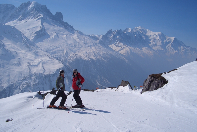
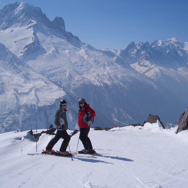
Le Tour is a great area for all round family fun, with something for everyone from the lower nursery slopes, to some great wide blues to perfect your technique and some nice reds for a challenge. Whilst lacking in blacks runs there is plenty of opportunity to ski off-piste and challenge yourself with powder and moguls (and in my case fall over). The forest ski down to Vallorcine is one of my favourite bits - even if you do need to walk the last final bit to the gondola to return (warms up your toes). Not great for snowboarders with long flattish linking sections, but now with a new snow park (opened last year) this may make up for it. Not for the ski party set as night life practically non-existent (one hotel bar and a restaurant) - so take your mates and party at home or go to Argentiere. We tend to spend a week in Le Tour at half term with the family and it provides the least frenetic, but not the least challenging, skiing at that time.The ski down at the end of the day can be challengingly busy, so if in doubt ski this run earlier in the day and just get the gondola down. At half term I think the other Chamonix resorts are nightmarish with some really bad tempered folk on challenging and crowded runs - we do ski them (very easy on the bus from Le Tour) but we are always glad to return to Le Tour. Of course at quieter times Le Tour would improve and the other areas would also be much more enjoyable. During busy times get to the bottom lift immediately before it opens or later morning to avoid too long a wait. Le Tour is a great spot if there is a bit of snow as with such a small amount of on-site accommodation people tend not to struggle up the valley from Chamonix etc so you have the pistes to yourself.
Dr Jam da United Kingdom scrive:
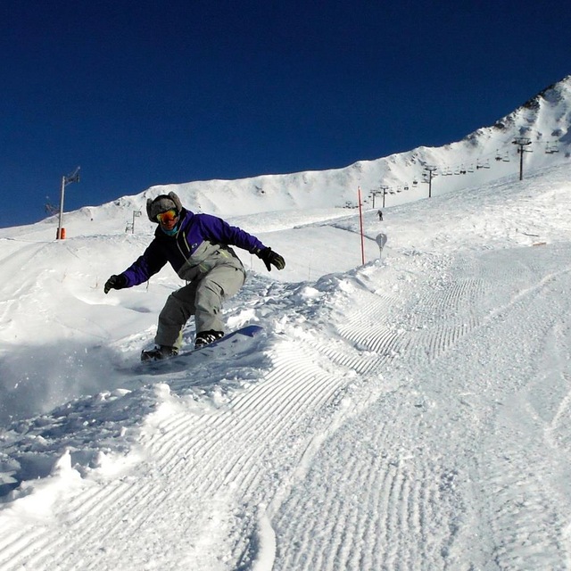
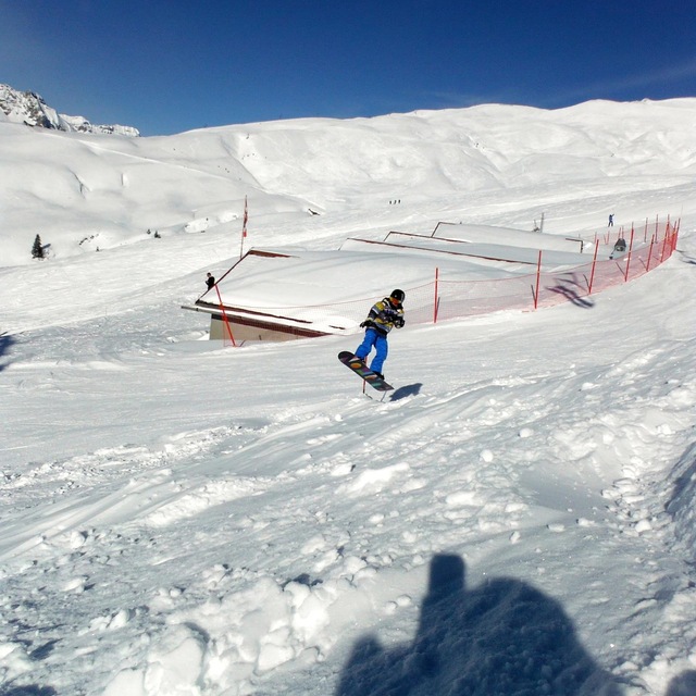
Le Tour is a great area for all round family fun, with something for everyone from the lower nursery slopes, to some great wide blues to perfect your technique and some nice reds for a challenge. Whilst lacking in blacks runs there is plenty of opportunity to ski off-piste and challenge yourself with powder and moguls (and in my case fall over). The forest ski down to Vallorcine is one of my favourite bits - even if you do need to walk the last final bit to the gondola to return (warms up your toes). Not great for snowboarders with long flattish linking sections, but now with a new snow park (opened last year) this may make up for it.
Not for the ski party set as night life practically non-existent (one hotel bar and a restaurant) - so take your mates and party at home or go to Argentiere.
We tend to spend a week in Le Tour at half term with the family and it provides the least frenetic, but not the least challenging, skiing at that time.The ski down at the end of the day can be challengingly busy, so if in doubt ski this run earlier in the day and just get the gondola down. At half term I think the other Chamonix resorts are nightmarish with some really bad tempered folk on challenging and crowded runs - we do ski them (very easy on the bus from Le Tour) but we are always glad to return to Le Tour. Of course at quieter times Le Tour would improve and the other areas would also be much more enjoyable.
During busy times get to the bottom lift immediately before it opens or later morning to avoid too long a wait. Le Tour is a great spot if there is a bit of snow as with such a small amount of on-site accommodation people tend not to struggle up the valley from Chamonix etc so you have the pistes to yourself.


 Nearest