Ultimi 6 giorniScorri a sinistra per gli ultimi 6 giorniOra
Next 4 days weather summary:
Pioggia abbondante (totale 28.0mm), più pesante durante Sabato notte. Temperature moderate (max 14°C Martedì pomeriggio, min 4°C Domenica mattina). Vento sarà generalmente leggero.
Giorni 5-7 La Rosière sommario meteo
Per lo più asciutto. Temperature moderate (max 18°C Venerdì pomeriggio, min 11°C Martedì notte). Vento sarà generalmente leggero.
La tabella sopra da le previsioni meteo per La Rosière a specifiche altezze 2799 m. I nostri sofisticati modelli meteo ci consentono di fornire previsioni neve per la vetta, l'area intermedia e a valle delle stazioni sciistiche di La Rosière. Per accedere alle previsioni meteo ad altre altezze, per spostarti usa tab sopra la tabella. Per una visione meteo piu' ampia , controlla la mappa meteo di France.
Clicca qui per leggere ulteriori informazioni sullo zero termico e il nostro sistema di prevedere le temperature.
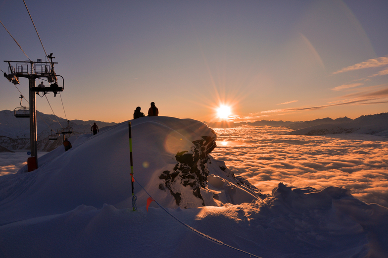
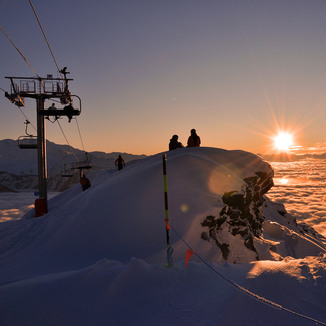
Il nome della localita' è scritto anche come La Rosiere.
Recensioni dei visitatori di La Rosière
Complessivamente 4.2 Basato su 28 voti e 28 recensioni
In the last few years La Rosiere has completely changed it's face and with the addition of 2 new chair lifts taking one up to 2800m it has put itself on the map of top ski resorts in the Alps. Together with La Thuile, in Italy, it offers one over 150km of piste runs. It is one of the best kept secret spots for off-piste skiing in the Alps mainly due to it's low number of tourist beds in relation to it's lift capacity. La Rosiere has only 4000 tourist beds in the resort and an uphill lift capacity of over 50,000 skiers per hour. Other nearby ski resorts have equal beds to uphill capacity. This means pistes are empty especially in low season periods and there is plenty of off-piste for everyone. I've skied untracked off-piste even 5 days after a snow fall which is pretty much unheard of anywhere else. It's my favourite off-piste paradise.
Complessivamente: 4.2 Basato su 28 voti e 28 recensioni
Snowsure
4.9
Varietà di piste
4.2
Fuoripista
4.3
Paesaggio
4.6
Apres-Ski
3.9
Edmond Nico da Italy scrive:
In the last few years La Rosiere has completely changed it's face and with the addition of 2 new chair lifts taking one up to 2800m it has put itself on the map of top ski resorts in the Alps. Together with La Thuile, in Italy, it offers one over 150km of piste runs. It is one of the best kept secret spots for off-piste skiing in the Alps mainly due to it's low number of tourist beds in relation to it's lift capacity. La Rosiere has only 4000 tourist beds in the resort and an uphill lift capacity of over 50,000 skiers per hour. Other nearby ski resorts have equal beds to uphill capacity. This means pistes are empty especially in low season periods and there is plenty of off-piste for everyone. I've skied untracked off-piste even 5 days after a snow fall which is pretty much unheard of anywhere else. It's my favourite off-piste paradise.
Gratis Snow-Forecast.com weather widget per il tho sito
Il La Rosière widget meteo qui sotto è disponibile per essere incorporato su siti Web esterni a titolo gratuito. Esso fornisce un riepilogo giornaliero delle nostre La Rosière previsioni meteo neve e dati meteo. Basta andare alla pagina di configurazione e seguire 3 semplici passi per prendere il codice html personalizzato ed incollarlo nel tuo sito. È possibile scegliere l'elevazione di previsione di neve (vetta, metà o piede della montagna) e l'unità metrica/imperiale per le previsioni meteo neve adeguata al proprio sito Web Clicca qui per ottenere il codice


 Nearest