Publicato da Snow-Forecast.com a:7 am (ora locale) / 31 Jul 2026
Ultimi 6 giorniScorri a sinistra per gli ultimi 6 giorniOra
Next 3 days weather summary:
Pioggia leggera (totale 3.0mm), per lo più che cade Venerdì pomeriggio. Caldo (max 23°C Domenica pomeriggio, min 16°C Sabato mattina). Vento sarà generalmente leggero.
Giorni 4-6 La Clusaz sommario meteo
Pioggia moderata (totale 14.0mm), più pesante Lunedì notte. Caldo (max 25°C Martedì pomeriggio, min 17°C Lunedì notte). Vento sarà generalmente leggero.
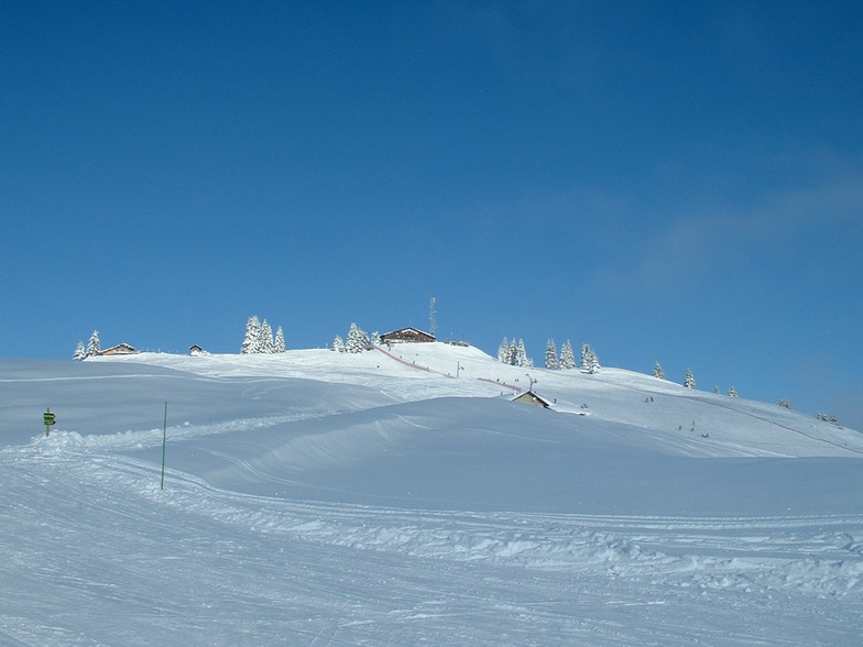
La tabella sopra da le previsioni meteo per La Clusaz a specifiche altezze 1742 m. I nostri sofisticati modelli meteo ci consentono di fornire previsioni neve per la vetta, l'area intermedia e a valle delle stazioni sciistiche di La Clusaz. Per accedere alle previsioni meteo ad altre altezze, per spostarti usa tab sopra la tabella. Per una visione meteo piu' ampia , controlla la mappa meteo di France.
Clicca qui per leggere ulteriori informazioni sullo zero termico e il nostro sistema di prevedere le temperature.
Recensioni dei visitatori di La Clusaz
Complessivamente 4.1 Basato su 41 voti e 24 recensioni
We went late March, which is always risky in terms of weather and conditions. It was warm and slushy, I'd recommend nothing later than mid March.
This was a 4 day trip, we left Luton at 6am Sunday (cheap flight, half empty) and because of the short transfer, we were on the first gondola at 11.30am. That's the key attraction here, the short transfer from Geneva.
Given the snow conditions, it's difficult to be fully objective, but a few things stand out. The lift system is generally old and slow, particularly the long and very slow chair at Baime, which does detract from the attraction of that area. Baime is the highest part of the resort and you can ski all the way from the top to the bottom (red and blue). None of the blacks are that steep and seem to be black because they are infrequently groomed.
The piste bashers are quite small and narrow, judging from the 'tramlines' that they leave behind, which can make the pistes a bit rutted and uneven in places.
Stayed at the Hotel Prestige Odalys, modern, good location. excellent pizzas at the tiny Pizza Minut right by the church.
Conclusion: a decent place for a 3/4 day weekend trip, but best to go before mid March.
Complessivamente: 4.1 Basato su 41 voti e 24 recensioni
Snowsure
3.8
Varietà di piste
4.6
Fuoripista
4.1
Paesaggio
4.5
Apres-Ski
4.3
bradley da United Kingdom scrive:
We went late March, which is always risky in terms of weather and conditions. It was warm and slushy, I'd recommend nothing later than mid March.
This was a 4 day trip, we left Luton at 6am Sunday (cheap flight, half empty) and because of the short transfer, we were on the first gondola at 11.30am. That's the key attraction here, the short transfer from Geneva.
Given the snow conditions, it's difficult to be fully objective, but a few things stand out. The lift system is generally old and slow, particularly the long and very slow chair at Baime, which does detract from the attraction of that area. Baime is the highest part of the resort and you can ski all the way from the top to the bottom (red and blue). None of the blacks are that steep and seem to be black because they are infrequently groomed.
The piste bashers are quite small and narrow, judging from the 'tramlines' that they leave behind, which can make the pistes a bit rutted and uneven in places.
Stayed at the Hotel Prestige Odalys, modern, good location. excellent pizzas at the tiny Pizza Minut right by the church.
Conclusion: a decent place for a 3/4 day weekend trip, but best to go before mid March.
Gratis Snow-Forecast.com weather widget per il tho sito
Il La Clusaz widget meteo qui sotto è disponibile per essere incorporato su siti Web esterni a titolo gratuito. Esso fornisce un riepilogo giornaliero delle nostre La Clusaz previsioni meteo neve e dati meteo. Basta andare alla pagina di configurazione e seguire 3 semplici passi per prendere il codice html personalizzato ed incollarlo nel tuo sito. È possibile scegliere l'elevazione di previsione di neve (vetta, metà o piede della montagna) e l'unità metrica/imperiale per le previsioni meteo neve adeguata al proprio sito Web Clicca qui per ottenere il codice


 Nearest