

America’s Next Indoor Snow Centre Takes Shape
Construction of a new indoor snow centre for skiers, boarders and tubers appears to be making good progress at Heritage Farm in Wayne County, West Virginia.

Next 3 days weather summary:Pioggia moderata (totale 14.0mm), più pesante Martedì pomeriggio. Caldo (max 26°C Martedì pomeriggio, min 12°C Mercoledì notte). Vento sarà generalmente leggero. | Giorni 4-6 Grand Targhee sommario meteoPioggia leggera (totale 5.0mm), per lo più che cade Sabato pomeriggio. Caldo (max 28°C Venerdì pomeriggio, min 15°C Venerdì notte). Venti in aumento (calma Venerdì notte, venti freschi da OSO per Domenica pomeriggio). | ||||||||||||||||
Mar 21 | Mercoledì 22 | Giovedì 23 | Venerdì 24 | Sabato 25 | Domenica 26 | ||||||||||||
PM | notte | AM | PM | notte | AM | PM | notte | AM | PM | notte | AM | PM | notte | AM | PM | notte | |
rischio temporale | rovesci pioggia | pioggia leggera | rischio temporale | rovesci pioggia | rovesci pioggia | poche nuvole | poche nuvole | limpido | rovesci pioggia | rovesci pioggia | poche nuvole | rischio temporale | limpido | limpido | limpido | limpido | |
km/h | |||||||||||||||||
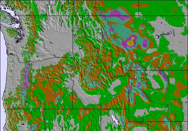
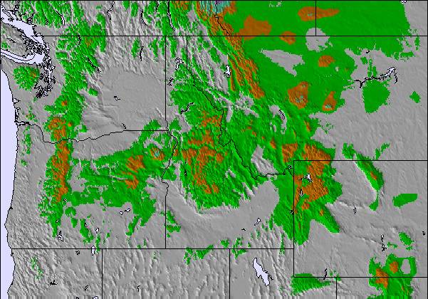
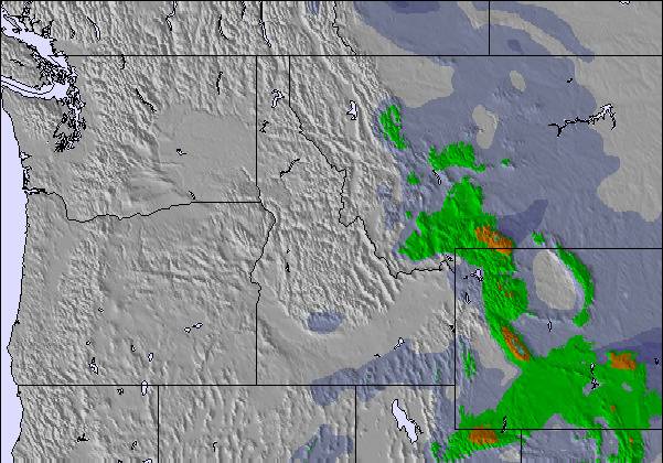
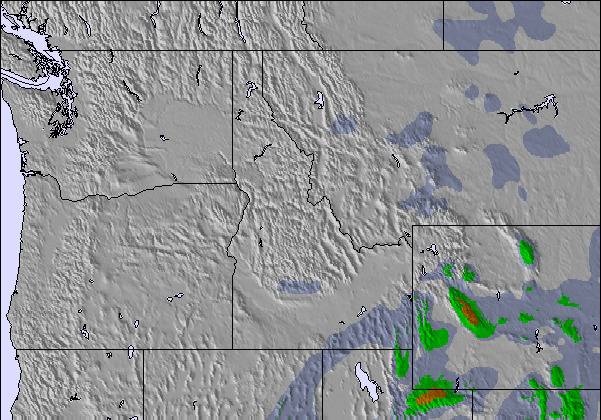
Mappa neve | 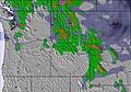 | 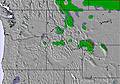 | 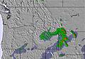 | 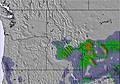 | 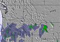 | 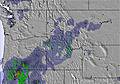 | |||||||||||
— | — | — | — | — | — | — | — | — | — | — | — | — | — | — | — | — | |
mm | 2 | 2 | 2 | 2 | 4 | 2 | — | — | — | 1 | 1 | — | 3 | — | — | — | — |
max °C | 26 | 16 | 22 | 21 | 16 | 19 | 23 | 18 | 26 | 28 | 16 | 25 | 24 | 18 | 24 | 26 | 18 |
min °C | 21 | 14 | 17 | 20 | 12 | 15 | 23 | 17 | 22 | 20 | 15 | 22 | 16 | 16 | 21 | 25 | 15 |
chill °C | 21 | 13 | 17 | 20 | 11 | 15 | 23 | 17 | 22 | 20 | 14 | 22 | 15 | 16 | 21 | 25 | 14 |
Umido. % | 28 | 68 | 69 | 53 | 76 | 78 | 41 | 38 | 35 | 20 | 43 | 40 | 35 | 43 | 22 | 18 | 19 |
Zero termico m | 5700 | 5450 | 5200 | 5500 | 5250 | 4950 | 5400 | 5500 | 5400 | 5600 | 5500 | 5400 | 5550 | 5500 | 5300 | 5400 | 5350 |
— | — | 6:01 | — | — | 6:03 | — | — | 6:03 | — | — | 6:05 | — | — | 6:05 | — | — | |
8:59 | — | — | 8:58 | — | — | 8:57 | — | — | 8:55 | — | — | 8:54 | — | — | 8:53 | — | |
Diventa pro e intaglia:
Informazioni valanghe: National Avalanche Center
Gli ultimi report della neve vicino a Grand Targhee:
| La profondità maggiore della neve é: | 0 cm |
|---|---|
| La profondità minore della neve é: | 0 cm |
| Fresh snowfall depth: | — |
| Quando ha nevicato l'ultima volta? | 29 Jun 2026 |
0.0 | Giorni neve fresca Neve fresca, prevalentemente soleggiato, vento debole. |
|---|---|
0.0 | Giorni neve fresca Fresh snow, limited sun, any wind. |
0.0 | Giorni Bluebird Neve media, prevalentemente soleggiato, vento debole. |
La tabella sopra da le previsioni meteo per Grand Targhee a specifiche altezze 2437 m. I nostri sofisticati modelli meteo ci consentono di fornire previsioni neve per la vetta, l'area intermedia e a valle delle stazioni sciistiche di Grand Targhee. Per accedere alle previsioni meteo ad altre altezze, per spostarti usa tab sopra la tabella. Per una visione meteo piu' ampia , controlla la mappa meteo di United States.
Clicca qui per leggere ulteriori informazioni sullo zero termico e il nostro sistema di prevedere le temperature.
Complessivamente 3.5 Basato su 17 voti e 5 recensioni
The view on a blue bird day is absolutely wonderful. Targhee is the best ski resort ever.
Alexis da United States scrive:
The view on a blue bird day is absolutely wonderful. Targhee is the best ski resort ever.

 Nearest