Previsione meteo per Chestnut Mountain a244m altitudine
Emesso: 6 am 16 Jul 2026 (ora locale)
Previsione neve aggiornata in ora min
View forecast
Chestnut Mountainat 244 m altitudine
Publicato da Snow-Forecast.com a:6 am (ora locale) / 16 Jul 2026
Ultimi 6 giorniScorri a sinistra per gli ultimi 6 giorniOra
Next 3 days weather summary:
Pioggia moderata (totale 11.0mm), più pesante Venerdì mattina. Caldo (max 30°C Giovedì pomeriggio, min 19°C Sabato notte). Vento sarà generalmente leggero.
Giorni 4-6 Chestnut Mountain sommario meteo
Pioggia leggera (totale 6.0mm), per lo più che cade Lunedì notte. Caldo (max 28°C Lunedì pomeriggio, min 14°C Martedì notte). Vento sarà generalmente leggero.
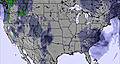
La tabella sopra da le previsioni meteo per Chestnut Mountain a specifiche altezze 244 m. I nostri sofisticati modelli meteo ci consentono di fornire previsioni neve per la vetta, l'area intermedia e a valle delle stazioni sciistiche di Chestnut Mountain. Per accedere alle previsioni meteo ad altre altezze, per spostarti usa tab sopra la tabella. Per una visione meteo piu' ampia , controlla la mappa meteo di United States.
Clicca qui per leggere ulteriori informazioni sullo zero termico e il nostro sistema di prevedere le temperature.
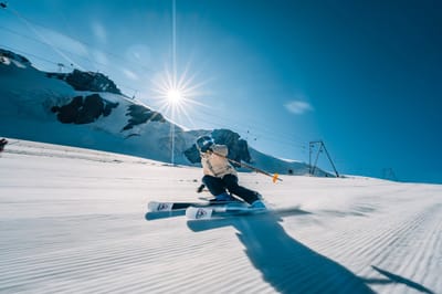
I was at Chestnut Mountain just once. It was the only resort I had close enough from work (Lena, IL). I ski there last Dec. 2nd 2008, and got the early season special "the date is the price" so I ski for $2 (cheapest I ever had).
First thing I can say is that the views of the Mississipi river are just amazing.
With a nice ski rental service and good lifts you can enjoy of the resort with no complain. The runs are short but, in some of the cases, real black ones. So even though it is a little resort, the well prepared runs have 100% snow making and lights. I could say it is a nice place to stop by if you are in the area, you'll get surprised.
Gratis Snow-Forecast.com weather widget per il tho sito
Il Chestnut Mountain widget meteo qui sotto è disponibile per essere incorporato su siti Web esterni a titolo gratuito. Esso fornisce un riepilogo giornaliero delle nostre Chestnut Mountain previsioni meteo neve e dati meteo. Basta andare alla pagina di configurazione e seguire 3 semplici passi per prendere il codice html personalizzato ed incollarlo nel tuo sito. È possibile scegliere l'elevazione di previsione di neve (vetta, metà o piede della montagna) e l'unità metrica/imperiale per le previsioni meteo neve adeguata al proprio sito Web Clicca qui per ottenere il codice


 Nearest