Ultimi 6 giorniScorri a sinistra per gli ultimi 6 giorniOra
Next 4 days weather summary:
Pioggia abbondante (totale 36.0mm), più pesante durante Mercoledì notte. Temperature moderate (max 13°C Mercoledì pomeriggio, min 7°C Mercoledì pomeriggio). Venti decrescenti (forte vento dalla O Mercoledì notte, venti deboli da SSW per Venerdì pomeriggio).
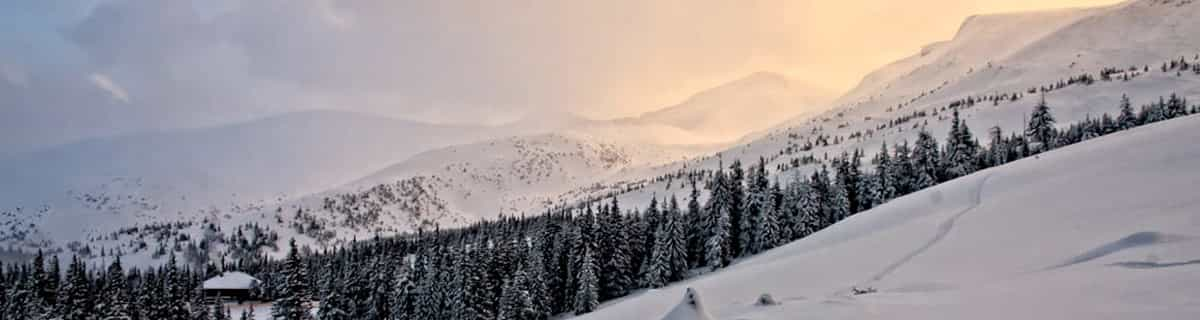
Giorni 5-7 Brides Les Bains sommario meteo
Pioggia moderata (totale 13.0mm), più pesante Domenica notte. Temperature moderate (max 9°C Venerdì notte, min 5°C Lunedì mattina). Vento sarà generalmente leggero.
La tabella sopra da le previsioni meteo per Brides Les Bains a specifiche altezze 2950 m. I nostri sofisticati modelli meteo ci consentono di fornire previsioni neve per la vetta, l'area intermedia e a valle delle stazioni sciistiche di Brides Les Bains. Per accedere alle previsioni meteo ad altre altezze, per spostarti usa tab sopra la tabella. Per una visione meteo piu' ampia , controlla la mappa meteo di France.
Clicca qui per leggere ulteriori informazioni sullo zero termico e il nostro sistema di prevedere le temperature.
Recensioni dei visitatori di Brides Les Bains
Complessivamente 3.9 Basato su 3 voti e 17 recensioni
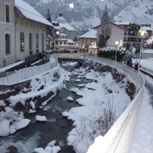
I have just come back from Brides Les Bains with Directski, a very good company which offered a remarkably good deal for a week's skiing. I agree with the reviewers who say it is a cheap way to experience the Three Valleys ski area.
We had a self-catering apartment but ate out a few times in the town. There was not a lot of choice in restaurants but the best for a bit of buzz, friendly staff and half-decent food at a reasonable price is La Petite Auberge.
We were VERY disappointed with our set menu dinner in Les Cerisiers, which you will pass as you walk down to the village from the lift station. The bar next door is comfortable and welcoming and you can sit out on the terrace and have a drink apres-ski but I would warn people about eating in the restaurant. We complained to the manager and although he apologised, the meal was so poor, we deserved a refund.
Complessivamente: 3.9 Basato su 3 voti e 17 recensioni
Snowsure
3.0
Varietà di piste
5.0
Fuoripista
5.0
Paesaggio
3.0
Apres-Ski
3.0
david hickie da Ireland scrive:
I have just come back from Brides Les Bains with Directski, a very good company which offered a remarkably good deal for a week's skiing. I agree with the reviewers who say it is a cheap way to experience the Three Valleys ski area.
We had a self-catering apartment but ate out a few times in the town. There was not a lot of choice in restaurants but the best for a bit of buzz, friendly staff and half-decent food at a reasonable price is La Petite Auberge.
We were VERY disappointed with our set menu dinner in Les Cerisiers, which you will pass as you walk down to the village from the lift station. The bar next door is comfortable and welcoming and you can sit out on the terrace and have a drink apres-ski but I would warn people about eating in the restaurant. We complained to the manager and although he apologised, the meal was so poor, we deserved a refund.
Gratis Snow-Forecast.com weather widget per il tho sito
Il Brides Les Bains widget meteo qui sotto è disponibile per essere incorporato su siti Web esterni a titolo gratuito. Esso fornisce un riepilogo giornaliero delle nostre Brides Les Bains previsioni meteo neve e dati meteo. Basta andare alla pagina di configurazione e seguire 3 semplici passi per prendere il codice html personalizzato ed incollarlo nel tuo sito. È possibile scegliere l'elevazione di previsione di neve (vetta, metà o piede della montagna) e l'unità metrica/imperiale per le previsioni meteo neve adeguata al proprio sito Web Clicca qui per ottenere il codice


 Nearest