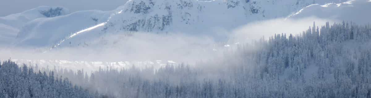
Previsione meteo per Berchtesgaden a1800m altitudine
Emesso: 7 pm 02 Aug 2026 (ora locale)
Previsione neve aggiornata in ora min
View forecast
Berchtesgadenat 1800 m altitudine
Publicato da Snow-Forecast.com a:7 pm (ora locale) / 02 Aug 2026
Ultimi 6 giorniScorri a sinistra per gli ultimi 6 giorniOra
Next 4 days weather summary:
Pioggia moderata (totale 19.0mm), più pesante Lunedì notte. Caldo (max 22°C Lunedì pomeriggio, min 15°C Martedì notte). Vento sarà generalmente leggero.
Giorni 5-7 Berchtesgaden sommario meteo
Pioggia abbondante (totale 49.0mm), più pesante durante Giovedì notte. Temperature moderate (max 19°C Giovedì pomeriggio, min 12°C Giovedì notte). Vento sarà generalmente leggero.
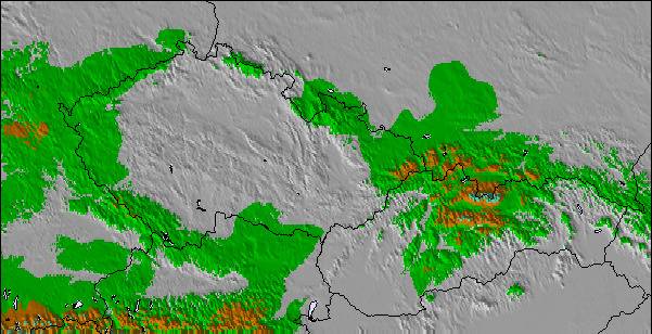
La tabella sopra da le previsioni meteo per Berchtesgaden a specifiche altezze 1800 m. I nostri sofisticati modelli meteo ci consentono di fornire previsioni neve per la vetta, l'area intermedia e a valle delle stazioni sciistiche di Berchtesgaden. Per accedere alle previsioni meteo ad altre altezze, per spostarti usa tab sopra la tabella. Per una visione meteo piu' ampia , controlla la mappa meteo di Germany.
Clicca qui per leggere ulteriori informazioni sullo zero termico e il nostro sistema di prevedere le temperature.
Recensioni dei visitatori di Berchtesgaden
Complessivamente 4.0 Basato su 11 voti e 2 recensioni
One of the best resorts in Germany! (maybe the Alps). When me and my family went to Berchtesgaden in February I was looking forward to the holiday but it surpassed even my expectations! I realised when I got there many people and websites had common misconception about Berchtesgaden, thinking it was mainly a cross-country ski resort. Well, you would be very wrong. I realised that although many websites state that there are only a few lifts, that is only one of the areas in the resort. There are 5 main areas in the resort (Jenner, Rossfeld, Hochschwarzeck, Gotschen (world cup area) and Gutshof/Obersalzburg ) all of these equal a huge ski area which has an incredible 30 lifts! Yes, they may not be linked but still are within 20 mins drive of each other. This means it rivals even Garmisch (24 lifts) in size. Although people may say the skiing is low altitude and therefore bad snow this is simply not true. nearly all the slopes are north facing and when we were there in February there was not a worry of too little snow but too much, having, when we got there, 3 metres of snow on the ground making great powder conditions! This is because Berchtesgaden is more inland than many alpine resorts so does not get as much warm Mediterranean blasts in a bad season. So next time when thinking of a ski resort in the Alps, think Berchtesgaden for a great family holiday for skiers and non-skiers alike for a great time to rival even mighty resorts like Val d'Isere and St Anton!
Complessivamente: 4.0 Basato su 11 voti e 2 recensioni
Snowsure
2.1
Varietà di piste
2.4
Fuoripista
5.0
Paesaggio
5.0
Apres-Ski
2.0
will da United Kingdom scrive:
One of the best resorts in Germany! (maybe the Alps). When me and my family went to Berchtesgaden in February I was looking forward to the holiday but it surpassed even my expectations! I realised when I got there many people and websites had common misconception about Berchtesgaden, thinking it was mainly a cross-country ski resort. Well, you would be very wrong. I realised that although many websites state that there are only a few lifts, that is only one of the areas in the resort. There are 5 main areas in the resort (Jenner, Rossfeld, Hochschwarzeck, Gotschen (world cup area) and Gutshof/Obersalzburg ) all of these equal a huge ski area which has an incredible 30 lifts! Yes, they may not be linked but still are within 20 mins drive of each other. This means it rivals even Garmisch (24 lifts) in size. Although people may say the skiing is low altitude and therefore bad snow this is simply not true. nearly all the slopes are north facing and when we were there in February there was not a worry of too little snow but too much, having, when we got there, 3 metres of snow on the ground making great powder conditions! This is because Berchtesgaden is more inland than many alpine resorts so does not get as much warm Mediterranean blasts in a bad season. So next time when thinking of a ski resort in the Alps, think Berchtesgaden for a great family holiday for skiers and non-skiers alike for a great time to rival even mighty resorts like Val d'Isere and St Anton!
Gratis Snow-Forecast.com weather widget per il tho sito
Il Berchtesgaden widget meteo qui sotto è disponibile per essere incorporato su siti Web esterni a titolo gratuito. Esso fornisce un riepilogo giornaliero delle nostre Berchtesgaden previsioni meteo neve e dati meteo. Basta andare alla pagina di configurazione e seguire 3 semplici passi per prendere il codice html personalizzato ed incollarlo nel tuo sito. È possibile scegliere l'elevazione di previsione di neve (vetta, metà o piede della montagna) e l'unità metrica/imperiale per le previsioni meteo neve adeguata al proprio sito Web Clicca qui per ottenere il codice


 Nearest