Le previsioni neve per Torgon-Les Portes du Soleil sono Per lo più asciutto. Condizioni di gelo e disgelo (max 3°C Lunedì mattina, min 0°C Lunedì notte). Vento sarà generalmente leggero.
Torgon-Les Portes du Soleil Weather (Next 3 days): The snow forecast for Torgon-Les Portes du Soleil is: Per lo più asciutto. Condizioni di gelo e disgelo (max 3°C Lunedì mattina, min 0°C Lunedì notte). Vento sarà generalmente leggero.
Torgon-Les Portes du Soleil Weather (Days 4-6): Pioviggina all'inizio, per poi diventare più freddo con spolverate di neve Venerdì notte. Condizioni di gelo e disgelo (max 3°C Giovedì mattina, min 0°C Venerdì notte). Vento sarà generalmente leggero.
Torgon-Les Portes du Soleil Live neve
Altezza
Spessore della neve
Temp. (°C)
Vento (km/h)
Meteo
Cima:
0
Media:
3
Fondo:
6
Torgon-Les Portes du Soleil Tempo
(Prossimi 3 giorni):
Le previsioni neve per Torgon-Les Portes du Soleil sono Per lo più asciutto. Condizioni di gelo e disgelo (max 3°C Lunedì mattina, min 0°C Lunedì notte). Vento sarà generalmente leggero.
Torgon-Les Portes du Soleil meteo (giorni 4-6):
Pioviggina all'inizio, per poi diventare più freddo con spolverate di neve Venerdì notte. Condizioni di gelo e disgelo (max 3°C Giovedì mattina, min 0°C Venerdì notte). Vento sarà generalmente leggero.
Per lo più asciutto. Condizioni di gelo e disgelo (max 3°C Lunedì mattina, min 0°C Lunedì notte). Vento sarà generalmente leggero.
Prossimi 4-6 giorni riassunto meteo
Pioviggina all'inizio, per poi diventare più freddo con spolverate di neve Venerdì notte. Condizioni di gelo e disgelo (max 3°C Giovedì mattina, min 0°C Venerdì notte). Vento sarà generalmente leggero.
La tabella sopra da le previsioni meteo per Torgon-Les Portes du Soleil a specifiche altezze 1945 m. I nostri sofisticati modelli meteo ci consentono di fornire previsioni neve per la vetta, l'area intermedia e a valle delle stazioni sciistiche di Torgon-Les Portes du Soleil. Per accedere alle previsioni meteo ad altre altezze, per spostarti usa tab sopra la tabella. Per una visione meteo piu' ampia , controlla la mappa meteo di Switzerland.
Clicca qui per leggere ulteriori informazioni sullo zero termico e il nostro sistema di prevedere le temperature.
Recensioni dei visitatori di Torgon-Les Portes du Soleil
Complessivamente 3.9 Basato su 11 voti e 9 recensioni
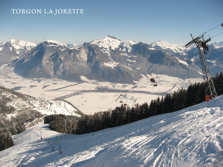
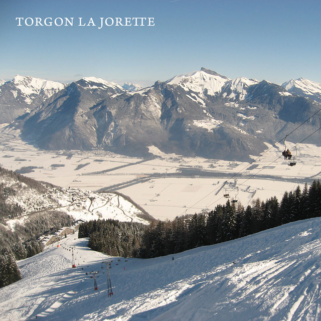
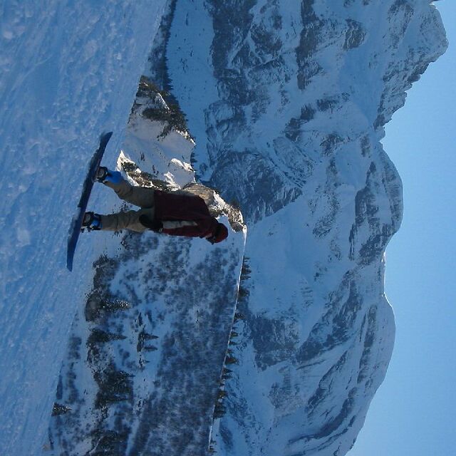
Torgon has really got it's act together and is now a smashing little starting off point for the whole Portes du Soleil.
There is now a very regular navette to the main plain du croix ski area from the La Jorette village; something that was lacking in previous years.
When the snow comes, it has to be one of the best places in the whole domain. Lots of relatively untouched powdery runs await. While Chatel, Avoriaz and Les Gets are easily accessible and not to be missed, some of the nicest runs are towards La Chapelle.
When snow cover is poor, take the main Trenchey lift and head towards Chatel and beyond.
There is a new restaurant that seems to be an upmarket steak house and in the old village, the hotel de Torgon serves nice Belgian beer.
Beware that Torgon is very small and if it is closed for lack of snow early or late in the season there is not a lot to do! But if you have a car, you can still wind your way round the mountain to higher-up Champery and its cable car, so you will get some skiing. Torgon's relatively low altitude means this drive only takes about 45-50 mins.
Recensioni dei visitatori di Torgon-Les Portes du Soleil
Complessivamente: 3.9 Basato su 11 voti e 9 recensioni
Snowsure
3.6
Varietà di piste
4.5
Fuoripista
4.1
Paesaggio
4.4
Apres-Ski
3.2
peter da Belgium scrive:
Torgon has really got it's act together and is now a smashing little starting off point for the whole Portes du Soleil.
There is now a very regular navette to the main plain du croix ski area from the La Jorette village; something that was lacking in previous years.
When the snow comes, it has to be one of the best places in the whole domain. Lots of relatively untouched powdery runs await. While Chatel, Avoriaz and Les Gets are easily accessible and not to be missed, some of the nicest runs are towards La Chapelle.
When snow cover is poor, take the main Trenchey lift and head towards Chatel and beyond.
There is a new restaurant that seems to be an upmarket steak house and in the old village, the hotel de Torgon serves nice Belgian beer.
Beware that Torgon is very small and if it is closed for lack of snow early or late in the season there is not a lot to do! But if you have a car, you can still wind your way round the mountain to higher-up Champery and its cable car, so you will get some skiing. Torgon's relatively low altitude means this drive only takes about 45-50 mins.
Gratis Snow-Forecast.com weather widget per il tho sito
Il Torgon-Les Portes du Soleil widget meteo qui sotto è disponibile per essere incorporato su siti Web esterni a titolo gratuito. Esso fornisce un riepilogo giornaliero delle nostre Torgon-Les Portes du Soleil previsioni meteo neve e dati meteo. Basta andare alla pagina di configurazione e seguire 3 semplici passi per prendere il codice html personalizzato ed incollarlo nel tuo sito. È possibile scegliere l'elevazione di previsione di neve (vetta, metà o piede della montagna) e l'unità metrica/imperiale per le previsioni meteo neve adeguata al proprio sito Web Clicca qui per ottenere il codice


 Nearest