


View forecast
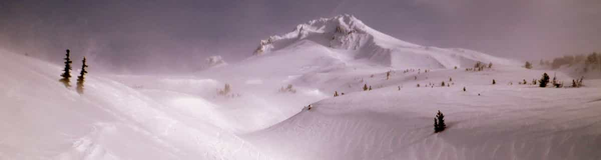
Steinberg am Rofan at 1250 m altitudine
Publicato da Snow-Forecast.com a: 1 pm (ora locale) / 19 Apr 2024
Now
Fri 19 | Saturday 20 | Sunday 21 | Monday 22 | Tuesday 23 | Wednesday 24 | Thursday 25 | ||||||||||||||
PM | notte | AM | PM | notte | AM | PM | notte | AM | PM | notte | AM | PM | notte | AM | PM | notte | AM | PM | notte | |
nevi cata leggera | nevi cata mod. | nevi cata leggera | nevi cata leggera | nevi cata leggera | nevi cata leggera | nevi cata leggera | nevi cata leggera | nevi cata leggera | nevi cata leggera | nevi cata leggera | nevi cata leggera | nevi cata leggera | nevi cata leggera | nevi cata leggera | nevi cata leggera | nevi cata leggera | nevi cata mod. | nevi cata leggera | nevi cata leggera | |
km/h | ||||||||||||||||||||
Snow map |  |  |  |  |  |  |  | |||||||||||||
cm | — | 10 | 2.0 | 4 | 4 | 1.0 | 1.0 | 1.0 | — | — | — | — | 1.0 | 3 | — | 2.0 | 3 | 5 | 2.0 | 1.0 |
mm | — | — | — | — | — | — | — | — | — | — | — | — | — | — | — | — | — | — | — | — |
max°C | 2 | 0 | -2 | -1 | -2 | -2 | -1 | -3 | -3 | 0 | -1 | -1 | 1 | -1 | 0 | -1 | -2 | -2 | 0 | -1 |
min°C | 0 | -2 | -3 | -1 | -4 | -4 | -2 | -5 | -5 | -1 | -3 | -3 | 0 | -3 | -3 | -1 | -3 | -3 | 0 | -2 |
chill°C | -3 | -7 | -7 | -5 | -4 | -4 | -6 | -5 | -5 | -3 | -3 | -3 | -2 | -7 | -7 | -6 | -7 | -7 | -2 | -4 |
Umido.% | 91 | 97 | 91 | 92 | 91 | 84 | 83 | 92 | 81 | 78 | 81 | 73 | 72 | 97 | 84 | 87 | 94 | 92 | 89 | 98 |
Zero termico (m) | 1300 | 1200 | 1000 | 1050 | 550 | 900 | 1050 | 0 | 850 | 1200 | 650 | 1100 | 1350 | 900 | 1250 | 1150 | 700 | 1000 | 1250 | 950 |
— | — | 6:13 | — | — | 6:11 | — | — | 6:09 | — | — | 6:07 | — | — | 6:07 | — | — | 6:05 | — | — | |
— | 8:07 | — | — | 8:08 | — | — | 8:10 | — | — | 8:12 | — | — | 8:14 | — | — | 8:15 | — | — | 8:15 | |
Prossimi 0-3 giorni riassunto meteo
Una pesante caduta di neve, più pesante durante Venerdì notte. Condizioni di gelo e disgelo (max 2°C Venerdì pomeriggio, min -5°C Domenica notte). Vento sarà generalmente leggero.
Prossimi 4-6 giorni riassunto meteo
Una moderata caduta di neve, concentrandosi maggiormente Giovedì mattina. Condizioni di gelo e disgelo (max 1°C Martedì pomeriggio, min -3°C Lunedì notte). Vento sarà generalmente leggero.
Popular Steinberg am Rofan Pages
Radar Neve
Invia un reportGli ultimi report della neve vicino a Steinberg am Rofan:
17 km Assente da Steinberg am Rofan
13 hour fa
Rain reported from Jenbach at 531 metres elevation only 4 kms NE of Burglift – Stans but it is forecast cold enough for snow at higher elevations in the ski area da Burglift – Stans
40 km Assente da Steinberg am Rofan
14 hour faRain reported from Mayrhofen at 639 metres elevation only 3 kms ENE of Finkenberg but it is forecast cold enough for snow at the ski area da Finkenberg
10 km Assente da Steinberg am Rofan
16 hour faRain reported from Jenbach at 531 metres elevation only 4 kms S of Maurach am Achensee but it is forecast cold enough for snow at the ski area da Maurach am Achensee
Steinberg am Rofan Condizioni della neve
| La profondità maggiore della neve é: | 0 cm |
|---|---|
| La profondità minore della neve é: | 0 cm |
| Fresh snowfall depth: | 9 cm |
| Quando ha nevicato l'ultima volta? | 18 Apr 2024 |
Altre località in Austria stanno segnalando: neve fresca (4) / buona pista (4)
Snow-Forecast Partner Offers
Show your business here
Storia della neve
Settimana 3 di April ha in media:
0.0 | Giorni neve fresca Neve fresca, prevalentemente soleggiato, vento debole. |
|---|---|
0.3 | Giorni neve fresca Fresh snow, limited sun, any wind. |
0.0 | Giorni Bluebird Neve media, prevalentemente soleggiato, vento debole. |


Altre località in Austria stanno segnalando: neve fresca (4) / buona pista (4)
La tabella sopra da le previsioni meteo per Steinberg am Rofan a specifiche altezze 1250 m. I nostri sofisticati modelli meteo ci consentono di fornire previsioni neve per la vetta, l'area intermedia e a valle delle stazioni sciistiche di Steinberg am Rofan. Per accedere alle previsioni meteo ad altre altezze, per spostarti usa tab sopra la tabella. Per una visione meteo piu' ampia , controlla la mappa meteo di Austria.
Clicca qui per leggere ulteriori informazioni sullo zero termico e il nostro sistema di prevedere le temperature.
Recensioni dei visitatori di Steinberg am Rofan
Complessivamente 3.8 Basato su 1 vote.
- Snowsure
- Varietà di piste
- Vota
Gratis Snow-Forecast.com weather widget per il tho sito
Il Steinberg am Rofan widget meteo qui sotto è disponibile per essere incorporato su siti Web esterni a titolo gratuito. Esso fornisce un riepilogo giornaliero delle nostre Steinberg am Rofan previsioni meteo neve e dati meteo. Basta andare alla pagina di configurazione e seguire 3 semplici passi per prendere il codice html personalizzato ed incollarlo nel tuo sito. È possibile scegliere l'elevazione di previsione di neve (vetta, metà o piede della montagna) e l'unità metrica/imperiale per le previsioni meteo neve adeguata al proprio sito Web Clicca qui per ottenere il codice
Guarda previsioni meteo neve dettagliate per Steinberg am Rofan a:
snow-forecast.com

 Nearest