


Global Weekly Snow Roundup #314
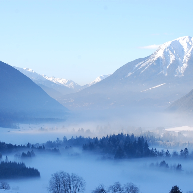
Weekly Global Snow News, updated 14 May 2026: Fresh snowfall in Argentina, Australia and Lesotho signals winter’s approach, while Japan maintains the world’s deepest snowpack.

Next 4 days weather summary:Una leggera copertura di neve nuova, che ancora cade Venerdì notte. Diventa più temperato con pioggia leggera (totale 9.0mm) Lunedì pomeriggio. Condizioni di gelo e disgelo (max 8°C Lunedì pomeriggio, min -2°C Venerdì notte). Vento sarà generalmente leggero. | Days 5-7 weather summary:Pioggia abbondante (totale 31.0mm), più pesante durante Lunedì notte. Temperature moderate (max 10°C Giovedì pomeriggio, min 2°C Lunedì notte). Vento sarà generalmente leggero. | |||||||||||||||
Saturday 16 | Sunday 17 | Monday 18 | Tuesday 19 | Wednesday 20 | ||||||||||||
notte | AM | PM | notte | AM | PM | notte | AM | PM | notte | AM | PM | notte | AM | PM | notte | |
nevi cata mod. | nevi cata leggera | nevi cata leggera | rovescio di neve | limpido | pioggia leggera | rovescio di pioggia | rovescio di pioggia | pioggia moderata | pioggia moderata | nuvol- oso | pioggia leggera | pioggia leggera | pioggia leggera | pioggia leggera | pioggia moderata | |
km/h | ||||||||||||||||
Snow map |  |  |  |  |  |  | ||||||||||
7 | 1 | 1 | — | — | — | — | — | — | — | — | — | — | — | — | — | |
— | — | — | — | — | 1 | 1 | 1 | 6 | 10 | — | 2 | 4 | 2 | 3 | 7 | |
max °C | 0 | -1 | 2 | 1 | 3 | 7 | 5 | 7 | 8 | 3 | 4 | 7 | 7 | 5 | 8 | 7 |
min °C | -2 | -2 | 1 | -2 | 0 | 6 | 2 | 4 | 6 | 2 | 3 | 7 | 5 | 5 | 6 | 6 |
-4 | -4 | -1 | -2 | 0 | 6 | 0 | 4 | 5 | 2 | 3 | 7 | 5 | 3 | 5 | 5 | |
99 | 88 | 80 | 86 | 64 | 59 | 78 | 62 | 86 | 95 | 80 | 75 | 96 | 89 | 76 | 88 | |
1450 | 1550 | 1850 | 1450 | 2100 | 2400 | 2100 | 2450 | 2500 | 2050 | 2350 | 2600 | 2500 | 2500 | 2700 | 2550 | |
— | 5:37 | — | — | 5:37 | — | — | 5:35 | — | — | 5:33 | — | — | 5:33 | — | — | |
— | — | — | 8:45 | — | — | 8:45 | — | — | 8:46 | — | — | 8:49 | — | — | 8:50 | |
Gli ultimi report della neve vicino a Seefeld:
| La profondità maggiore della neve é: | — |
|---|---|
| La profondità minore della neve é: | — |
| Fresh snowfall depth: | 15 cm |
| Quando ha nevicato l'ultima volta? | 14 May 2026 |
0.0 | Giorni neve fresca Neve fresca, prevalentemente soleggiato, vento debole. |
|---|---|
0.2 | Giorni neve fresca Fresh snow, limited sun, any wind. |
0.0 | Giorni Bluebird Neve media, prevalentemente soleggiato, vento debole. |
La tabella sopra da le previsioni meteo per Seefeld a specifiche altezze 1650 m. I nostri sofisticati modelli meteo ci consentono di fornire previsioni neve per la vetta, l'area intermedia e a valle delle stazioni sciistiche di Seefeld. Per accedere alle previsioni meteo ad altre altezze, per spostarti usa tab sopra la tabella. Per una visione meteo piu' ampia , controlla la mappa meteo di Austria.
Clicca qui per leggere ulteriori informazioni sullo zero termico e il nostro sistema di prevedere le temperature.
Complessivamente 4.1 Basato su 27 voti e 25 recensioni
I’ve been visiting Seefeld yearly for almost 20 years since learning to ski here as a 30 year old. It’s a fabulous resort for beginners with a dedicated slope (Birkenlift & Geigenbühel t-bar drag lifts) that is a lovely area to master those snow plough turns. As it’s purely a beginners area there are no fast skiers flying past you, it feels very safe. It’s in town so you can walk to it and there are loads of ski rental shops a minute away. You can buy lift passes at the drag lift here. After that you move up to the 2 other main areas. Gschwandtkopf slope is a 15 min walk or 5 mins on the free bus, there’s also a free car park if you have a car. It’s a fantastic slope, a chair lift up the front and this slope has numerous ways to come down, you can make this slope as easy or hard as you wish. Straight down the right hand side is pretty much a red run but amble down the left side and it’s a lovely undulating easy blue. A great slope to build your confidence. There are also a couple of blue runs down the back, a bit narrower and great fun but only accessible on a T bar drag lift. Fab lunch stops at the top and bottom of the chair lift. You get the morning sun here but it’s colder and shady from mid afternoon. Next you take on the Rosshütte area. A 10 min free bus ride from town or also has a free car park. This is the largest of the areas in Seefeld. To the right you have a heated chairlift that takes you to a perfect blue run. A little narrow at first then a huge wide blue slope. There is also a great red off this chair. A train takes you to the top or a couple of chair lifts. The reds on this slope are decent easier reds. The blues are all excellent blues, nothing scary and never too busy. There are only 2 black runs. The black at the very top above the train is short and an easy black if it’s not windy. The short black in the trees is nearly always sheet ice and steep, a proper black run! If you’re looking for extensive terrain and tough skiing then there are better resorts. For leisurely fun confidence building this is the perfect resort. We come here every year for a week and then do a week in the 3 valleys for more extensive terrain. It’s also a beautiful town, no real apres ski but a nice place to potter and shop and drink hot chocolate.
Caroline Holder da United Kingdom scrive:
I’ve been visiting Seefeld yearly for almost 20 years since learning to ski here as a 30 year old. It’s a fabulous resort for beginners with a dedicated slope (Birkenlift & Geigenbühel t-bar drag lifts) that is a lovely area to master those snow plough turns. As it’s purely a beginners area there are no fast skiers flying past you, it feels very safe. It’s in town so you can walk to it and there are loads of ski rental shops a minute away. You can buy lift passes at the drag lift here. After that you move up to the 2 other main areas. Gschwandtkopf slope is a 15 min walk or 5 mins on the free bus, there’s also a free car park if you have a car. It’s a fantastic slope, a chair lift up the front and this slope has numerous ways to come down, you can make this slope as easy or hard as you wish. Straight down the right hand side is pretty much a red run but amble down the left side and it’s a lovely undulating easy blue. A great slope to build your confidence. There are also a couple of blue runs down the back, a bit narrower and great fun but only accessible on a T bar drag lift. Fab lunch stops at the top and bottom of the chair lift. You get the morning sun here but it’s colder and shady from mid afternoon. Next you take on the Rosshütte area. A 10 min free bus ride from town or also has a free car park. This is the largest of the areas in Seefeld. To the right you have a heated chairlift that takes you to a perfect blue run. A little narrow at first then a huge wide blue slope. There is also a great red off this chair. A train takes you to the top or a couple of chair lifts. The reds on this slope are decent easier reds. The blues are all excellent blues, nothing scary and never too busy. There are only 2 black runs. The black at the very top above the train is short and an easy black if it’s not windy. The short black in the trees is nearly always sheet ice and steep, a proper black run! If you’re looking for extensive terrain and tough skiing then there are better resorts. For leisurely fun confidence building this is the perfect resort. We come here every year for a week and then do a week in the 3 valleys for more extensive terrain. It’s also a beautiful town, no real apres ski but a nice place to potter and shop and drink hot chocolate.


 Nearest