


View forecast
Mittenwald/Dammkar at 2244 m altitudine
Publicato da Snow-Forecast.com a: 7 pm (ora locale) / 08 May 2024
Now
Thursday 9 | Friday 10 | Saturday 11 | Sunday 12 | Monday 13 | Tuesday 14 | ||||||||||||||
notte | AM | PM | notte | AM | PM | notte | AM | PM | notte | AM | PM | notte | AM | PM | notte | AM | PM | notte | |
nevi cata leggera | nuvol- oso | pioggia leggera | rovescio di pioggia | poche nuvole | poche nuvole | limpido | poche nuvole | poche nuvole | poche nuvole | limpido | nuvol- oso | rovescio di pioggia | pioggia leggera | rischio temporale | pioggia moderata | rovescio di pioggia | nevi cata leggera | nevi cata leggera | |
km/h | |||||||||||||||||||
Snow map |  |  |  |  |  |  |  | ||||||||||||
cm | 1.0 | — | — | — | — | — | — | — | — | — | — | — | — | — | — | — | — | 1.0 | 1.0 |
mm | — | — | 2.0 | 1.0 | — | — | — | — | — | — | — | — | 4 | 3 | 5 | 9 | 1.0 | 1.0 | — |
max°C | 0 | 1 | 3 | 3 | 4 | 6 | 4 | 6 | 8 | 6 | 7 | 9 | 7 | 6 | 6 | 5 | 5 | 3 | 2 |
min°C | 0 | 0 | 3 | 3 | 3 | 5 | 3 | 4 | 7 | 5 | 5 | 8 | 5 | 5 | 6 | 4 | 5 | 2 | 1 |
chill°C | -2 | -3 | 1 | 2 | 3 | 4 | 2 | 4 | 7 | 3 | 3 | 8 | 3 | 3 | 6 | 4 | 3 | 2 | 1 |
Umido.% | 98 | 90 | 84 | 61 | 45 | 67 | 62 | 49 | 68 | 60 | 53 | 71 | 82 | 77 | 94 | 88 | 88 | 99 | 95 |
Zero termico (m) | 2200 | 2400 | 2650 | 2900 | 2900 | 2850 | 2900 | 3100 | 3150 | 3200 | 3050 | 3200 | 3100 | 3000 | 3100 | 2950 | 2950 | 2700 | 2550 |
— | 5:45 | — | — | 5:43 | — | — | 5:41 | — | — | 5:41 | — | — | 5:39 | — | — | 5:37 | — | — | |
— | — | — | 8:37 | — | — | 8:38 | — | — | 8:39 | — | — | 8:40 | — | — | 8:42 | — | — | 8:44 | |
Prossimi 0-3 giorni riassunto meteo
Pioggia leggera (totale 3.0mm), per lo più che cade Giovedì pomeriggio. Condizioni di gelo e disgelo (max 8°C Sabato pomeriggio, min 0°C Mercoledì notte). Vento sarà generalmente leggero.
Prossimi 4-6 giorni riassunto meteo
Pioggia abbondante (totale 23.0mm), più pesante durante Lunedì notte. Temperature moderate (max 9°C Domenica pomeriggio, min 2°C Martedì pomeriggio). Vento sarà generalmente leggero.
Popular Mittenwald/Dammkar Pages
Radar Neve
Invia un reportGli ultimi report della neve vicino a Mittenwald/Dammkar:
26 km Assente da Mittenwald/Dammkar
3 hour fa
Drizzle reported from Flughafen Innsbruck Automatic Weather Station at 721 metres elevation 8 kms NNE of Axamer Lizum but it is forecast cold enough for snow at higher elevations in the ski area da Axamer Lizum
25 km Assente da Mittenwald/Dammkar
3 hour faContinuous light snow reported from Zugspitze at 2960 metres elevation one km S of Garmisch-Partenkirchen-Zugspitze but it is probably falling as rain at the bottom of the ski area da Garmisch-Partenkirchen-Zugspitze
23 km Assente da Mittenwald/Dammkar
10 hour faLight rain reported from Flughafen Innsbruck Automatic Weather Station at 721 metres elevation 5 kms WNW of Muttereralm but it is forecast cold enough for snow at higher elevations in the ski area da Muttereralm
49 km Assente da Mittenwald/Dammkar
10 hour faRain reported from Mayrhofen at 639 metres elevation 9 kms S of Zell am Ziller but it is forecast cold enough for snow at higher elevations in the ski area da Zell am Ziller
Mittenwald/Dammkar Condizioni della neve
| La profondità maggiore della neve é: | — |
|---|---|
| La profondità minore della neve é: | — |
| Fresh snowfall depth: | — |
| Quando ha nevicato l'ultima volta? | 3 May 2024 |
Altre località in Germany stanno segnalando: neve fresca (0) / buona pista (0)
Snow-Forecast Partner Offers
Show your business here
Storia della neve
Settimana 2 di May ha in media:
0.1 | Giorni neve fresca Neve fresca, prevalentemente soleggiato, vento debole. |
|---|---|
0.6 | Giorni neve fresca Fresh snow, limited sun, any wind. |
0.1 | Giorni Bluebird Neve media, prevalentemente soleggiato, vento debole. |
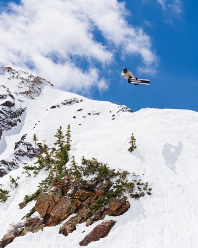


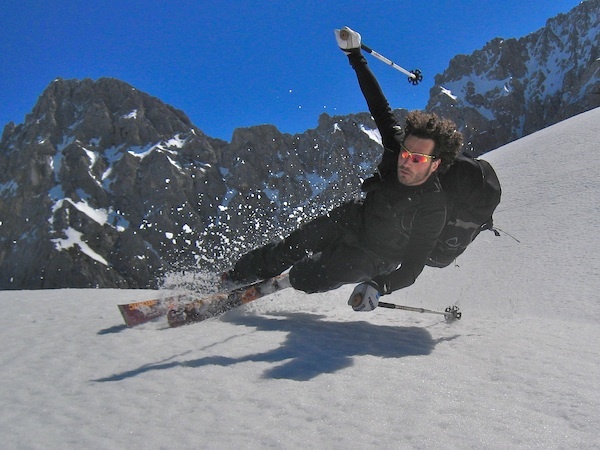
Fotografie di Mittenwald/Dammkar
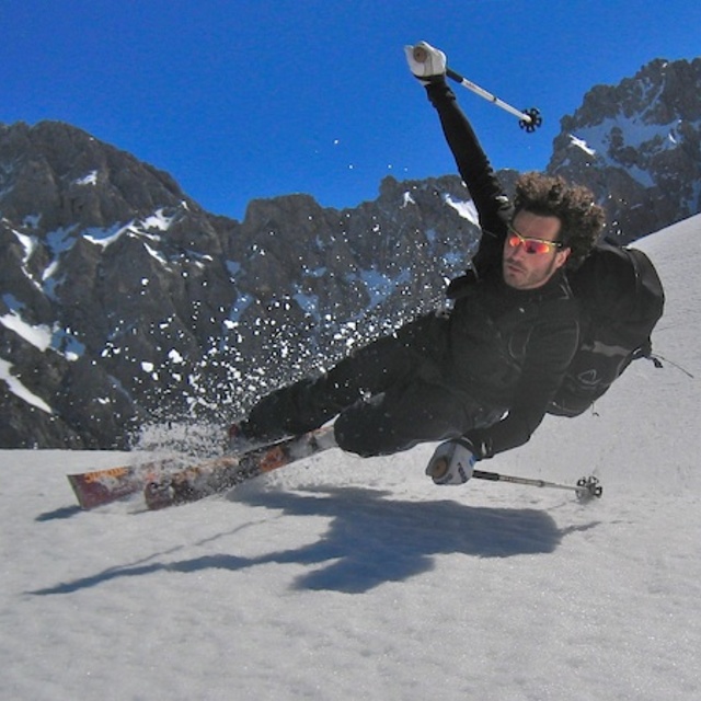
free-heel skiing by daThom
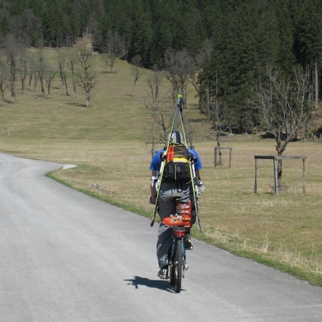
back from spring skiing by daThom
Altre località in Germany stanno segnalando: neve fresca (0) / buona pista (0)
La tabella sopra da le previsioni meteo per Mittenwald/Dammkar a specifiche altezze 2244 m. I nostri sofisticati modelli meteo ci consentono di fornire previsioni neve per la vetta, l'area intermedia e a valle delle stazioni sciistiche di Mittenwald/Dammkar. Per accedere alle previsioni meteo ad altre altezze, per spostarti usa tab sopra la tabella. Per una visione meteo piu' ampia , controlla la mappa meteo di Germany.
Clicca qui per leggere ulteriori informazioni sullo zero termico e il nostro sistema di prevedere le temperature.
Recensioni dei visitatori di Mittenwald/Dammkar
Complessivamente 3.8 Basato su 1 vote e 2 recensioni
- Snowsure
- Varietà di piste
- Vota
- I Fisher da United Kingdom scrive:
Picturesque resort with modest sized family skiing area, and a good off-piste area off the Karwendel(1300m vertical drop). Usually fairly empty during weekdays meaning smooth well groomed pistes. Popular also with walkers, X country etc.
Recensioni dei visitatori di Mittenwald/Dammkar
I Fisher da United Kingdom scrive:
Picturesque resort with modest sized family skiing area, and a good off-piste area off the Karwendel(1300m vertical drop). Usually fairly empty during weekdays meaning smooth well groomed pistes. Popular also with walkers, X country etc.
Gratis Snow-Forecast.com weather widget per il tho sito
Il Mittenwald/Dammkar widget meteo qui sotto è disponibile per essere incorporato su siti Web esterni a titolo gratuito. Esso fornisce un riepilogo giornaliero delle nostre Mittenwald/Dammkar previsioni meteo neve e dati meteo. Basta andare alla pagina di configurazione e seguire 3 semplici passi per prendere il codice html personalizzato ed incollarlo nel tuo sito. È possibile scegliere l'elevazione di previsione di neve (vetta, metà o piede della montagna) e l'unità metrica/imperiale per le previsioni meteo neve adeguata al proprio sito Web Clicca qui per ottenere il codice
Guarda previsioni meteo neve dettagliate per Mittenwald/Dammkar a:
snow-forecast.com

 Nearest