Publicato da Snow-Forecast.com a:1 am (ora locale) / 16 May 2026
Last 6 daysScroll left for last 6 daysNow
Next 3 days weather summary:
Una leggera copertura di neve nuova, che ancora cade Lunedì notte. Le temperature saranno sotto lo zero (max -8°C Lunedì notte, min -17°C Sabato mattina). Vento sarà generalmente leggero.
Days 4-6 weather summary:
Una spolverata di neve nuova. Condizioni di gelo e disgelo (max 1°C Giovedì notte, min -8°C Martedì mattina). Vento sarà generalmente leggero.
La tabella sopra da le previsioni meteo per Chamonix a specifiche altezze 3842 m. I nostri sofisticati modelli meteo ci consentono di fornire previsioni neve per la vetta, l'area intermedia e a valle delle stazioni sciistiche di Chamonix. Per accedere alle previsioni meteo ad altre altezze, per spostarti usa tab sopra la tabella. Per una visione meteo piu' ampia , controlla la mappa meteo di France.
Clicca qui per leggere ulteriori informazioni sullo zero termico e il nostro sistema di prevedere le temperature.
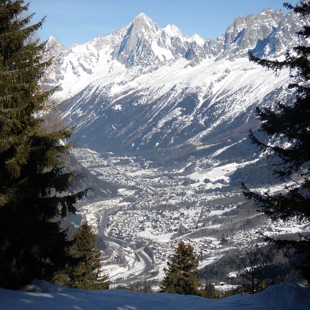
Recensioni dei visitatori di Chamonix
Complessivamente 4.1 Basato su 56 voti e 92 recensioni
I have been going to Chamonix for several years now, both winter and summer, and it just gets better and better. The thing about Chamonix is not only does it have world class skiing, but it is a bustling beautiful town that has a huge array of bars and restaurants, fantastic varied accommodation and fabulous shops. I like to experience different resorts across Europe but whilst skiing may be great, the off-piste can be limiting and you will only go once. With Chamonix (and a few other bigger resorts) you get an ever changing resort, suitable to budgets of all sizes and plenty to do for non-skiers too. The summer there is also just as good as the winter! If you want a purpose built ski-in / ski-out ski resort, then Chamonix is not for you. If you want the original and authentic ski town, then I can't recommend enough..
Complessivamente: 4.1 Basato su 56 voti e 92 recensioni
Snowsure
4.1
Varietà di piste
4.4
Fuoripista
4.9
Paesaggio
4.7
Apres-Ski
4.5
Spencer da United Kingdom scrive:
I have been going to Chamonix for several years now, both winter and summer, and it just gets better and better. The thing about Chamonix is not only does it have world class skiing, but it is a bustling beautiful town that has a huge array of bars and restaurants, fantastic varied accommodation and fabulous shops. I like to experience different resorts across Europe but whilst skiing may be great, the off-piste can be limiting and you will only go once. With Chamonix (and a few other bigger resorts) you get an ever changing resort, suitable to budgets of all sizes and plenty to do for non-skiers too. The summer there is also just as good as the winter! If you want a purpose built ski-in / ski-out ski resort, then Chamonix is not for you. If you want the original and authentic ski town, then I can't recommend enough..
Gratis Snow-Forecast.com weather widget per il tho sito
Il Chamonix widget meteo qui sotto è disponibile per essere incorporato su siti Web esterni a titolo gratuito. Esso fornisce un riepilogo giornaliero delle nostre Chamonix previsioni meteo neve e dati meteo. Basta andare alla pagina di configurazione e seguire 3 semplici passi per prendere il codice html personalizzato ed incollarlo nel tuo sito. È possibile scegliere l'elevazione di previsione di neve (vetta, metà o piede della montagna) e l'unità metrica/imperiale per le previsioni meteo neve adeguata al proprio sito Web Clicca qui per ottenere il codice


 Nearest