
Ski Hire by Skiset
extra 5% off

Berwang-Bichlbach-Rinnen Weather (Next 3 days): The snow forecast for Berwang-Bichlbach-Rinnen is: Pioggia abbondante (totale 26.0mm), più pesante durante Domenica pomeriggio. Temperature moderate (max 19°C Lunedì pomeriggio, min 7°C Sabato notte). Vento sarà generalmente leggero.
Berwang-Bichlbach-Rinnen Weather (Days 4-6): Pioggia abbondante (totale 39.0mm), più pesante durante Giovedì pomeriggio. Temperature moderate (max 15°C Giovedì mattina, min 6°C Mercoledì notte). Vento sarà generalmente leggero.
| Altezza | Spessore della neve | Temp. (°C) | Vento (km/h) | Meteo | ||
|---|---|---|---|---|---|---|
| Cima: | 0.0 m | 9 | ||||
| Media: | 12 | |||||
| Fondo: | 0.0 m | 14 |
Gli ultimi report della neve vicino a Berwang-Bichlbach-Rinnen:
Rain and snow or hail reported from Oberstdorf at 723 metres elevation 6 kms SW of Oberstdorf-Nebelhorn but it is probably falling as rain apart from near the top of the ski area da Oberstdorf-Nebelhorn
Rain reported from Pitztaler Gletscher at 2848 metres elevation only 4 kms SSE of Pitztal Glacier but it is forecast cold enough for snow at higher elevations in the ski area da Pitztal Glacier

Sat 18 | Sunday 19 | Monday 20 | Tuesday 21 | Wednesday 22 | Thursday 23 | Friday 24 | ||||||||||||||
PM | notte | AM | PM | notte | AM | PM | notte | AM | PM | notte | AM | PM | notte | AM | PM | notte | AM | PM | notte | |
pioggia leggera | pioggia moderata | rovescio di pioggia | rischio temporale | pioggia leggera | rovescio di pioggia | rischio temporale | rovescio di pioggia | poche nuvole | pioggia moderata | pioggia moderata | pioggia leggera | rischio temporale | rovescio di pioggia | rovescio di pioggia | rischio temporale | rovescio di pioggia | nuvol- oso | pioggia leggera | pioggia moderata | |
km/h | ||||||||||||||||||||
Snow map |  |  |  |  |  |  |  | |||||||||||||
cm | — | — | — | — | — | — | — | — | — | — | — | — | — | — | — | — | — | — | — | — |
mm | 1.0 | 7 | 1.0 | 6 | 4 | 1.0 | 3 | 3 | — | 7 | 9 | 5 | 3 | 3 | 1.0 | 7 | 4 | — | 2.0 | 8 |
max°C | 16 | 10 | 14 | 14 | 12 | 18 | 19 | 14 | 18 | 13 | 9 | 9 | 13 | 11 | 15 | 15 | 12 | 15 | 17 | 12 |
min°C | 14 | 7 | 10 | 14 | 8 | 11 | 18 | 9 | 13 | 10 | 8 | 8 | 13 | 6 | 10 | 15 | 7 | 11 | 13 | 9 |
chill°C | 14 | 6 | 10 | 14 | 8 | 11 | 18 | 8 | 13 | 10 | 7 | 7 | 13 | 6 | 10 | 15 | 6 | 11 | 13 | 8 |
Umido.% | 60 | 91 | 62 | 74 | 79 | 52 | 54 | 74 | 49 | 96 | 87 | 87 | 74 | 87 | 63 | 69 | 76 | 57 | 81 | 81 |
Zero termico (m) | 2850 | 2600 | 2800 | 3000 | 3000 | 3100 | 3300 | 3350 | 3300 | 3100 | 2550 | 2500 | 2750 | 2750 | 2900 | 3050 | 3100 | 3050 | 3000 | 2800 |
— | — | 5:35 | — | — | 5:33 | — | — | 5:33 | — | — | 5:31 | — | — | 5:31 | — | — | 5:30 | — | — | |
— | 8:51 | — | — | 8:52 | — | — | 8:52 | — | — | 8:53 | — | — | 8:54 | — | — | 8:57 | — | — | 8:58 | |
Pioggia abbondante (totale 26.0mm), più pesante durante Domenica pomeriggio. Temperature moderate (max 19°C Lunedì pomeriggio, min 7°C Sabato notte). Vento sarà generalmente leggero.
Pioggia abbondante (totale 39.0mm), più pesante durante Giovedì pomeriggio. Temperature moderate (max 15°C Giovedì mattina, min 6°C Mercoledì notte). Vento sarà generalmente leggero.
Gli ultimi report della neve vicino a Berwang-Bichlbach-Rinnen:
Rain and snow or hail reported from Oberstdorf at 723 metres elevation 6 kms SW of Oberstdorf-Nebelhorn but it is probably falling as rain apart from near the top of the ski area da Oberstdorf-Nebelhorn
Rain reported from Pitztaler Gletscher at 2848 metres elevation only 4 kms SSE of Pitztal Glacier but it is forecast cold enough for snow at higher elevations in the ski area da Pitztal Glacier
| La profondità maggiore della neve é: | 0 cm |
|---|---|
| La profondità minore della neve é: | 0 cm |
| Fresh snowfall depth: | — |
| Quando ha nevicato l'ultima volta? | 24 Apr 2024 |
0.0 | Giorni neve fresca Neve fresca, prevalentemente soleggiato, vento debole. |
|---|---|
0.0 | Giorni neve fresca Fresh snow, limited sun, any wind. |
0.0 | Giorni Bluebird Neve media, prevalentemente soleggiato, vento debole. |
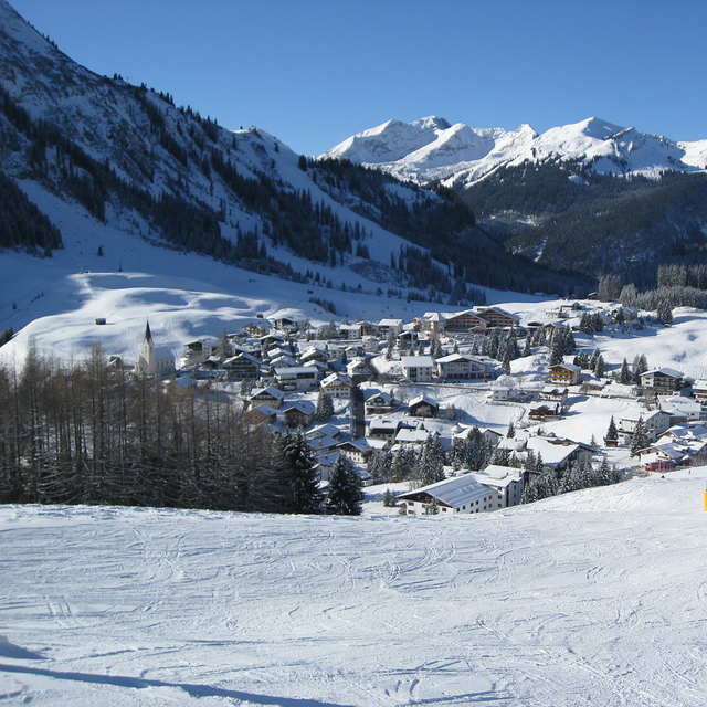
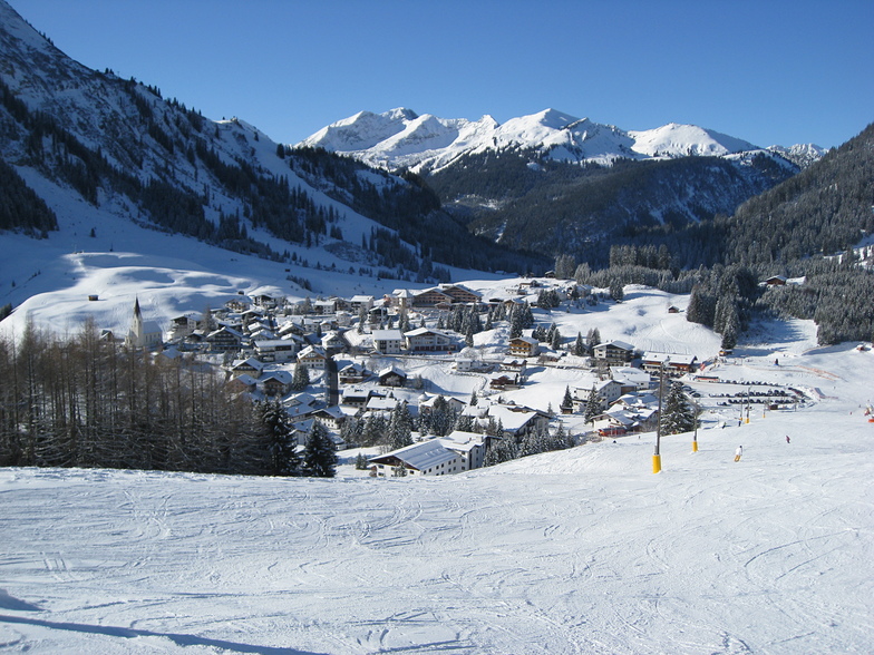
La tabella sopra da le previsioni meteo per Berwang-Bichlbach-Rinnen a specifiche altezze 1075 m. I nostri sofisticati modelli meteo ci consentono di fornire previsioni neve per la vetta, l'area intermedia e a valle delle stazioni sciistiche di Berwang-Bichlbach-Rinnen. Per accedere alle previsioni meteo ad altre altezze, per spostarti usa tab sopra la tabella. Per una visione meteo piu' ampia , controlla la mappa meteo di Austria.
Clicca qui per leggere ulteriori informazioni sullo zero termico e il nostro sistema di prevedere le temperature.
Complessivamente 3.8 Basato su 1 vote e 1 recensione
Just back from a long weekend in Berwang. No wonder there are so few non locals, it's clearly a best kept secret. What a spot: stunning scenery, less than 2 hours from Munich, quaint, the friendliest folk in the Alps and a variety of runs that seems way more than the disclosed distances probably because they are so interesting! Superb food all over. Cake that will make me diabetic it's so good. Want long endless runs? Go to Courchevel. Want a ski holiday with local atmosphere? Come here. You will not regret it!
walter da South Africa scrive:
Just back from a long weekend in Berwang. No wonder there are so few non locals, it's clearly a best kept secret. What a spot: stunning scenery, less than 2 hours from Munich, quaint, the friendliest folk in the Alps and a variety of runs that seems way more than the disclosed distances probably because they are so interesting! Superb food all over. Cake that will make me diabetic it's so good.
Want long endless runs? Go to Courchevel. Want a ski holiday with local atmosphere? Come here. You will not regret it!
Clicca qui per inviare la tua recensione di Berwang-Bichlbach-Rinnen
Il Berwang-Bichlbach-Rinnen widget meteo qui sotto è disponibile per essere incorporato su siti Web esterni a titolo gratuito. Esso fornisce un riepilogo giornaliero delle nostre Berwang-Bichlbach-Rinnen previsioni meteo neve e dati meteo. Basta andare alla pagina di configurazione e seguire 3 semplici passi per prendere il codice html personalizzato ed incollarlo nel tuo sito. È possibile scegliere l'elevazione di previsione di neve (vetta, metà o piede della montagna) e l'unità metrica/imperiale per le previsioni meteo neve adeguata al proprio sito Web Clicca qui per ottenere il codice
Guarda previsioni meteo neve dettagliate per Berwang-Bichlbach-Rinnen a:
snow-forecast.com


 Nearest